The second volume of history for eighth grade compiled by the People's Education Publishing House
Zhonghua Book Company Edition Eighth Grade History Volume 2
People's Education Press Seventh Grade History Volume 1
People's Education Edition Eighth Grade History Volume 1
Zhonghua Book Company Edition Seventh Grade History Volume 2
Volume 1 of the seventh grade history compiled by the People's Education Publishing House
Yuelu Edition Seventh Grade History Volume 2
People's Education Edition History and Society 9th Grade Part II
People's Education Press Seventh Grade History Volume 2
People's Education Press History and Society Grade 7
People's Education Edition Eighth Grade History Volume 2
East China Normal University Edition Seventh Grade History Volume 1
People's Education Press Ninth Grade History Volume 2
People's Education Press History and Society Grade 9
People's Education Press History and Society for Grade 8 Volume 1
Yuelu Edition Seventh Grade History Volume 1
| Category | Format | Size |
|---|---|---|
| People's Education Press History and Society Grade 7 | pptx | 6 MB |

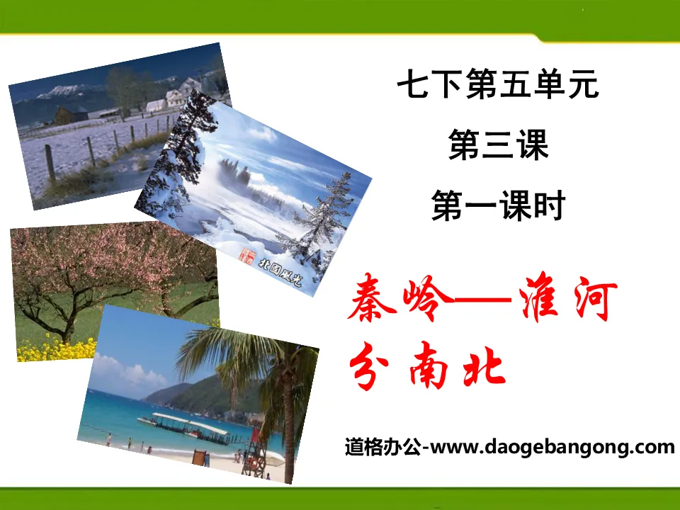
"Qinling Mountains - Huaihe River Divides North and South" Homeland of People of All Nationalities in China PPT Courseware
2024-11-22
Copyright statement: This material is compiled and released by the user of Daoge Resources. The copyright belongs to the author. For commercial use, please contact the copyright owner. If there is any infringement, please contact the webmaster to remove the resource.
Download Points: 0.00
Free Download
Upgrade VIP
Favorite
Views: 1585 / Downloads: 260
Description
"Qinling Mountains - Huaihe River Divides North and South" Homeland of People of All Nationalities in China PPT Courseware
Part One: Classroom Activities
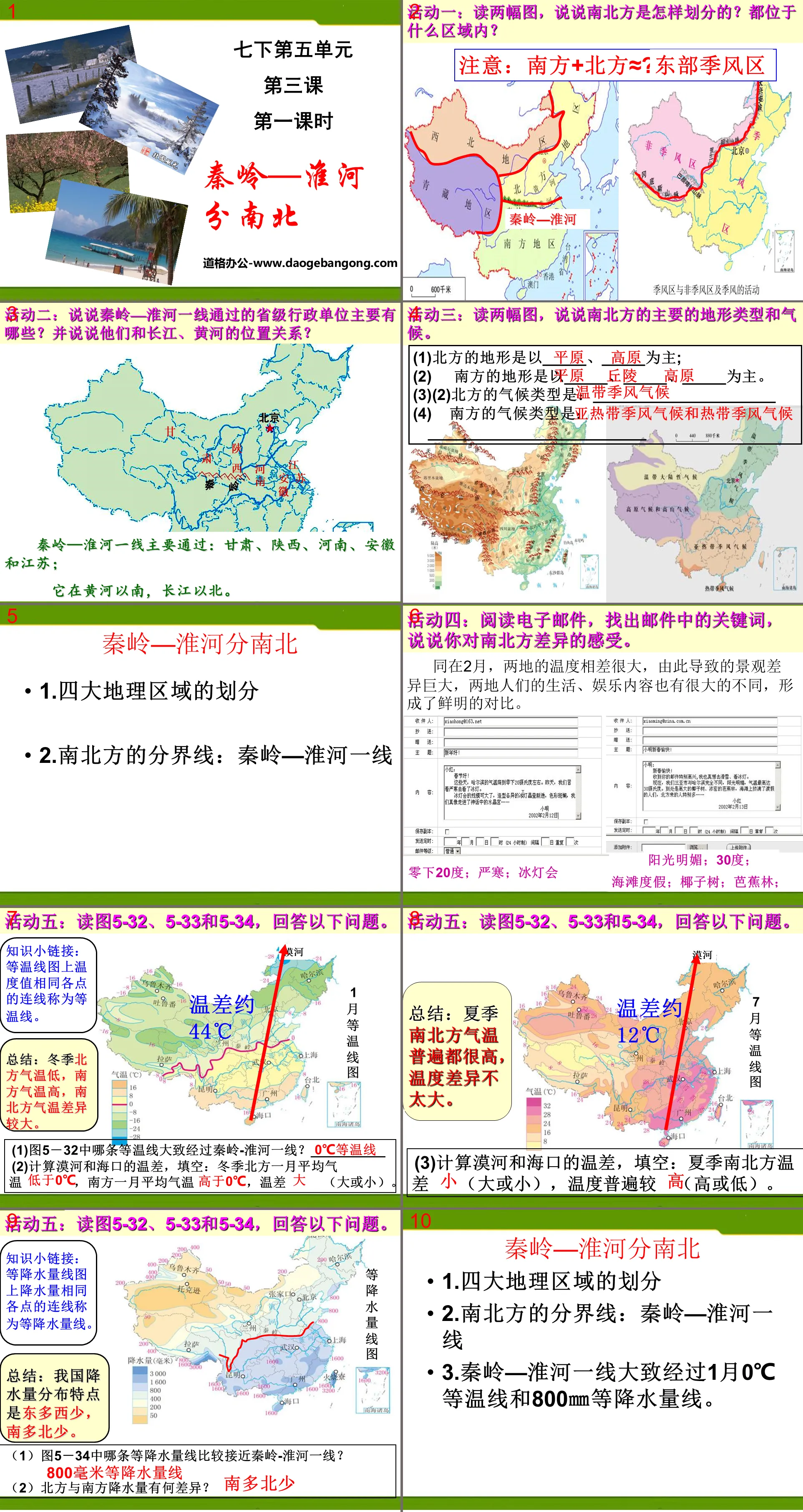
Activity 1: Read two pictures and talk about how the north and south are divided? What areas are they located in?
Activity 2: What are the main provincial administrative units passing through the Qinling-Huaihe River line? And talk about their positional relationship with the Yangtze River and Yellow River?
The Qinling-Huaihe line mainly passes through: Gansu, Shaanxi, Henan, Anhui and Jiangsu;
It is south of the Yellow River and north of the Yangtze River.
Activity 3: Read two pictures and talk about the main terrain types and climate in the north and south.
(1) The terrain in the north is dominated by _____ and _____;
The terrain of the south is dominated by _____, _____, and _____.
(2)The climate type in the north is: ____________________
The climate type in the south is: ____________________________
Qinling Mountains and Huaihe River are divided into north and south PPT, part 2 content: Qinling Mountains and Huaihe River are divided into north and south
1. Division of four geographical regions
2. The dividing line between north and south: Qinling-Huaihe River line
3. The Qinling Mountains-Huaihe River line roughly passes through the January 0℃ isotherm and the 800℃ precipitation line.
4. The climate difference between the north and the south causes differences in the natural environment and human environment.
Qinling Mountains and Huaihe River are divided into north and south PPT, the third part of the content: induction and knowledge expansion:
The Qinling Mountains-Huaihe River line is an important geographical dividing line in China.
1. Climate
1. Qinling Mountains-Huaihe River is the boundary of the 800 mm annual precipitation line. The precipitation to the south of the Qinling Mountains and the Huaihe River is greater than 800 mm; to the north, the precipitation is less than 800 mm.
2. The Qinling Mountains-Huaihe River is the dividing line between the humid zone and the semi-humid zone.
3. Qinling Mountains-Huaihe River is the boundary of the 0℃ isotherm in January. The average January temperature in the south of the Qinling Mountains and the Huaihe River is above 0°C, and there is basically no ice in winter; the average January temperature in the north of the Qinling Mountains and the Huaihe River is below 0°C, and it is generally frozen in the winter.
4. Qinling Mountains-Huaihe River is the dividing line between warm temperate zone and subtropical zone.
5. The Qinling Mountains-Huaihe River is the dividing line between subtropical monsoon climate and temperate monsoon climate. In summer, it is hot and rainy south and north of the Qinling Mountains-Huaihe River. In winter, the south of the Qinling Mountains and the Huaihe River is mild and rainy, while the north of the Qinling Mountains and the Huaihe River is cold and dry.
6. The dividing line between north and south regions.
2. Vegetation
To the south of the Qinling Mountains and the Huaihe River is the subtropical evergreen broad-leaved forest; to the north of the Qinling Mountains and the Huaihe River is the temperate deciduous broad-leaved forest. Therefore, there is a saying that "when oranges grow in Huainan, they become tangerines, and when they grow in northern Huaibei, they become oranges."
3. River hydrology
The rivers south of the Qinling Mountains and the Huaihe River have rich flow, small seasonal changes, low sand content, long flood seasons, and no ice in winter; the rivers north of the Qinling Mountains and the Huaihe River have smaller flows, large seasonal changes, high sand contents, short flood seasons, and no ice in the winter. . The Qinling Mountains-Huaihe River is also the watershed between the Yellow River and the Yangtze River.
4. Topography, soil and mineral resources
1. Terrain: The area south of the Qinling Mountains and the Huaihe River is dominated by hills; the area north of the Qinling Mountains and the Huaihe River is dominated by plains and plateaus.
2. Soil: From the Qinling Mountains to the Huaihe River to the south, red soil gradually dominates; to the north of Qinling Mountains to the Huaihe River, yellow soil or brown soil dominates, the northeast is dominated by black soil, and the northwest is mostly white sandy soil.
3. Minerals: The area south of the Qinling Mountains and the Huaihe River is dominated by non-ferrous metals. The industry is dominated by light industries such as non-ferrous metal smelting and export processing. The area north of the Qinling Mountains and the Huaihe River is dominated by coal, iron and petroleum. In terms of industry, heavy industry accounts for a larger proportion. big.
Qinling Mountains and Huaihe River are divided into north and south PPT, part 4: feedback in class
1. Which of the following lines is not where the Qinling-Huaihe line passes ( )
A.800mm constant precipitation line
B. The dividing line between warm temperate zone and subtropical zone
C. The dividing line between the northwest region and the Qinghai-Tibet region
D. January 0℃ isotherm
2. Among the following rivers, which one has freezing phenomenon in winter ( )
A. Yangtze River B. Pearl River C. Yellow River D. Minjiang River
3. The dividing line between the southern and northern regions of my country is ( )
A. 400 mm constant precipitation line B. Qinling-Huaihe line
C. Heihe-Tengchong line D. Yangtze River
Keywords: free download of PPT courseware for history and society in the second volume of the seventh grade of the People's Education Press, PPT download of the homeland of the people of all ethnic groups in China, PPT download of Qinling Mountains and the Huaihe River dividing the north and south, .PPT format;
For more information about the PPT courseware "The Qinling Mountains and the Huaihe River are divided into the north and the south, the homeland of the people of all ethnic groups in China", please click on the Qinling Mountains and the Huaihe River, the homeland of the people of all ethnic groups in China, are divided into the north and the south ppt courseware.
"Understanding the Treasure Island of Taiwan" The Homeland of People of All Nationalities in China PPT Courseware:
The first part of the PPT courseware "Understanding the Treasure Island of Taiwan", the home of the people of all ethnic groups in China: 1. The scope and composition of Taiwan. Taiwan Island is China's largest island, covering an area of approximately 36,000 square kilometers. Penghu Islands, Diaoyu Islands, Chiwei Island, a total of more than 80 islands and fishing islands. The island has been...
"Understanding the Treasure Island of Taiwan" Homeland of People of All Nationalities in China PPT:
"Understanding the Treasure Island of Taiwan" PPT, the homeland of the people of all ethnic groups in China. Part 1: The scope of Taiwan Province. Taiwan's land and sea location. Taiwan faces _____ to the west, _____ to the north, _____ to the east, and _____ to the south. Taiwan Island is located in the connection zone between the Eurasian continent and the Pacific Ocean. We...
"Significant Differences Between the East and the West" Homelands of People of All Nationalities in China PPT:
"The Difference Between the East and the West is Significant" The Homelands of People of All Ethnic Groups in China PPT Part One: How to divide the East and the West? Let’s talk about the provincial administrative units in the western region. Western China consists of five provinces in the southwest, five provinces in the northwest, Inner Mongolia, Guangxi and Hunan..
File Info
Update Time: 2024-11-22
This template belongs to History courseware People's Education Press History and Society Grade 7 industry PPT template
"Qinling Mountains - Huaihe River Divides North and South" Homeland of People of All Nationalities in China PPT Courseware Simple campus recruitment activity planning plan summary enterprise and institution recruitment publicity lecture PPT template is a general PPT template for business post competition provided by the manuscript PPT, simple campus recruitment activity planning plan summary enterprise and institution recruitment promotion Lecture PPT template, you can edit and modify the text and pictures in the source file by downloading the source file. If you want more exquisite business PPT templates, you can come to grid resource. Doug resource PPT, massive PPT template slide material download, we only make high-quality PPT templates!
Tips: If you open the template and feel that it is not suitable for all your needs, you can search for related content "Qinling Mountains - Huaihe River Divides North and South" Homeland of People of All Nationalities in China PPT Courseware is enough.
How to use the Windows system template
Directly decompress the file and use it with office or wps
How to use the Mac system template
Directly decompress the file and use it Office or wps can be used
Related reading
For more detailed PPT-related tutorials and font tutorials, you can view: Click to see
How to create a high-quality technological sense PPT? 4 ways to share the bottom of the box
Notice
Do not download in WeChat, Zhihu, QQ, built-in browsers, please use mobile browsers to download! If you are a mobile phone user, please download it on your computer!
1. The manuscript PPT is only for study and reference, please delete it 24 hours after downloading.
2. If the resource involves your legitimate rights and interests, delete it immediately.
3. Contact information: service@daogebangong.com
"Qinling Mountains - Huaihe River Divides North and South" Homeland of People of All Nationalities in China PPT Courseware, due to usage restrictions, it is only for personal study and reference use. For commercial use, please go to the relevant official website for authorization.
(Personal non-commercial use refers to the use of this font to complete the display of personal works, including but not limited to the design of personal papers, resumes, etc.)
Preview
Related Search:
"Qinling Mountains - Huaihe River Divides North and South" Homeland of People of All Nationalities in China PPT Courseware
2024-11-22
Copyright statement: This material is compiled and released by the user of Daoge Resources. The copyright belongs to the author. For commercial use, please contact the copyright owner. If there is any infringement, please contact the webmaster to remove the resource.
Download Points: 0.00
Free Download
Upgrade VIP
Favorite
Views: 1585 / Downloads: 260


