Business Planet Edition 7th Grade Geography Volume 1
Business Planet Edition 7th Grade Geography Volume 2
People's Education Edition Geography for Seventh Grade Volume 2
Business Planet Edition Geography for Grade 8 Volume 1
Shanghai Education Edition Seventh Grade Geography Volume 1
People's Education Edition Geography for Eighth Grade Volume 2
Hunan Education Edition High School Geography Compulsory Course I
People's Education Edition Geography for Grade 7 Volume 1
Business Planet Edition Geography for Eighth Grade Volume 2
Compulsory Course 1 of High School Geography in China Graphics Edition
Shanghai Education Edition Geography for Sixth Graders Volume 1
People's Education Edition Geography for Grade 8 Volume 1
Hunan Education Edition High School Geography Compulsory Course II
Lu Ke version of high school geography compulsory course I
Shanghai Education Edition Seventh Grade Geography Volume 2
People's Education Press High School Geography Compulsory Course 1

| Category | Format | Size |
|---|---|---|
| Business Planet Edition 7th Grade Geography Volume 1 | pptx | 6 MB |

"Interpretation of Topographic Maps" PPT download
2024-10-19
Copyright statement: This material is compiled and released by the user of Daoge Resources. The copyright belongs to the author. For commercial use, please contact the copyright owner. If there is any infringement, please contact the webmaster to remove the resource.
Download Points: 0.00
Free Download
Upgrade VIP
Favorite
Views: 1897 / Downloads: 514
Description
"Interpretation of Topographic Maps" PPT download
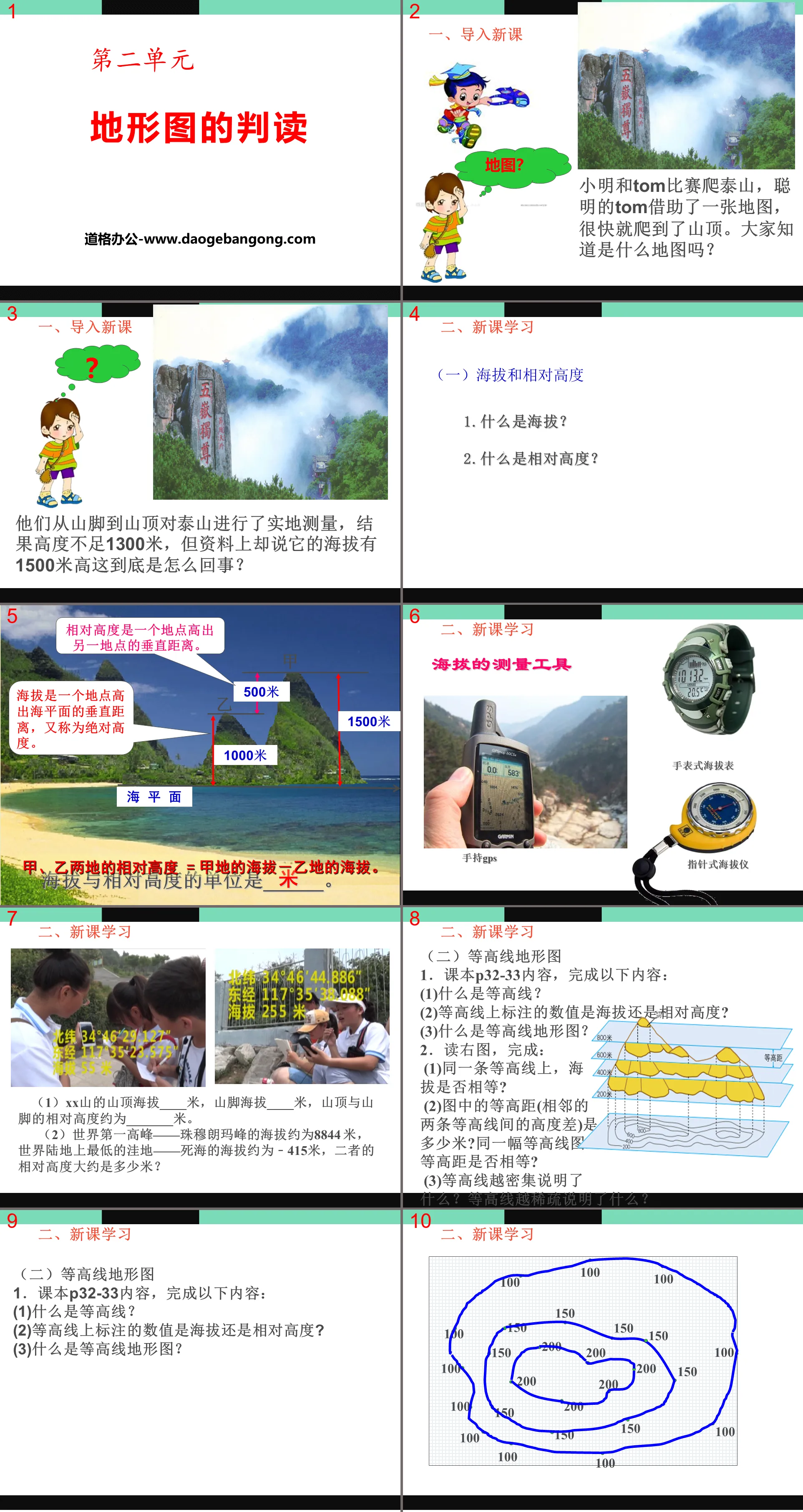
Part One Content: New Course Knowledge
1. Introduction of new courses
Xiao Ming competed with TOM to climb Mount Taishan. The clever TOM used a map and climbed to the top of the mountain quickly. Does anyone know what map it is?
They conducted on-site measurements of Mount Tai from the foot of the mountain to the top of the mountain. The result was that the height was less than 1,300 meters, but the data said its altitude was 1,500 meters high. What the hell is going on?
2. Learning new courses
(1) Altitude and relative altitude
1. What is altitude?
2. What is relative height?
Altitude measuring tool
(1) The top of XX Mountain is ____ meters above sea level, and the foot of the mountain is ____ meters above sea level. The relative height between the top of the mountain and the foot of the mountain is about _______ meters.
(2) The altitude of the world's highest peak, Mount Everest, is about 8844 meters, and the altitude of the Dead Sea, the lowest depression on land in the world, is about 415 meters. What is the relative height of the two?
(2) Contour topographic map
1. Textbook P32-33 content, complete the following content:
(1)What are contour lines?
(2) Are the values marked on the contour lines altitude or relative height?
(3) What is a contour topographic map?
2. Read the picture on the right and complete:
(1) On the same contour line, are the altitudes equal?
(2) How many meters is the contour distance (height difference between two adjacent contour lines) in the picture? Are the contour distances equal on the same contour map?
(3) What does the denser contour lines mean? What does the sparser contour lines mean?
Part 2 content: Class summary
3. Conclusion summary
Please use the contour topographic map of XX Mountain you just drew and combine it with the model you made to talk about the names of different parts of the mountain and the characteristics of the contour lines.
Contour lines are closed, high in the center and low around
Contour lines are closed, low in the center and high around them
The lowland between two adjacent peaks
Contour lines overlap
Contour lines bulge downwards
Contour lines bulge upwards
The third part: summary of knowledge points
Interpretation of topographic maps
(1) Altitude and relative altitude
(1) Altitude
(2) Relative height
(2) Contour topographic map
(1) Contour lines
(2) Contour topographic map
(3) Contour lines and isobath topographic maps
(4) Five basic terrains and layered color terrain maps
Keywords: Free download of Geography PPT courseware for the seventh grade of Business Planet Edition, Interpretation of Topographic Maps PPT courseware, .PPT format;
For more information about the "Interpretation of Topographic Maps" PPT courseware, please click the Interpretation of Topographic Maps ppt tab.
"Interpretation of Topographic Maps" PPT courseware:
"Interpretation of Topographic Maps" PPT courseware Part 1: Learning objectives 1. What is the definition and calculation of altitude and relative altitude? 2. What is the definition of terrain? What are the five common types of terrain and their characteristics? 3. Identify the slope size and cliffs, peaks, saddles, mountains...
"Interpretation of Topographic Maps" PPT:
"Interpretation of Topographic Maps" PPT Part One Content: New Lesson Learning The vertical distance between a certain point and another point is called the relative height. The vertical distance between a certain point and the sea level is called the absolute height, which is the various ups and downs of the altitude surface. Collectively called terrain. Five kinds of ground...
"Interpretation of Topographic Maps" Earth and Map PPT Courseware 8:
"Interpretation of Topographic Maps" Earth and Map PPT Courseware 8 This lesson aims to identify peaks, ridges, valleys, cliffs, saddles and other parts on contour topographic maps, and identify plateaus and mountains on layered color topographic maps. , plains, hills, basins and other basic terrains..
File Info
Update Time: 2024-10-19
This template belongs to Geography courseware Business Planet Edition 7th Grade Geography Volume 1 industry PPT template
"Interpretation of Topographic Maps" PPT download Simple campus recruitment activity planning plan summary enterprise and institution recruitment publicity lecture PPT template is a general PPT template for business post competition provided by the manuscript PPT, simple campus recruitment activity planning plan summary enterprise and institution recruitment promotion Lecture PPT template, you can edit and modify the text and pictures in the source file by downloading the source file. If you want more exquisite business PPT templates, you can come to grid resource. Doug resource PPT, massive PPT template slide material download, we only make high-quality PPT templates!
Tips: If you open the template and feel that it is not suitable for all your needs, you can search for related content "Interpretation of Topographic Maps" PPT download is enough.
How to use the Windows system template
Directly decompress the file and use it with office or wps
How to use the Mac system template
Directly decompress the file and use it Office or wps can be used
Related reading
For more detailed PPT-related tutorials and font tutorials, you can view: Click to see
How to create a high-quality technological sense PPT? 4 ways to share the bottom of the box
Notice
Do not download in WeChat, Zhihu, QQ, built-in browsers, please use mobile browsers to download! If you are a mobile phone user, please download it on your computer!
1. The manuscript PPT is only for study and reference, please delete it 24 hours after downloading.
2. If the resource involves your legitimate rights and interests, delete it immediately.
3. Contact information: service@daogebangong.com
"Interpretation of Topographic Maps" PPT download, due to usage restrictions, it is only for personal study and reference use. For commercial use, please go to the relevant official website for authorization.
(Personal non-commercial use refers to the use of this font to complete the display of personal works, including but not limited to the design of personal papers, resumes, etc.)
Preview
Related Search:
"Interpretation of Topographic Maps" PPT download
2024-10-19
Copyright statement: This material is compiled and released by the user of Daoge Resources. The copyright belongs to the author. For commercial use, please contact the copyright owner. If there is any infringement, please contact the webmaster to remove the resource.
Download Points: 0.00
Free Download
Upgrade VIP
Favorite
Views: 1897 / Downloads: 514


