
"Basic Elements of Maps" PPT Simple campus recruitment activity planning plan summary enterprise and institution recruitment publicity lecture PPT template is a general PPT template for business post competition provided by the manuscript PPT, simple campus recruitment activity planning plan summary enterprise and institution recruitment promotion Lecture PPT template, you can edit and modify the text and pictures in the source file by downloading the source file. If you want more exquisite business PPT templates, you can come to grid resource. Doug resource PPT, massive PPT template slide material download, we only make high-quality PPT templates!
| 文件名 如何下载使用 | 下载次数 | Download Points | 下载地址 |
|---|---|---|---|
| "Basic Elements of Maps"... | 5550次 | 0.00 | Free Download |
Tips: If you open the template and feel that it is not suitable for all your needs, you can search for related content "Basic Elements of Maps" PPT is enough.
How to use the Windows system template
Directly decompress the file and use it with office or wps
How to use the Mac system template
Directly decompress the file and use it Office or wps can be used
Related reading
For more detailed PPT-related tutorials and font tutorials, you can view: Click to see
How to create a high-quality technological sense PPT? 4 ways to share the bottom of the box
Notice
Do not download in WeChat, Zhihu, QQ, built-in browsers, please use mobile browsers to download! If you are a mobile phone user, please download it on your computer!
1. The manuscript PPT is only for study and reference, please delete it 24 hours after downloading.
2. If the resource involves your legitimate rights and interests, delete it immediately.
3. Contact information: service@daogebangong.com
"Basic Elements of Maps" PPT, due to usage restrictions, it is only for personal study and reference use. For commercial use, please go to the relevant official website for authorization.
(Personal non-commercial use refers to the use of this font to complete the display of personal works, including but not limited to the design of personal papers, resumes, etc.)
Related reading
For more detailed PPT-related tutorials and font tutorials, you can view:Please click to see

Authoritative PPT Summary
"Basic Elements of Maps" PPT
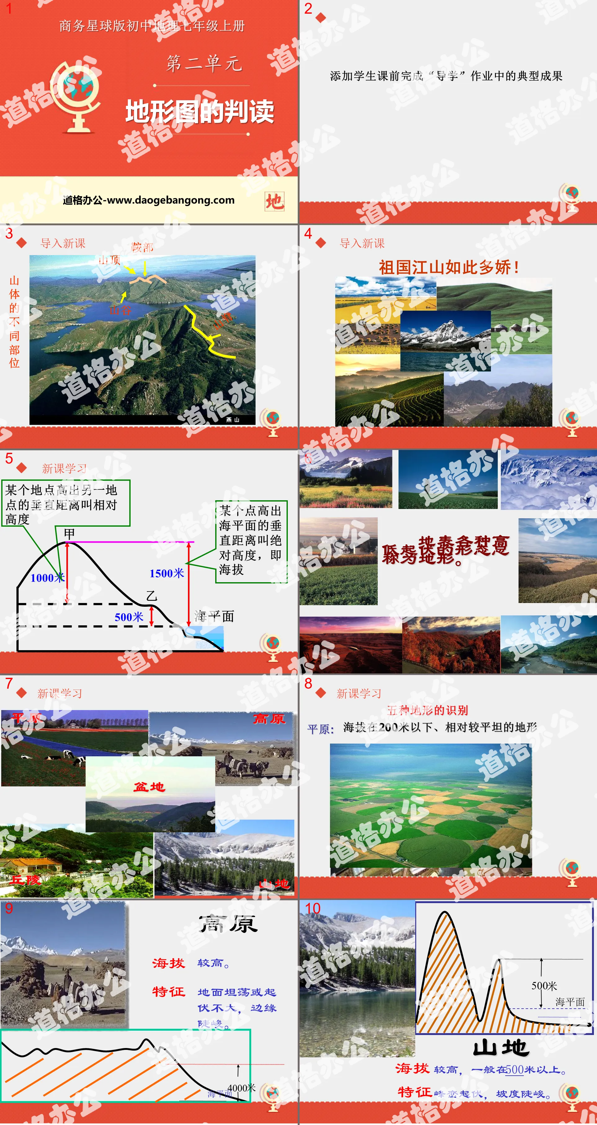
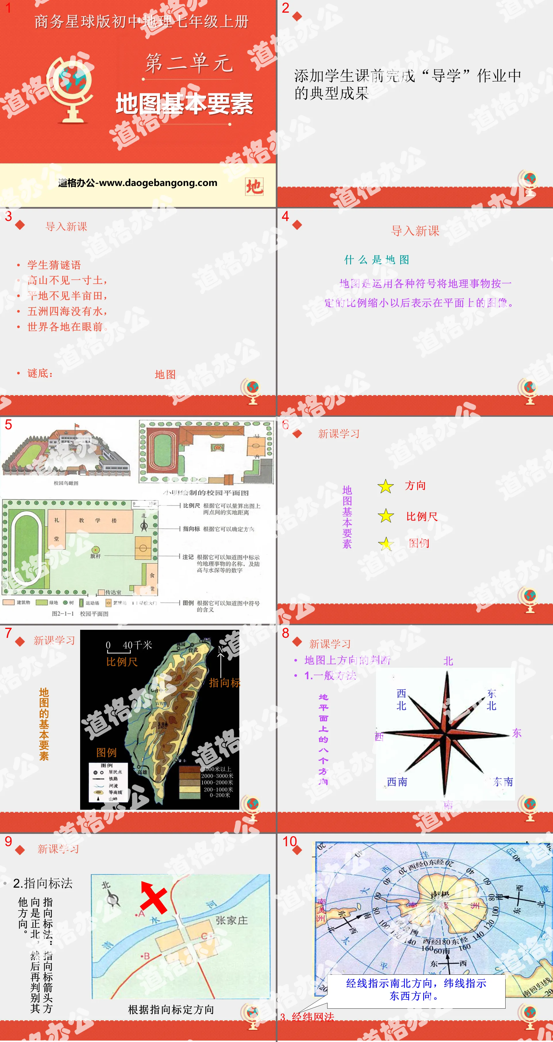
Part 1: Importing new lessons
Students guess riddles
There is not even an inch of soil in the mountains,
There is not even half an acre of land on the flat land;
There is no water in the five continents and seas,
All over the world is in front of you.
Answer: map
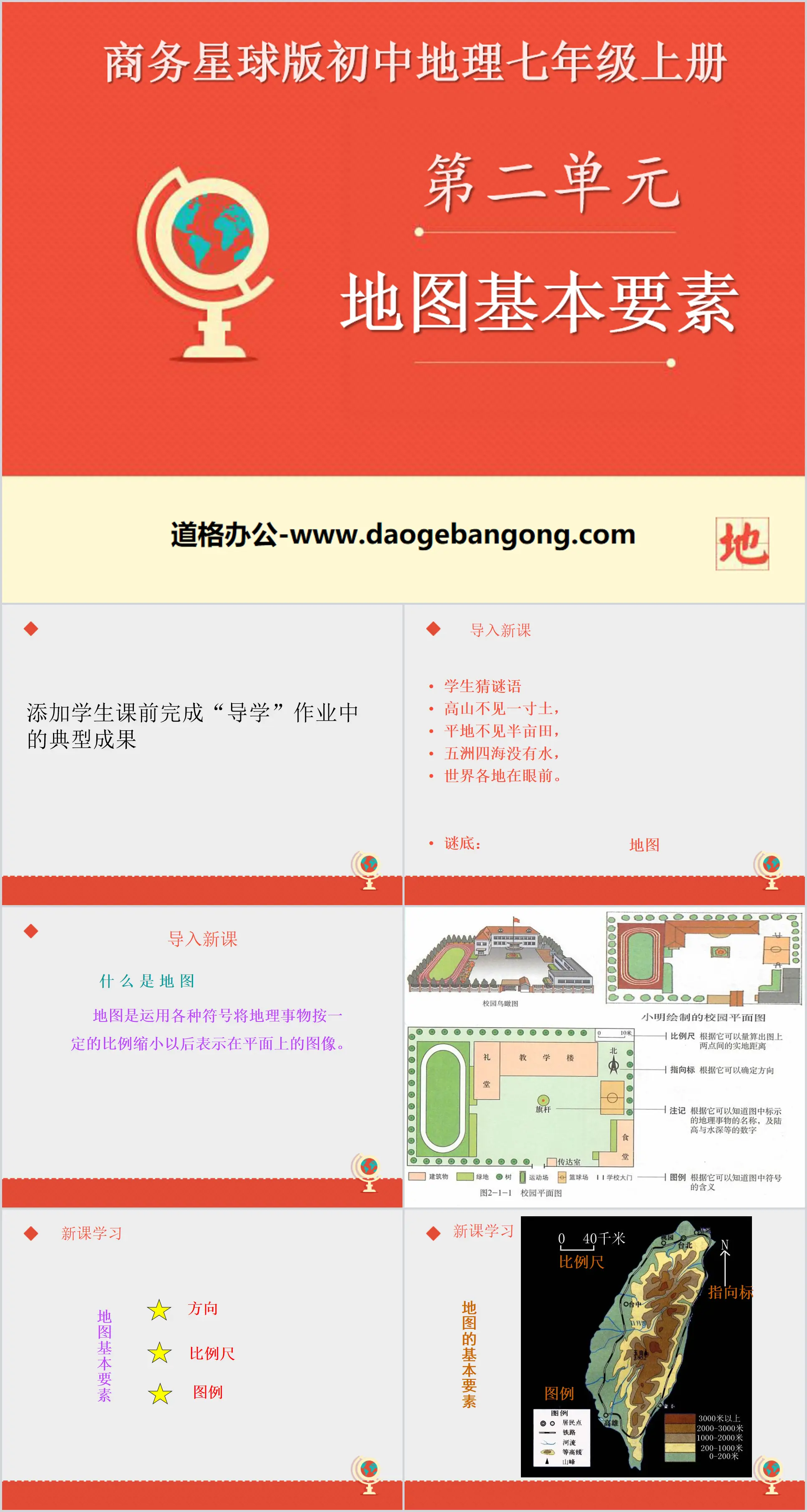
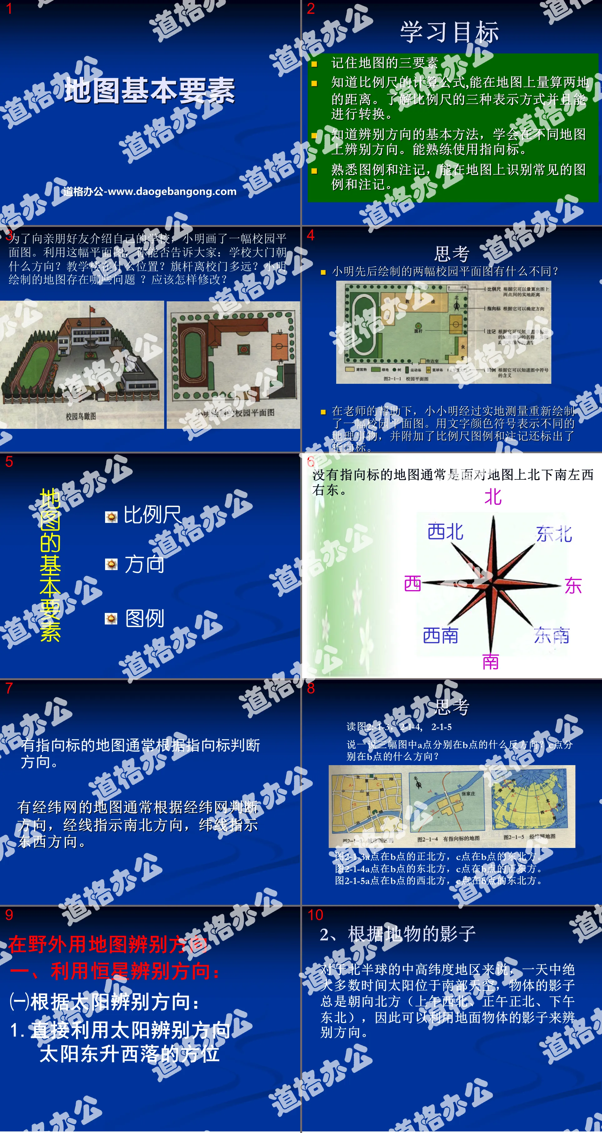
what is map
A map is an image that uses various symbols to reduce geographical things to a certain proportion and represent them on a flat surface.
PPT on basic map elements, part 2: new lesson learning
Judgment of directions on the map
1. General method
2. Pointing method
Pointing method: The direction of the pointing arrow is true north, and then determine other directions.
The following methods are commonly used to identify directions in the wild:
1. Use a compass to identify directions.
2. Use the sun: In winter, the sunrise position is east by south and the sunset position is west by south; in summer, the sunrise position is east by north and the sunset position is north by west.
3. As long as there is sun, you can use your watch to identify the direction.
4. Use the Stars: Aim for the North Star. First, look for the spoon-shaped Big Dipper. Extend the distance between the two stars on the spoon C and then find the North Star on this straight line. The direction of the North Star is due north.
5. Use ground objects to determine the direction: Independent large trees usually have lush branches and smooth bark in the south, while sparse branches and rough bark in the north. Its south side is usually covered with lush grass, while its north side is humid and covered with moss.
6. The main entrances of larger temples and pagodas in northern China and the doors and windows of independent houses in rural areas mostly open to the south.
7. The grass is denser at the northern edge of the clearing in the forest. The growth rings on the cross section of a tree stump are generally spaced wider in the south and smaller in the north.
8. Use a satellite navigation system to determine direction.
Basic map elements PPT, the third part: scale
Calculation of scale
Given the distance on the ground and the distance on the map, find the scale
Scale bar = distance on the map/distance on the ground
Given the scale and real distance, find the distance on the map:
Distance on the map = actual distance * scale bar
Given the distance and scale on the map, find the distance on the ground:
Distance on the ground = distance on the map/scale bar
Comparison of scale sizes
a. When comparing scale sizes, first unify the representation into numbers;
b. Unit conversion: 1 kilometer = 100,000 centimeters.
Summary: The larger the denominator, the smaller the scale; the smaller the denominator, the larger the scale.
PPT on basic map elements, part 4: legends and notes
What is a legend?
Different geographical things are represented by different symbols on the map, and these symbols are called legends.
What is annotation?
The text descriptions on the map, as well as the numbers indicating the height of the mountains, the depth of the sea, etc., are called annotations.
PPT on basic map elements, part 5: summary of this section
In this lesson, we learned the basic elements of a map: direction, scale, and legend. We learned the three methods of judging direction on a map, as well as how to judge the direction scale, legend, and annotations in the wild. We also learned about the concept, formula, and Three expression methods, size comparison, range of representation, details of content and some commonly used legends. I hope everyone will read more pictures and develop the habit of acquiring geographical knowledge from pictures.
PPT on basic map elements, Part 6: Classroom exercises
1. The largest of the following scales is ( )
A. 1: 50000
B. 1 centimeter on the picture represents 50 kilometers on the ground.
C. 0___500�
D. 1:5000
2. If the straight-line distance between two places measured on the map is 3 cm, and the scale on the map is 1:6000000, then the real distance between the two places is ( )
A. 18 kilometers B. 180 kilometers
C. 1800 kilometers D. 18000 kilometers
3. If the straight-line distance between two places measured on the map is 3 cm, and the scale on the map is 1:6000000, then the real distance between the two places is ( )
A.18 kilometers B.180 kilometers C.1800 kilometers D.18000 kilometers
4. If the four maps are of equal size, then the one that represents geographical things in the most detail is ( )
A. World political map b. Beijing city map
C. Jinan City topographic map D. Taishan Scenic Area Guide Map
PPT on basic map elements, part 7: homework assignments
Make a classroom floor plan
Method tips:
Determine the scale: Estimate the length and width of the drawing paper and determine the length and width of the classroom
Determine the direction: Determine the direction of north and make a legend
Keywords: Business Planet version seventh grade geography PPT courseware free download, basic map elements PPT download, .PPT format;
For more information about the "Basic Elements of Maps" PPT courseware, please click the "Basic Elements of Maps" ppt tab.
"Basic Elements of Maps" PPT courseware download:
"Basic Elements of Maps" PPT courseware download Part 1: Introduction of new lessons Riddle guessing There is not an inch of soil in the mountains, and there is not even half an acre of land in the flatlands. There is no water all over the world, and all the countries in the world are in front of us. ... ... ... Basic map elements PPT, the second part of the content:..
"Basic Elements of Maps" PPT courseware:
"Basic Elements of Maps" PPT courseware Part One: Learning Objectives: Remember the three elements of a map, know the calculation formula of the scale, and be able to measure the distance between two places on the map. Understand the three representations of scales and be able to convert them. Know the basics of identifying directions...