The second volume of history for eighth grade compiled by the People's Education Publishing House
Zhonghua Book Company Edition Eighth Grade History Volume 2
Zhonghua Book Company Edition Seventh Grade History Volume 2
People's Education Edition Eighth Grade History Volume 1
Yuelu Edition Seventh Grade History Volume 2
People's Education Edition History and Society 9th Grade Part II
People's Education Press History and Society Grade 9
Volume 1 of the seventh grade history compiled by the People's Education Publishing House
People's Education Press Seventh Grade History Volume 1
People's Education Press History and Society for Grade 8 Volume 1
East China Normal University Edition Seventh Grade History Volume 1
People's Education Press Ninth Grade History Volume 2
People's Education Press History and Society Grade 7
People's Education Edition Eighth Grade History Volume 2
Yuelu Edition Seventh Grade History Volume 1
People's Education Press Seventh Grade History Volume 2
| Category | Format | Size |
|---|---|---|
| People's Education Press History and Society seventh grade | pptx | 6 MB |

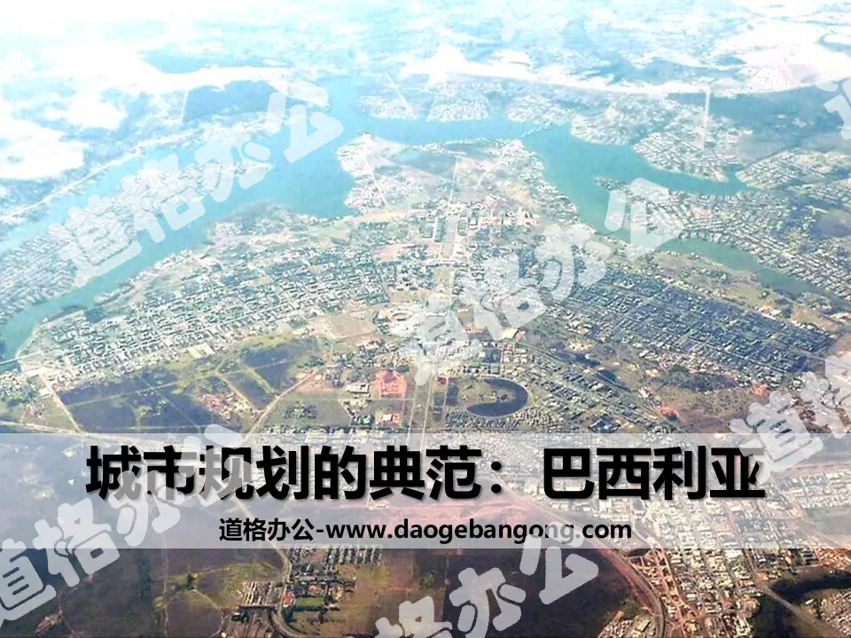
"A Model of Urban Planning—Brasilia" Civilization Center—Urban PPT
2024-09-02
Copyright statement: This material is compiled and released by the user of Daoge Resources. The copyright belongs to the author. For commercial use, please contact the copyright owner. If there is any infringement, please contact the webmaster to remove the resource.
Download Points: 0.00
Free Download
Upgrade VIP
Favorite
Views: 1835 / Downloads: 353
Description
"A Model of Urban Planning—Brasilia" Civilization Center—Urban PPT
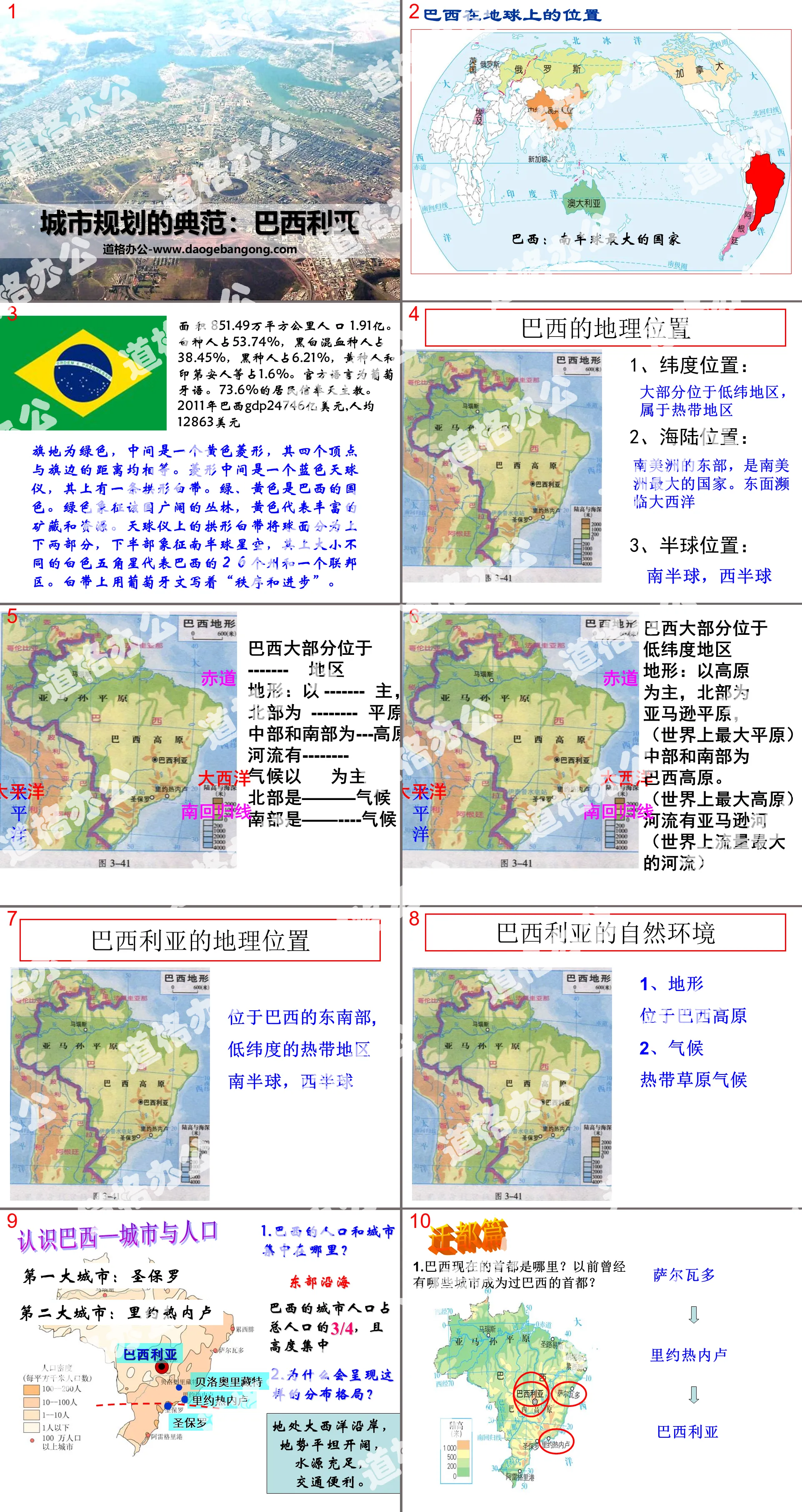
Part One: Brazil’s Place on Earth
Area: 8.5149 million square kilometers, population: 191 million. White people account for 53.74%, mulattoes account for 38.45%, black people account for 6.21%, and yellow people and Indians account for 1.6%. The official language is Portuguese. 73.6% of residents believe in Catholicism. In 2011, Brazil’s GDP was US$2,474.6 billion, with a per capita GDP of US$12,863.
The flag ground is green, with a yellow diamond in the middle, the four vertices of which are all equidistant from the edge of the flag. In the middle of the rhombus is a blue celestial globe with an arched white band above it. Green and yellow are Brazil’s national colors. Green symbolizes the country's vast jungles, while yellow represents the rich mineral deposits and resources. The arched white band on the celestial globe divides the sphere into upper and lower parts. The lower half symbolizes the starry sky of the southern hemisphere. The white five-pointed stars of different sizes on it represent the 26 states and a federal district of Brazil. Written on the white band in Portuguese is "Order and Progress."
Brasilia PPT, a model of urban planning, part 2: Brazil’s geographical location
1. Latitude location: Most of them are located in low latitudes and belong to tropical areas.
2. Sea and land location: The eastern part of South America is the largest country in South America. To the east is the Atlantic Ocean
3. Hemisphere location: Southern Hemisphere, Western Hemisphere
Most of Brazil is located in low latitudes
Terrain: Mainly plateau, with Amazon plain in the north.
(The largest plain in the world)
The central and southern parts are the Brazilian Plateau.
(The largest plateau in the world)
rivers amazon
(The largest river in the world)
Brasilia PPT, a model of urban planning, part 3: Capital
Moving the capital
1. Where is the current capital of Brazil? Which cities have been the capital of Brazil in the past?
rio de janeiro
It is currently the second largest city and largest port city in Brazil;
Around 1950, Rio de Janeiro was the capital of Brazil and the country's political, economic and cultural center. At that time, its area accounted for 0.5% of the country's total area, but it concentrated more than 10% of the country's population.
Dingdu Chapter
Why is the Brazilian government moving the capital from Rio de Janeiro to Brasilia?
1. Rio de Janeiro’s “urban diseases” are serious; (large population, traffic jams, difficulty in employment, poor environment, difficulty in housing...)
2. Brasilia is located on the Brazilian Plateau, with high terrain, cool climate, and suitable for human habitation;
3. Relocating the capital can strengthen the management and development of the vast inland and promote the development of the inland. It can also relieve the pressure on the eastern coastal cities.
4. From a national security perspective, coastal cities are vulnerable to attack and moving inland is safer.
Brasilia PPT, a model of urban planning, part 4: inquiry learning
Four students form a group and read p108 of the book.
Pictures and text, think about the following questions:
1. What areas are divided on the Brasilia urban planning map?
2. Where are these areas located?
3. What are the characteristics of such regional division? (Advantages of urban planning)
Concentrated or dispersed green spaces complement buildings of different styles, creating a regular layout without losing vitality.
Showing urban design thinking is the concept of harmony
Keywords: free download of PPT courseware for seventh-grade history and society from People's Education Edition, PPT download of civilized central city, PPT download of Brasilia, a model of urban planning, in .PPT format;
For more information about the PPT courseware "Brasilia, a model of urban planning in a civilized central city", please click on the Brasilia ppt, a model of urban planning in a civilized central city ppt tag.
"How to Understand the City - Taking Moscow as an Example" Civilization Center - City PPT courseware:
"How to Understand the City - Taking Moscow as an Example" Civilized Central City PPT Courseware Part One: Describe the location and environment of the city. Read textbook P110 and answer the question: What are the main factors that determine the initial formation of a city? 1) Defense, transportation A. Defense: River..
"How to Understand the City - Taking Moscow as an Example" Civilization Center - City PPT:
"How to Know a City - Taking Moscow as an Example" Civilized Central City PPT Part One Content: Russia's geographical location Russia, Europe, Asia (a traditional European country) The northern and eastern hemispheres are bordered by the Arctic Ocean in the north. Russia: Spanning the two continents of Europe and Asia, the territory 1..
"A Model of Urban Planning - Brasilia" Civilization Center - Urban PPT Courseware:
"Brasilia, a Model of Urban Planning" Civilized Central City PPT courseware Part One: Step-by-step learning 1. The location of Brazil 1. It is located in the Western Hemisphere, mostly in the Southern Hemisphere. The largest country in the southern hemisphere. 2. Mostly located in low latitudes and tropics 3. Located in South America..
File Info
Update Time: 2024-09-02
This template belongs to History courseware People's Education Press History and Society seventh grade industry PPT template
"A Model of Urban Planning—Brasilia" Civilization Center—Urban PPT Simple campus recruitment activity planning plan summary enterprise and institution recruitment publicity lecture PPT template is a general PPT template for business post competition provided by the manuscript PPT, simple campus recruitment activity planning plan summary enterprise and institution recruitment promotion Lecture PPT template, you can edit and modify the text and pictures in the source file by downloading the source file. If you want more exquisite business PPT templates, you can come to grid resource. Doug resource PPT, massive PPT template slide material download, we only make high-quality PPT templates!
Tips: If you open the template and feel that it is not suitable for all your needs, you can search for related content "A Model of Urban Planning—Brasilia" Civilization Center—Urban PPT is enough.
How to use the Windows system template
Directly decompress the file and use it with office or wps
How to use the Mac system template
Directly decompress the file and use it Office or wps can be used
Related reading
For more detailed PPT-related tutorials and font tutorials, you can view: Click to see
How to create a high-quality technological sense PPT? 4 ways to share the bottom of the box
Notice
Do not download in WeChat, Zhihu, QQ, built-in browsers, please use mobile browsers to download! If you are a mobile phone user, please download it on your computer!
1. The manuscript PPT is only for study and reference, please delete it 24 hours after downloading.
2. If the resource involves your legitimate rights and interests, delete it immediately.
3. Contact information: service@daogebangong.com
"A Model of Urban Planning—Brasilia" Civilization Center—Urban PPT, due to usage restrictions, it is only for personal study and reference use. For commercial use, please go to the relevant official website for authorization.
(Personal non-commercial use refers to the use of this font to complete the display of personal works, including but not limited to the design of personal papers, resumes, etc.)
Preview
Related Search:
"A Model of Urban Planning—Brasilia" Civilization Center—Urban PPT
2024-09-02
Copyright statement: This material is compiled and released by the user of Daoge Resources. The copyright belongs to the author. For commercial use, please contact the copyright owner. If there is any infringement, please contact the webmaster to remove the resource.
Download Points: 0.00
Free Download
Upgrade VIP
Favorite
Views: 1835 / Downloads: 353


