| Category | Format | Size |
|---|---|---|
| Compulsory Course 2 of High School Geography in China Graphics Edition | pptx | 6 MB |
Description
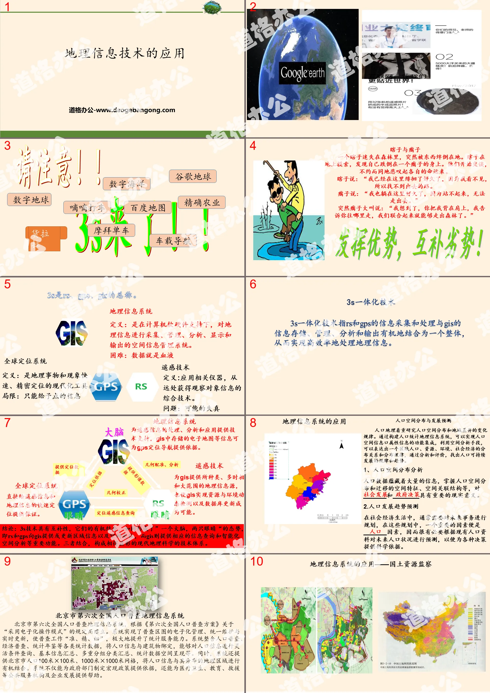
"Application of Geographic Information Technology" Land Development and Protection PPT Courseware
Part One: Geographic Information System
Definition: It is a spatial information management system that collects, manages, analyzes, displays and outputs geographical information with the support of computer software and hardware.
Difficulty: Data is blood
Global Positioning System
Definition: It is a modern tool for rapid and precise positioning of geographical objects and phenomena.
Limitations: Only point information can be given
Remote Sensing Technology
Definition: A comprehensive technology that uses relevant instruments to obtain information about observed objects from a distance.
Problem: Possible distortion
Part 2: Application of Geographic Information System
Population spatial distribution and development forecast
Population geography focuses on the study of the changing patterns of population spatial distribution and regional differences. By constructing a demographic geographic information system, the functional integration of population spatial information and attribute information can be realized. Using spatial analysis methods, the distribution relationships and distribution rules of a regional population, resources, environment, and social economy can be expressed. Through analysis and evaluation, Find out the laws and trends of sustainable population development.
1. Analysis of population spatial distribution
Population data contains a large amount of information, and understanding the spatial characteristics and spatial correlation structure of population spatial distribution and migration is of great practical significance to ________ and ________.
2. Forecast of population development trends
In social and economic life, it is usually necessary to plan for future affairs. In these plans, an important factor is the _______ factor. Therefore, it is necessary to predict future population status based on existing population data in order to provide various Provide scientific basis for decision-making.
Application of Geographic Information System - Land and Resources Supervision
Land and resources supervision mainly includes land use ____________, ____________, __________ and ______________, etc. Through the geographical information system, various resource information can be overlaid and analyzed in a timely, accurate and efficient manner, and various comprehensive electronic maps of land and resources can be generated to provide ________ support for daily decision-making and business management, as well as response to emergencies. .
The use of geographic information systems can also ______ and _____ land and resources issues, improve the rapid response capabilities of grassroots land and resources teams, and greatly improve the accuracy of monitoring.
Application of geographic information system - vehicle navigation and dispatching
In terms of transportation, many industries such as car rental services and logistics distribution can use _______________ to navigate, track, dispatch and manage vehicles, and allocate vehicles reasonably.
Application of Geographic Information System - Tourism Information Query
The development of geographic information technology has promoted the ________ process of tourism. _______________ can quickly realize the visualization of tourism resources, quick query of tourism resources and information, and ________ function. It helps to establish a tourism geographical information system, realize the information management of tourism resources, and enable users to observe the tourism landscape in an all-round way.
Application of geographical information system - urban planning and evaluation consultation
Urban planning and construction is a long-term process, involving all aspects of the city, and is closely related to the city's humanities, history, geographical environment and economic construction. Therefore, by using ___________ to conduct information analysis on the spatial layout of the city, we can obtain information to guide urban planning, including urban traffic surveys, population surveys, environmental surveys, urban land use change monitoring, etc., which is of great significance to the development of the city.
Keywords: Free download of PPT courseware for high school geography compulsory course II of China Graphics Edition, PPT download of application of geographic information technology, PPT download of land development and protection, .PPT format;
For more information about the "Application of Geographic Information Technology in Land Development and Protection" PPT courseware, please click on the "Application of Geographic Information Technology PPT in Land Development and Protection" PPT tab.
"Application of Geographic Information Technology" Land Development and Protection PPT Download:
"Application of Geographic Information Technology" Land Development and Protection PPT Download Part One: Learning Objectives: Master the application of geographic information technology in human geography. (Key and difficult points) ... ... Application of geographic information technology PPT, part 2: independent prediction...
"South China Sea Islands and Diaoyu Islands and their affiliated islands" land development and protection PPT download:
"South China Sea Islands and Diaoyu Islands and their Affiliated Islands" Land Development and Protection PPT Download Part One: Learning Objectives: 1. Understand that the South China Sea Islands are an integral part of China's territory. (Key points) 2. Understand that Diaoyu Island and its affiliated islands are indivisible territory of China.
"National Marine Rights and Marine Development Strategy" Land Development and Protection PPT Download:
"National Marine Rights and Marine Development Strategy" Land Development and Protection PPT Download Part One Content: Learning Objectives: 1. Remember the marine rights and interests and marine development strategy. (Key points) 2. Master my country’s maritime rights and interests and maritime development strategy. (Key and difficult points) 3. Understand the ocean..
File Info
Update Time: 2024-08-05
This template belongs to Geography courseware Compulsory Course 2 of High School Geography in China Graphics Edition industry PPT template
"Application of Geographic Information Technology" Land Development and Protection PPT Courseware Simple campus recruitment activity planning plan summary enterprise and institution recruitment publicity lecture PPT template is a general PPT template for business post competition provided by the manuscript PPT, simple campus recruitment activity planning plan summary enterprise and institution recruitment promotion Lecture PPT template, you can edit and modify the text and pictures in the source file by downloading the source file. If you want more exquisite business PPT templates, you can come to grid resource. Doug resource PPT, massive PPT template slide material download, we only make high-quality PPT templates!
Tips: If you open the template and feel that it is not suitable for all your needs, you can search for related content "Application of Geographic Information Technology" Land Development and Protection PPT Courseware is enough.
How to use the Windows system template
Directly decompress the file and use it with office or wps
How to use the Mac system template
Directly decompress the file and use it Office or wps can be used
Related reading
For more detailed PPT-related tutorials and font tutorials, you can view: Click to see
How to create a high-quality technological sense PPT? 4 ways to share the bottom of the box
Notice
Do not download in WeChat, Zhihu, QQ, built-in browsers, please use mobile browsers to download! If you are a mobile phone user, please download it on your computer!
1. The manuscript PPT is only for study and reference, please delete it 24 hours after downloading.
2. If the resource involves your legitimate rights and interests, delete it immediately.
3. Contact information: service@daogebangong.com
"Application of Geographic Information Technology" Land Development and Protection PPT Courseware, due to usage restrictions, it is only for personal study and reference use. For commercial use, please go to the relevant official website for authorization.
(Personal non-commercial use refers to the use of this font to complete the display of personal works, including but not limited to the design of personal papers, resumes, etc.)
Preview
