Business Planet Edition 7th Grade Geography Volume 1
Business Planet Edition 7th Grade Geography Volume 2
Business Planet Edition Geography for Grade 8 Volume 1
People's Education Edition Geography for Seventh Grade Volume 2
People's Education Edition Geography for Eighth Grade Volume 2
Shanghai Education Edition Seventh Grade Geography Volume 1
Hunan Education Edition High School Geography Compulsory Course I
People's Education Edition Geography for Grade 8 Volume 1
Compulsory Course 1 of High School Geography in China Graphics Edition
People's Education Edition Geography for Grade 7 Volume 1
Shanghai Education Edition Geography for Sixth Graders Volume 1
Lu Ke version of high school geography compulsory course I
Hunan Education Edition High School Geography Compulsory Course II
People's Education Press High School Geography Compulsory Course 1
Business Planet Edition Geography for Eighth Grade Volume 2
Shanghai Education Edition Seventh Grade Geography Volume 2

| Category | Format | Size |
|---|---|---|
| Shanghai Education Edition Geography for Sixth Graders Volume 1 | pptx | 6 MB |
Description
"Various Maps" PPT
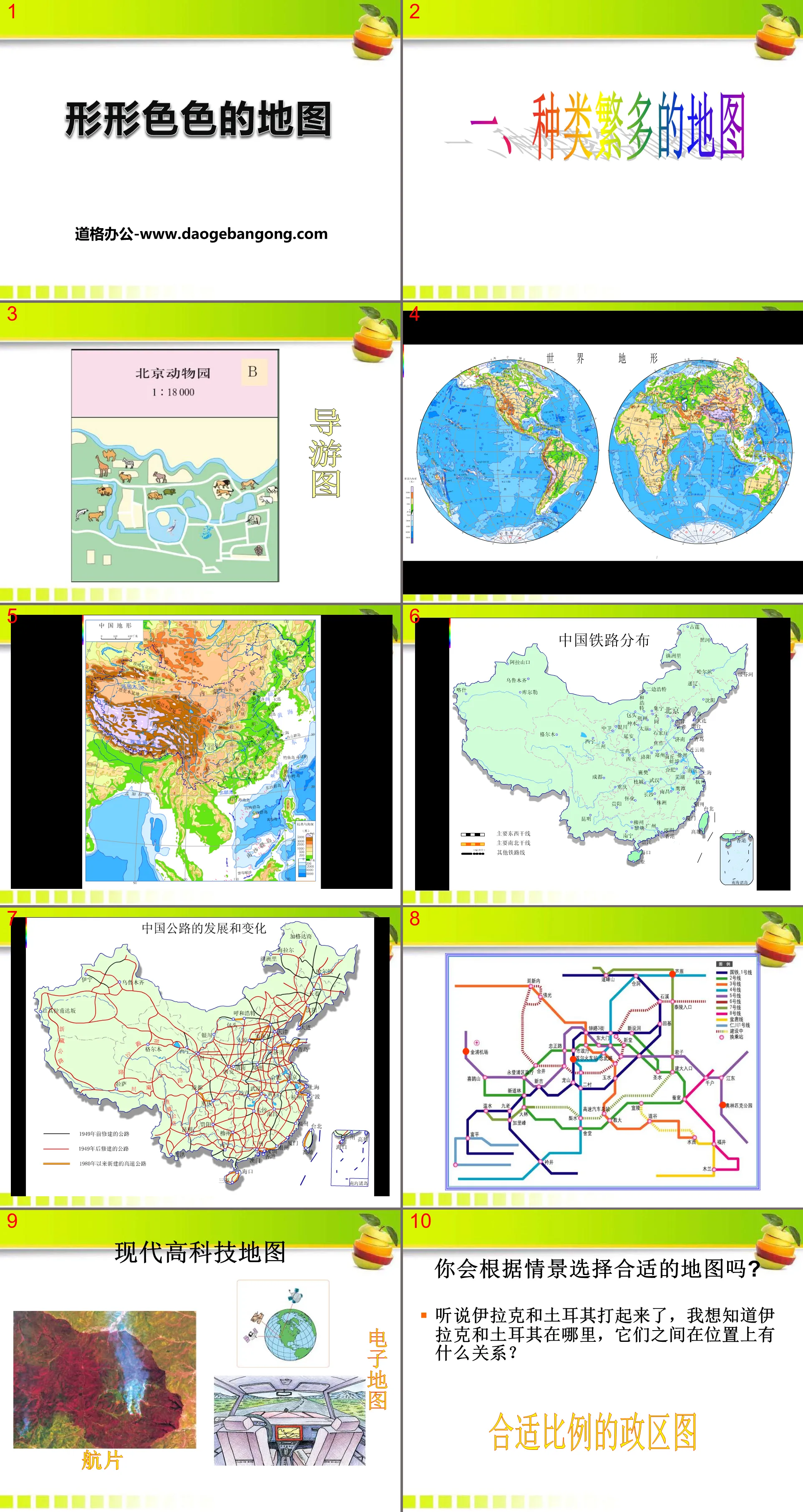
Part One: A wide variety of maps
Will you choose the right map based on the situation?
I heard that Iraq and Turkey are fighting. I want to know where Iraq and Turkey are and what is the relationship between them in terms of location?
Appropriately proportioned political district map
Sunday is here and I want to go to the museum. The museum is close to my home, I have to figure out how to get there by bus
City traffic map
When I arrive at the entrance of the zoo, how should I choose the appropriate route to see the animals I want to see?
Tour guide map
Various map PPTs, part 2: practice
1. The dividing lines between continents
①The dividing line between Asia and Europe——
Ural Mountains, Ural River, Greater Caucasus Mountains and Turkish Straits
The Asian continent and the European continent are closely connected and become the largest landmass on the earth, called Eurasia. People customarily regard the Ural Mountains, the Ural River and the Greater Caucasus Mountains as the dividing line between the European and Asian continents.
②The dividing line between Asia and Africa——
suez canal
The Suez Canal connects the Mediterranean Sea and the Red Sea, and connects the Atlantic Ocean and the Indian Ocean, making the routes from Asia to European countries shorter by 8,000 kilometers to 10,000 kilometers than detouring around the Cape of Good Hope.
③The dividing line between North America and South America——
panama canal
The Panama Canal is a canal dug at the narrowest point of the Central American Isthmus. Its opening has greatly shortened the voyage between the Atlantic and Pacific Oceans, making the Panama Canal an important maritime shipping hub in the world.
④The dividing line between North America and Asia——
Bering Strait
The Bering Strait is a narrow waterway connecting the Pacific and Arctic Oceans
⑤The dividing line between South America and Antarctica——
drake strait
The Drake Passage is a narrow waterway connecting the Pacific and Atlantic Oceans
Various map PPTs, the third part: layered color topographic maps
According to the principle that the higher it is, the brighter it is, or the higher it is, the darker it is. Different colors are painted between different contour lines, so that the heights and depths of the ground and the depth of the sea can be clearly seen. This kind of map is called ______________.
Elevation: The vertical distance a location is above sea level.
Relative height: The vertical distance that one location is above another location.
Contour lines: lines connecting points with equal altitudes.
Isobath: A line connecting points of the same depth in the ocean.
Where the slope is steep, contour lines are densely packed;
Where the slope is gentle, the contour lines are sparse.
Keywords: Free download of Geography PPT courseware for sixth graders in Shanghai Education Edition, various map PPT downloads, .PPT format;
For more information about the "Various Maps" PPT courseware, please click on the "Various Maps ppt" tab.
"Various Maps" PPT courseware:
"Various Maps" PPT courseware Part 1: Layered color topographic map What is the altitude? 8848.43m Altitude: The vertical distance a location is above sea level. Relative height: The vertical distance between one location and another. Mountain peaks we can use...
File Info
Update Time: 2024-11-21
This template belongs to Geography courseware Shanghai Education Edition Geography for Sixth Graders Volume 1 industry PPT template
"Various Maps" PPT Simple campus recruitment activity planning plan summary enterprise and institution recruitment publicity lecture PPT template is a general PPT template for business post competition provided by the manuscript PPT, simple campus recruitment activity planning plan summary enterprise and institution recruitment promotion Lecture PPT template, you can edit and modify the text and pictures in the source file by downloading the source file. If you want more exquisite business PPT templates, you can come to grid resource. Doug resource PPT, massive PPT template slide material download, we only make high-quality PPT templates!
Tips: If you open the template and feel that it is not suitable for all your needs, you can search for related content "Various Maps" PPT is enough.
How to use the Windows system template
Directly decompress the file and use it with office or wps
How to use the Mac system template
Directly decompress the file and use it Office or wps can be used
Related reading
For more detailed PPT-related tutorials and font tutorials, you can view: Click to see
How to create a high-quality technological sense PPT? 4 ways to share the bottom of the box
Notice
Do not download in WeChat, Zhihu, QQ, built-in browsers, please use mobile browsers to download! If you are a mobile phone user, please download it on your computer!
1. The manuscript PPT is only for study and reference, please delete it 24 hours after downloading.
2. If the resource involves your legitimate rights and interests, delete it immediately.
3. Contact information: service@daogebangong.com
"Various Maps" PPT, due to usage restrictions, it is only for personal study and reference use. For commercial use, please go to the relevant official website for authorization.
(Personal non-commercial use refers to the use of this font to complete the display of personal works, including but not limited to the design of personal papers, resumes, etc.)
Preview


