Business Planet Edition 7th Grade Geography Volume 2
People's Education Edition Geography for Seventh Grade Volume 2
Business Planet Edition 7th Grade Geography Volume 1
Business Planet Edition Geography for Grade 8 Volume 1
Shanghai Education Edition Seventh Grade Geography Volume 1
Business Planet Edition Geography for Eighth Grade Volume 2
Hunan Education Edition High School Geography Compulsory Course I
People's Education Edition Geography for Grade 7 Volume 1
Shanghai Education Edition Geography for Sixth Graders Volume 1
Lu Ke version of high school geography compulsory course I
Shanghai Education Edition Geography for Sixth Graders Volume 2
People's Education Edition Geography for Eighth Grade Volume 2
People's Education Press High School Geography Compulsory Course 1
Shanghai Education Edition Seventh Grade Geography Volume 2
Compulsory Course 1 of High School Geography in China Graphics Edition
Compulsory Course 2 of High School Geography in China Graphics Edition
| Category | Format | Size |
|---|---|---|
| People's Education Edition Geography for Eighth Grade Volume 2 | pptx | 6 MB |

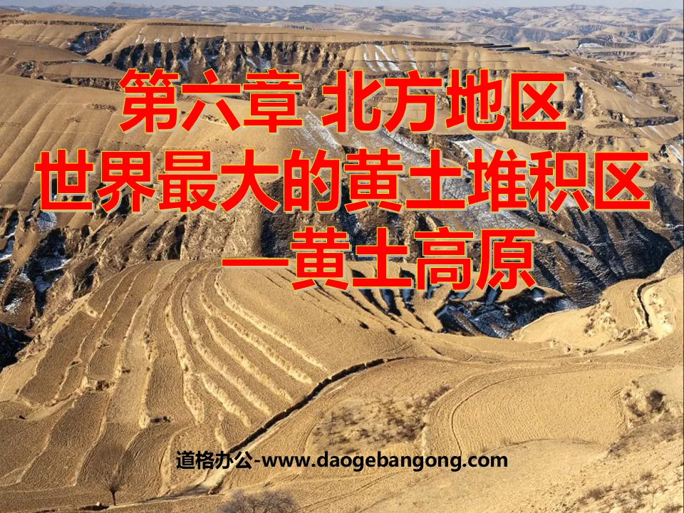
"The World's Largest Loess Accumulation Area - Loess Plateau" Northern Region PPT Courseware 2
2024-09-08
Copyright statement: This material is compiled and released by the user of Daoge Resources. The copyright belongs to the author. For commercial use, please contact the copyright owner. If there is any infringement, please contact the webmaster to remove the resource.
Download Points: 0.00
Free Download
Upgrade VIP
Favorite
Views: 1617 / Downloads: 1000
Description
"The World's Largest Loess Accumulation Area - Loess Plateau" Northern Region PPT Courseware 2
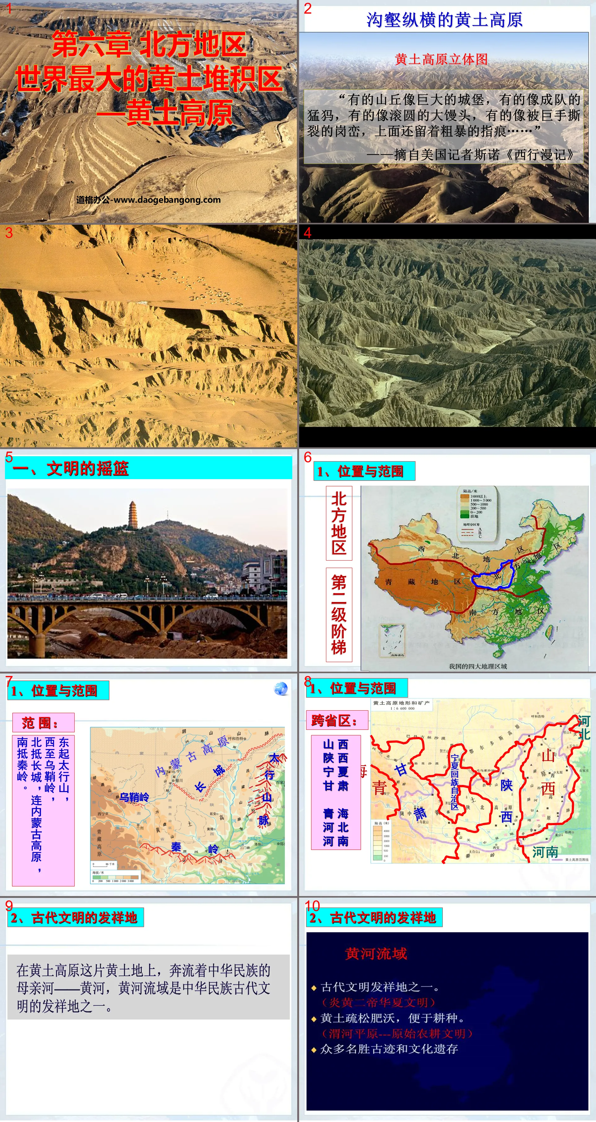
1. The Cradle of Civilization
1. Location and scope
scope:
It starts from Taihang Mountain in the east and ends at Wushaoling Mountain in the west.
It reaches the Great Wall in the north, connects to the Inner Mongolia Plateau, and reaches the Qinling Mountains in the south.
Cross-provincial area:
Shanxi Shaanxi
Ningxia Gansu
Qinghai Hebei Henan
2. The birthplace of ancient civilization
As early as six or seven thousand years ago, a primitive farming civilization appeared in the Weihe Plain.
The "Altar of Sheji" in Beijing's Zhongshan Park is a place where emperors of the Ming and Qing Dynasties offered sacrifices to land and prayed for a good harvest. The loess is located in the center of the "five-color soil" on the altar.
3. Unique “loess style”
The ancient civilization and unique geographical environment of the Loess Plateau have formed many unique folk customs.
Cave dwellings are traditional dwellings unique to the Loess Plateau. Loess is upright and not easy to collapse. It is relatively dry and easy to excavate, making it suitable for digging cave dwellings as residences.
Xintianyou is a folk song in northern Shaanxi that is rich in local folk customs. Its singing tune is high-pitched and long, with a rich loess style and strong artistic appeal, and is deeply loved by people.
2. Loess blown by the wind
The Loess Plateau is the largest loess accumulation area in the world, with an altitude of 1,000 to 2,000 meters. Except for some rocky mountains, the ground is covered with deep loess.
The thickness of loess cover on the Loess Plateau is generally about 100 meters. From the east of Liupan Mountain to the west of Luliang Mountain, the thickness of loess is between 100 meters and 200 meters. The thickest loess is more than 300 meters in Lanzhou. The loess distribution area and thickness rank highest in the world.
think about it
How did such a thick layer of loess form? Why aren't there other regions?
What other evidence can support the "Fengcheng theory"?
Follow the direction of the wind...
Coarse gravel remains in place - Gobi
Coarse-grained sand accumulates nearby - desert
Fine dust moves eastward and southward with the wind and accumulates - loess layer
Use the "Feng Cheng Theory" of loess to explain the following geographical phenomena
1. The following phenomena are considered to be evidence supporting the "Feng Cheng Theory". Let's talk about what problems they illustrate respectively.
Loess is like snow on the ground in winter, covering various terrains with different undulations in a similar thickness.
From northwest to southeast on the Loess Plateau, the particles of loess become increasingly finer.
The mineral composition of loess is different from that of the underlying bedrock.
The first piece of evidence, "The thickness of the loess is uniform," indicates that the loess was blown from above rather than washed by running water;
The second piece of evidence is that "the grains get finer and finer from northwest to southeast", indicating that the loess comes from northwest to southeast;
The third piece of evidence shows that loess is not produced locally, but is imported. (Central Asian or Mongolian)
3. Serious soil erosion
1. Common landforms on the Loess Plateau:
The loose soil of the Loess Plateau has been eroded by water for a long time, causing the floor of the Loess Plateau to be broken and crisscrossed with ravines, forming a variety of loess landforms such as plateaus, beams, mountains, and rivers...
Loess plateau: It is a remnant plateau surface with a flat top and is composed of a thick layer of loess. It has weak erosion and is a good farming area.
Loess ridge: The plateau is eroded by running water, and ravines develop, dividing it into long strip-shaped mountain ridges.
Huangtumao: The beams are further cut and separated by ravines, forming isolated steamed bun-shaped hills.
2. Reasons for serious soil erosion:
Analyze the natural causes and harm of soil and water loss in the Loess Plateau
1. Read Figure 6.34 and talk about the relationship between soil erosion and surface vegetation.
(1) Vegetation has the function of conserving water sources and preserving soil and water.
(2) The higher the vegetation coverage, the lighter the soil and water loss.
2. Discuss the effects of different soil textures (sand and clay), different slopes (steep slopes and gentle slopes), and different precipitation intensities (heavy rain and light rain) on soil erosion.
①Soil quality: ____ (sand or clay) is more prone to soil erosion.
②Slope: ____ (steep slope or gentle slope) is more prone to soil erosion.
③The ____ the precipitation intensity is, the more serious soil erosion will be.
4. Soil and Water Conservation—Ecological Construction
Successful experience:
1) Control water and soil erosion:
Biological measures: planting trees and grass, etc.
Engineering measures: build terraces, build retaining dams, etc.
2) Reasonably arrange production activities, such as returning farmland to forests and grasslands on steep slopes, reducing the number of grazing animals in overgrazed areas, etc.
3) Control population growth and alleviate the contradiction between man and land.
Improve ability
Single choice
1. The important boundary between the Loess Plateau and the southern region is: ( )
A. Huaihe River B. Qinling Mountains C. Taihang Mountain D. Daxinganling
2. Regarding the formation of the Loess Plateau, the widely supported statement is: ( )
A. Glacier B. Earthquake C. Fengcheng theory D. volcanic ash accumulation
3. The important reasons for the large sediment content in the middle and lower reaches of the Yellow River are: ( )
A. There are many tributaries flowing into it B. There is a lot of precipitation and it is located in a humid area C. The water flow is fast D. Flows through the Loess Plateau area
4. The most important natural disasters in the Loess Plateau are: ( )
A. Drought and flood disasters B. Typhoon C. Cold wave D. earthquake
5. The fundamental measure to control the Yellow River is ( )
A. Build a levee downstream B. Build a reservoir upstream
C. Maintain soil and water in the middle reaches D. Excavation of new river downstream
6. Which of the following statements about the Loess Plateau is correct ( )
A. The ground is rugged and a mountainous plateau
B. Limestone is widely distributed and karst landforms are developed
C. It is the place where loess is most widely distributed and thickest in the world.
D. There are many valleys and lakes on the plateau.
7. Among the following four groups of cities, the one that is located on the Loess Plateau and is the central city of a provincial administrative region is ( )
A. Lanzhou, Xi'an, Taiyuan B. Taiyuan, Xi'an, Baotou
C. Yan'an, Taiyuan, Lanzhou D. Zhengzhou, Xi'an, Lanzhou
Keywords: Northern region teaching courseware, the world's largest loess accumulation area - the Loess Plateau teaching courseware, New People's Education Edition Geography PPT courseware for eighth grade volume 2, eighth grade geography slide courseware download, northern region PPT courseware download, the world's largest loess Accumulation Area-Loess Plateau PPT courseware download, .ppt format
For more information about the PPT courseware "The World's Largest Loess Accumulation Area in the Northern Region - Loess Plateau", please click on the ppt label of "The World's Largest Loess Accumulation Area in the Northern Region - Loess Plateau".
"The World's Largest Loess Accumulation Area - Loess Plateau" Northern Region PPT Courseware 3:
"The World's Largest Loess Accumulation Area - Loess Plateau" Northern Region PPT Courseware 3 Can you tell which natural landscape this reflects? What is the reason for your judgment? Do you know which provinces and regions the Loess Plateau is mainly included in? Some hills are like huge castles, some...
"The World's Largest Loess Accumulation Area - Loess Plateau" PPT courseware for the northern region:
"The World's Largest Loess Accumulation Area - Loess Plateau" Northern Region PPT Courseware 1. The Cradle of Civilization Let me summarize: 1. Explain the scope of the Loess Plateau in terms of provinces and regions. 2. Find the boundaries of the Loess Plateau in the diagram. 3. Let’s talk about the significance of the Loess Plateau and the Yellow River to Chinese civilization...
File Info
Update Time: 2024-09-08
This template belongs to Geography courseware People's Education Edition Geography for Eighth Grade Volume 2 industry PPT template
"The World's Largest Loess Accumulation Area - Loess Plateau" Northern Region PPT Courseware 2 Simple campus recruitment activity planning plan summary enterprise and institution recruitment publicity lecture PPT template is a general PPT template for business post competition provided by the manuscript PPT, simple campus recruitment activity planning plan summary enterprise and institution recruitment promotion Lecture PPT template, you can edit and modify the text and pictures in the source file by downloading the source file. If you want more exquisite business PPT templates, you can come to grid resource. Doug resource PPT, massive PPT template slide material download, we only make high-quality PPT templates!
Tips: If you open the template and feel that it is not suitable for all your needs, you can search for related content "The World's Largest Loess Accumulation Area - Loess Plateau" Northern Region PPT Courseware 2 is enough.
How to use the Windows system template
Directly decompress the file and use it with office or wps
How to use the Mac system template
Directly decompress the file and use it Office or wps can be used
Related reading
For more detailed PPT-related tutorials and font tutorials, you can view: Click to see
How to create a high-quality technological sense PPT? 4 ways to share the bottom of the box
Notice
Do not download in WeChat, Zhihu, QQ, built-in browsers, please use mobile browsers to download! If you are a mobile phone user, please download it on your computer!
1. The manuscript PPT is only for study and reference, please delete it 24 hours after downloading.
2. If the resource involves your legitimate rights and interests, delete it immediately.
3. Contact information: service@daogebangong.com
"The World's Largest Loess Accumulation Area - Loess Plateau" Northern Region PPT Courseware 2, due to usage restrictions, it is only for personal study and reference use. For commercial use, please go to the relevant official website for authorization.
(Personal non-commercial use refers to the use of this font to complete the display of personal works, including but not limited to the design of personal papers, resumes, etc.)
Preview
Related Search:
"The World's Largest Loess Accumulation Area - Loess Plateau" Northern Region PPT Courseware 2
2024-09-08
Copyright statement: This material is compiled and released by the user of Daoge Resources. The copyright belongs to the author. For commercial use, please contact the copyright owner. If there is any infringement, please contact the webmaster to remove the resource.
Download Points: 0.00
Free Download
Upgrade VIP
Favorite
Views: 1617 / Downloads: 1000


