| Category | Format | Size |
|---|---|---|
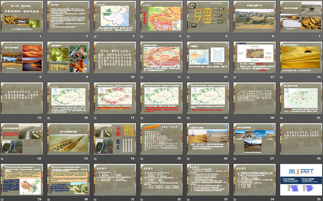
| People's Education Edition Geography for Eighth Grade Volume 2 | pptx | 6 MB |

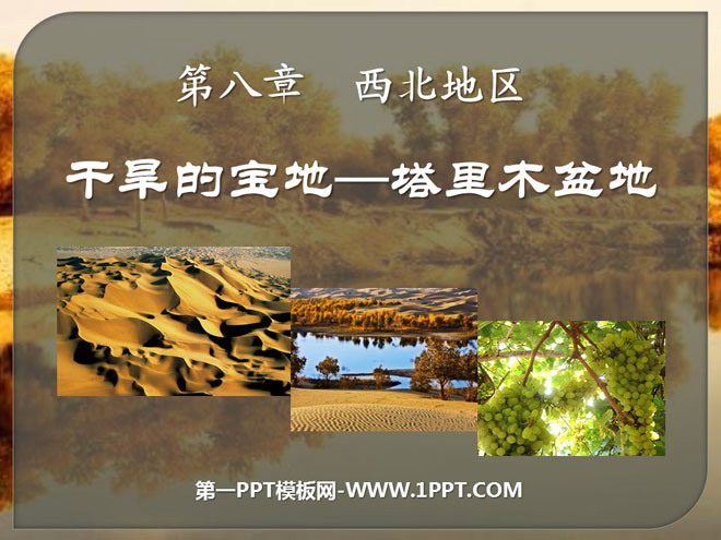
"The Arid Treasure of the Tarim Basin" Northwest Region PPT Courseware 3
Description
"The Arid Treasure of the Tarim Basin" Northwest Region PPT Courseware 3
learning target:
Please draw a hand-drawn map of the location of the Tarim Basin, and mark the locations of the Tianshan Mountains, Kunlun Mountains and Taklimakan Desert on the map? And analyze the reasons why the Tarim Basin has become an extremely dry area in my country?
Combined with the 80-page activity in the textbook, understand the relationship between the distribution of towns and transportation lines in the Tarim Basin and the natural environment?
Why do people call the Tarim Basin a "dry treasure land"? What is the reason for building two desert roads in the inaccessible Taklimakan Desert? What issues need to be paid attention to in the construction of these two desert highways? What role did the highway play after it was completed?
Combined with the activity on page 81 of the textbook, understand the significance of the West-East Gas Transmission Project to the development of the eastern and western regions?
Can you compose a hymn in praise of the Tarim Basin?
The geographical location of the basin
Located in southern Xinjiang, my country, it stretches from the eastern foothills of the Pamir Plateau in the west, to the Lop Nur Depression in the east, to the southern foothills of the Tianshan Mountains in the north, and to the northern foothills of the Kunlun Mountains in the south. It is the largest basin in my country.
Climate characteristics
Natural environment of the Tarim Basin: arid climate, scarce precipitation, and widespread deserts
causes of drought
1. Go deep inland and away from the ocean
2. Surrounded by high mountains, it is difficult for warm and humid air from the ocean to reach, causing a dry climate and making it an extremely arid area in my country.
Living Environment
There are scattered oases in the foothills and along the rivers on the edge of the Tarim Basin. Their water sources mainly come from mountains and ice and snow meltwater. Local people live in these oases. Cities, highways and railways are concentrated in dotted oasis areas on the edge of the basin.
Understand the relationship between towns in the Tarim Basin, the distribution of traffic lines and the natural environment
1. Read Figure 8.18, find out the main towns in the Tarim Basin, and describe their distribution characteristics.
Cities and towns are mainly distributed in oases and are distributed in a ring along the edge of the Tarim Basin.
The main towns are: Korla, Luntai, Kuqa, Aksu, Kashgar, Yecheng, Hotan, Yutian, Minfeng, Qiemo, Ruoqiang, etc.
2. Discuss the relationship between the towns and traffic distribution and the distribution of water sources and oases in the Tarim Basin.
The towns in the Tarim Basin are mainly distributed in oases with water sources. Transportation lines connect the towns in series and are distributed in a ring along the edge of the Tarim Basin.
3. In Figure 8.18, there are two roads that run through the Taklima Desert. Guess the reason for the construction of these two roads.
Mainly for the development and utilization of oil and gas resources in the Tarim Basin.
Xinjiang’s “Best in China”
The province with the largest area
Province farthest from the ocean
Provinces bordering the most neighboring countries
The largest basin (Tarim Basin)
The largest desert (Taklimakan Desert)
The largest inland river (Tarimu River)
The lowest place (Aiding Lake in Turpan Basin)
Where the highest temperatures occur (Turpan Basin)
The place with the least precipitation (Tokxun in Turpan Basin)
power enhanced
1. The largest basin in my country is ( )
A. Sichuan Basin B. Tarim Basin
C. Qaidam Basin D. Turpan Basin
3. "The solitary smoke is straight in the desert, and the sun is setting in the long river" is the most suitable thing to describe the following areas ( )
A. The middle and lower reaches of the Yangtze River B. Shandong hilly areas
C. Brahmaputra Valley D. Lower Tarim River area
4. The population and cities in the Tarim Basin are mainly distributed in ( )
A. Oasis area B. Desert area
C. Salt swamp area D. Desert and oases
5. The dominant factors affecting the population and urban distribution of the Tarim Basin are ( )
A. Forest resources B. Water resources
C. Mineral resources D. Wildlife
6. Compared with other regions in my country, the advantageous climate conditions for the development of high-quality agriculture in oasis areas are ( )
A. Sufficient sunshine, large temperature difference between day and night B. Abundant water and heat, good thermal conditions
C. Sufficient light and heat, long frost-free period D. Rain and heat in the same period, high multiple cropping index
Keywords: Northwest region teaching courseware, arid treasure land Tarim Basin teaching courseware, New People's Education Edition eighth grade geography PPT courseware volume 2, eighth grade geography slide courseware download, northwest region PPT courseware download, arid treasure land Tarim Basin PPT courseware download ,.ppt format
For more information about the PPT courseware "The Tarim Basin, a Dry Treasure Land in the Northwest Region", please click the PPT tag of the Tarim Basin, a Dry Treasure Land in the Northwest Region.
"The Arid Treasure of the Tarim Basin" Northwest Region PPT Courseware 4:
"The Arid Treasure of the Tarim Basin" Northwest Region PPT Courseware 4 Objective Navigation: 1. Understand the location and natural landscape of the Tarim Basin. 2. Understand the relationship between the distribution of towns and oases and the natural environment in the Tarim Basin. 3. Understand the West-East Gas Transmission Project and its significance. ..
"The Arid Treasure of the Tarim Basin" Northwest Region PPT Courseware 2:
"The Arid Treasure Tarim Basin" PPT courseware for the northwest region 2 1. Widespread desert and Gobi 1. Location and scope: The Tarim Basin is located in the south of ___, between the ___ Mountains and the ___ Mountains. It is the largest area in my country. basin. 2. What are the climate characteristics of the Tarim Basin? ..
"The Arid Treasure of the Tarim Basin" Northwest Region PPT courseware:
"The Arid Treasure of the Tarim Basin" Northwest Region PPT Courseware 1. Understanding the Tarim Basin Talk: What do you think are the characteristics of the natural landscape of the Tarim Basin? The natural environment of the Tarim Basin: arid climate, scarce precipitation, and widespread deserts. It is the largest desert in my country..
File Info
Update Time: 2024-08-01
This template belongs to Geography courseware People's Education Edition Geography for Eighth Grade Volume 2 industry PPT template
"The Arid Treasure of the Tarim Basin" Northwest Region PPT Courseware 3 Simple campus recruitment activity planning plan summary enterprise and institution recruitment publicity lecture PPT template is a general PPT template for business post competition provided by the manuscript PPT, simple campus recruitment activity planning plan summary enterprise and institution recruitment promotion Lecture PPT template, you can edit and modify the text and pictures in the source file by downloading the source file. If you want more exquisite business PPT templates, you can come to grid resource. Doug resource PPT, massive PPT template slide material download, we only make high-quality PPT templates!
Tips: If you open the template and feel that it is not suitable for all your needs, you can search for related content "The Arid Treasure of the Tarim Basin" Northwest Region PPT Courseware 3 is enough.
How to use the Windows system template
Directly decompress the file and use it with office or wps
How to use the Mac system template
Directly decompress the file and use it Office or wps can be used
Related reading
For more detailed PPT-related tutorials and font tutorials, you can view: Click to see
How to create a high-quality technological sense PPT? 4 ways to share the bottom of the box
Notice
Do not download in WeChat, Zhihu, QQ, built-in browsers, please use mobile browsers to download! If you are a mobile phone user, please download it on your computer!
1. The manuscript PPT is only for study and reference, please delete it 24 hours after downloading.
2. If the resource involves your legitimate rights and interests, delete it immediately.
3. Contact information: service@daogebangong.com
"The Arid Treasure of the Tarim Basin" Northwest Region PPT Courseware 3, due to usage restrictions, it is only for personal study and reference use. For commercial use, please go to the relevant official website for authorization.
(Personal non-commercial use refers to the use of this font to complete the display of personal works, including but not limited to the design of personal papers, resumes, etc.)
Preview
Related Search: