Business Planet Edition 7th Grade Geography Volume 1
People's Education Edition Geography for Seventh Grade Volume 2
Business Planet Edition 7th Grade Geography Volume 2
Business Planet Edition Geography for Grade 8 Volume 1
People's Education Edition Geography for Eighth Grade Volume 2
Hunan Education Edition High School Geography Compulsory Course I
Shanghai Education Edition Seventh Grade Geography Volume 1
People's Education Edition Geography for Grade 8 Volume 1
Compulsory Course 1 of High School Geography in China Graphics Edition
People's Education Edition Geography for Grade 7 Volume 1
Shanghai Education Edition Geography for Sixth Graders Volume 1
People's Education Press High School Geography Compulsory Course 1
Hunan Education Edition High School Geography Compulsory Course II
Lu Ke version of high school geography compulsory course I
Business Planet Edition Geography for Eighth Grade Volume 2
Shanghai Education Edition Seventh Grade Geography Volume 2
| Category | Format | Size |
|---|---|---|
| Business Planet Edition Geography for Eighth Grade Volume 2 | pptx | 6 MB |

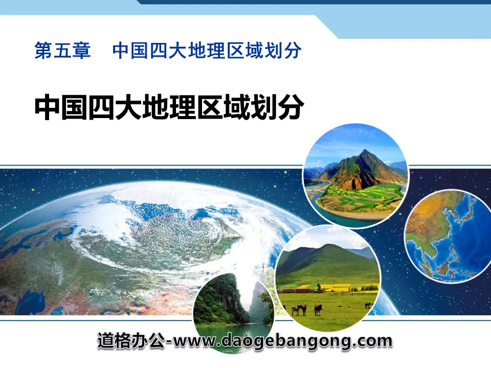
"Division of China's Four Major Geographic Regions" PPT
2024-11-21
Copyright statement: This material is compiled and released by the user of Daoge Resources. The copyright belongs to the author. For commercial use, please contact the copyright owner. If there is any infringement, please contact the webmaster to remove the resource.
Download Points: 0.00
Free Download
Upgrade VIP
Favorite
Views: 2404 / Downloads: 177
Description
"Division of China's Four Major Geographic Regions" PPT
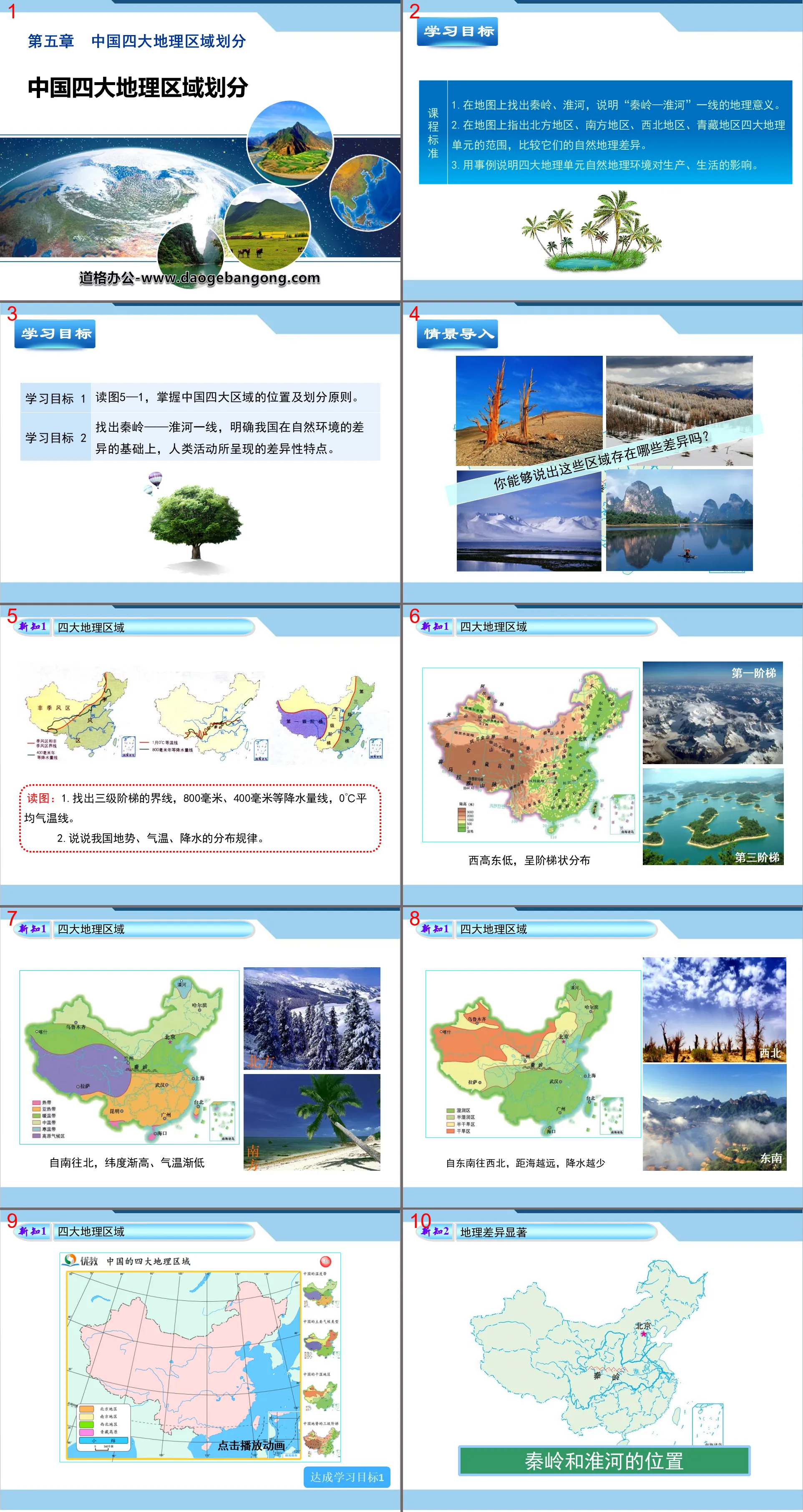
Part One: Learning Objectives
1. Find the Qinling Mountains and Huaihe River on the map and explain the geographical significance of the "Qinling Mountains-Huaihe River" line.
2. Point out the scope of the four geographical units on the map: the northern region, the southern region, the northwest region, and the Qinghai-Tibet region, and compare their physical geographical differences.
3. Use examples to illustrate the impact of the natural geographical environment of the four geographical units on production and life.
Read Figure 5-1 to understand the location and division principles of China's four major regions.
Find out the line between the Qinling Mountains and the Huaihe River, and clarify the different characteristics of human activities based on the differences in the natural environment in our country.
PPT on the division of China's four major geographical regions, part 2: learning new knowledge
New knowledge 1 Four major geographical regions
Read the picture:
1. Find the boundaries of the three-level ladder, the 800 mm and 400 mm precipitation lines, and the 0°C average temperature line.
2. Talk about the distribution patterns of terrain, temperature, and precipitation in my country.
High in the west and low in the east, distributed in a ladder shape
From south to north, the latitude becomes higher and the temperature becomes lower.
From southeast to northwest, the further away from the sea, the less precipitation occurs.
New Knowledge 2 Significant geographical differences
The location of Qinling Mountains and Huaihe River
Reading pictures
What characteristics of life and culture can you tell us about the two regions?
Obvious differences in human activities
1.The west is dominated by _______
The east is dominated by _______
2. Population, cities, and transportation lines have ________ distribution characteristics.
3. The level of economic development is _______ in the east and _______ in the west.
PPT on the division of China's four major geographical regions, the third part: on-site training
1. In a normal year, the area with the scene of “everywhere is raining during the yellow plum season, and frogs are everywhere in the grass pond” in early summer is ()
A. Hulunbuir Grassland in Area A
B. The lower reaches of the Yellow River in area B
C. The lower reaches of the Brahmaputra River in Region C
D. The middle and lower reaches of the Yangtze River in Ding area
2. Which of the following statements about the ethnic customs of the four geographical regions in the picture is incorrect ()
A. Region A holds the Naadam Conference
B. Every household in area B makes rice cakes during the Chinese New Year.
C. Area C welcomes guests and offers Hada
D. There is a Dragon Boat Festival dragon boat racing event in Dingdi
3. The Qinling Mountains are an important geographical dividing line in my country, and its geographical significance is reflected in ()
A. It is the dividing line between farming area and livestock area.
B. It is the area passing through the 400 mm annual precipitation line.
C. It is the dividing line between the Yangtze River system and the Huaihe River system.
D. It is the dividing line between subtropical monsoon climate and temperate monsoon climate.
Keywords: Free download of Geography PPT courseware for the second volume of the eighth grade edition of Business Planet Edition, PPT download of the division of China's four major geographical regions, .PPT format;
For more information about the PPT courseware "China's Four Major Geographic Regions", please click on the China's Four Major Geographic Regions ppt tab.
"Division of China's Four Major Geographic Regions" PPT courseware download:
"Dividing China's Four Major Geographic Regions" PPT courseware download Part One: Learning Objectives 1. Understand the basis of my country's four major geographical regions, as well as the differences between natural landscapes and cultural landscapes. 2. Understand the Qinling Mountains and the Huaihe River, an important geographical dividing line in my country. The size of our country...
"Division of China's Four Major Geographic Regions" PPT download:
"Division of China's Four Major Geographic Regions" PPT Download Part One: Introduction of New Courses Our country has a vast territory and significant regional differences. From the forests and snowfields of Northeast China to the tropical scenery of Hainan Island; from the water towns of Jiangnan with dense river networks to the Qinghai-Tibet Plateau with rolling snow-capped mountains and herds of cattle and sheep...
"Division of China's Four Major Geographic Regions" PPT courseware:
"Division of China's Four Major Geographic Regions" PPT courseware Learning objectives 1. Understand the general scope of my country's four major geographical regions and the main basis for their division, and remember the boundaries of the four major geographical regions. 2. Understand that the Qinling Mountains and the Huaihe River line are important geographical dividing lines in my country. study..
File Info
Update Time: 2024-11-21
This template belongs to Geography courseware Business Planet Edition Geography for Eighth Grade Volume 2 industry PPT template
"Division of China's Four Major Geographic Regions" PPT Simple campus recruitment activity planning plan summary enterprise and institution recruitment publicity lecture PPT template is a general PPT template for business post competition provided by the manuscript PPT, simple campus recruitment activity planning plan summary enterprise and institution recruitment promotion Lecture PPT template, you can edit and modify the text and pictures in the source file by downloading the source file. If you want more exquisite business PPT templates, you can come to grid resource. Doug resource PPT, massive PPT template slide material download, we only make high-quality PPT templates!
Tips: If you open the template and feel that it is not suitable for all your needs, you can search for related content "Division of China's Four Major Geographic Regions" PPT is enough.
How to use the Windows system template
Directly decompress the file and use it with office or wps
How to use the Mac system template
Directly decompress the file and use it Office or wps can be used
Related reading
For more detailed PPT-related tutorials and font tutorials, you can view: Click to see
How to create a high-quality technological sense PPT? 4 ways to share the bottom of the box
Notice
Do not download in WeChat, Zhihu, QQ, built-in browsers, please use mobile browsers to download! If you are a mobile phone user, please download it on your computer!
1. The manuscript PPT is only for study and reference, please delete it 24 hours after downloading.
2. If the resource involves your legitimate rights and interests, delete it immediately.
3. Contact information: service@daogebangong.com
"Division of China's Four Major Geographic Regions" PPT, due to usage restrictions, it is only for personal study and reference use. For commercial use, please go to the relevant official website for authorization.
(Personal non-commercial use refers to the use of this font to complete the display of personal works, including but not limited to the design of personal papers, resumes, etc.)
Preview
Related Search:
"Division of China's Four Major Geographic Regions" PPT
2024-11-21
Copyright statement: This material is compiled and released by the user of Daoge Resources. The copyright belongs to the author. For commercial use, please contact the copyright owner. If there is any infringement, please contact the webmaster to remove the resource.
Download Points: 0.00
Free Download
Upgrade VIP
Favorite
Views: 2404 / Downloads: 177


