Business Planet Edition 7th Grade Geography Volume 1
People's Education Edition Geography for Seventh Grade Volume 2
Business Planet Edition 7th Grade Geography Volume 2
Business Planet Edition Geography for Grade 8 Volume 1
People's Education Edition Geography for Eighth Grade Volume 2
Hunan Education Edition High School Geography Compulsory Course I
Shanghai Education Edition Seventh Grade Geography Volume 1
People's Education Edition Geography for Grade 8 Volume 1
Compulsory Course 1 of High School Geography in China Graphics Edition
People's Education Edition Geography for Grade 7 Volume 1
Lu Ke version of high school geography compulsory course I
Shanghai Education Edition Geography for Sixth Graders Volume 1
People's Education Press High School Geography Compulsory Course 1
Hunan Education Edition High School Geography Compulsory Course II
Business Planet Edition Geography for Eighth Grade Volume 2
Shanghai Education Edition Seventh Grade Geography Volume 2
| Category | Format | Size |
|---|---|---|
| Shanghai Education Edition Geography for Sixth Graders Volume 2 | pptx | 6 MB |

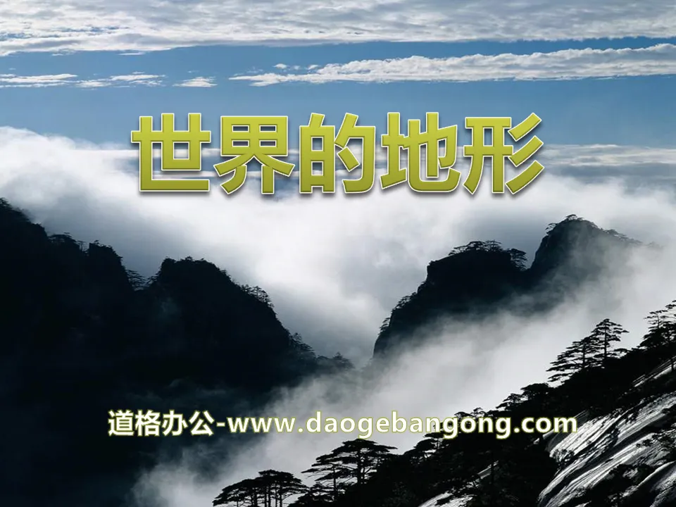
"Topography of the World" PPT
2024-11-24
Copyright statement: This material is compiled and released by the user of Daoge Resources. The copyright belongs to the author. For commercial use, please contact the copyright owner. If there is any infringement, please contact the webmaster to remove the resource.
Download Points: 0.00
Free Download
Upgrade VIP
Favorite
Views: 3272 / Downloads: 286
Description
"Topography of the World" PPT
Part One: Course Introduction
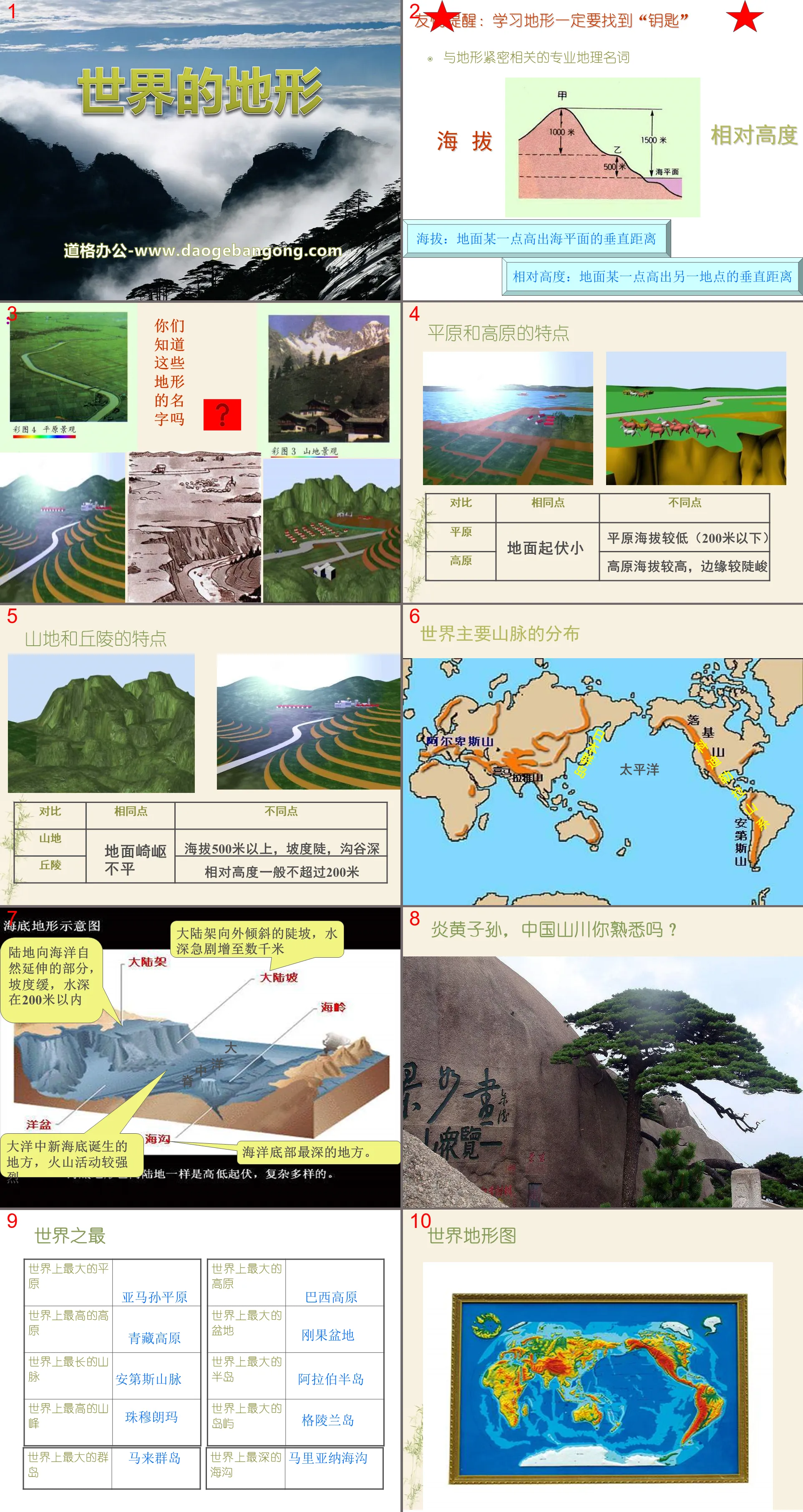
Professional geographical terms closely related to terrain
Altitude: the vertical distance above sea level at a point on the ground
Relative height: The vertical distance between a point on the ground and another point on the ground
Characteristics of plains and plateaus
plain
The plain has a lower altitude (below 200 meters)
plateau
The plateau has a higher altitude and steeper edges.
Characteristics of mountains and hills
Mountain
More than 500 meters above sea level, with steep slopes and deep ravines
hills
The relative height generally does not exceed 200 meters
Topography of the world PPT, part 2: corresponding training:
1. The relative height of the world’s highest peak (8844 meters) and the lowest point (-400 meters) is ( ) meters.
2. The bottom of a certain basin is 900 meters lower than the peak of 768 meters above sea level. The relative height of the two is ( ) meters.
3. The flagpole on the playground is 10 meters high, which refers to the height of ( ).
The topography of the world PPT, the third part: content learning
Plain: It is a vast flat area with low altitude, mostly between 0 and 500 meters above sea level, usually in coastal areas.
Those with an altitude of 0-200 meters are called low plains, and those with an altitude of 200-500 meters are called high plains.
The causes are classified into alluvial plains, marine plains, moraine plains, and glacial plains.
Plateau: The altitude is generally above 1,000 meters. It has a vast area and open terrain. It is bounded by obvious steep slopes. A relatively complete large-area uplifted area is called a plateau.
Mountainous areas: refer to highlands with an altitude of more than 500 meters, with great undulations, steep slopes, deep valleys, and are generally distributed in a vein shape.
A mountainous area is an area where many mountains are located, which is different from a single mountain or range.
Hills: refers to the gently undulating shape of the earth's surface, with an absolute height within 500 meters and a relative height no more than 200 meters, and a slope combination composed of various rock types. The slope is generally gentle, cut and broken, and has no certain direction.
Basin: a basin-shaped terrain surrounded by mountains and plateaus, with plains or hills in the middle;
When a plain is surrounded by mountains, it is a landform type composed of a plain and a hillside facing the plain.
Keywords: Free download of Geography PPT courseware for the second volume of the sixth grade of Shanghai Education Edition, PPT download of world terrain, .PPT format;
For more information about the "Topography of the World" PPT courseware, please click the "Topography of the World" ppt tag.
"Topography of the World" PPT courseware:
"Topography of the World" PPT courseware Part One: Altitude and Topography 1. Altitude and relative height Altitude is the vertical distance above sea level at a location on the ground. Relative height refers to the vertical distance between one location on the ground and another location. 2. Land terrain..
File Info
Update Time: 2024-11-24
This template belongs to Geography courseware Shanghai Education Edition Geography for Sixth Graders Volume 2 industry PPT template
"Topography of the World" PPT Simple campus recruitment activity planning plan summary enterprise and institution recruitment publicity lecture PPT template is a general PPT template for business post competition provided by the manuscript PPT, simple campus recruitment activity planning plan summary enterprise and institution recruitment promotion Lecture PPT template, you can edit and modify the text and pictures in the source file by downloading the source file. If you want more exquisite business PPT templates, you can come to grid resource. Doug resource PPT, massive PPT template slide material download, we only make high-quality PPT templates!
Tips: If you open the template and feel that it is not suitable for all your needs, you can search for related content "Topography of the World" PPT is enough.
How to use the Windows system template
Directly decompress the file and use it with office or wps
How to use the Mac system template
Directly decompress the file and use it Office or wps can be used
Related reading
For more detailed PPT-related tutorials and font tutorials, you can view: Click to see
How to create a high-quality technological sense PPT? 4 ways to share the bottom of the box
Notice
Do not download in WeChat, Zhihu, QQ, built-in browsers, please use mobile browsers to download! If you are a mobile phone user, please download it on your computer!
1. The manuscript PPT is only for study and reference, please delete it 24 hours after downloading.
2. If the resource involves your legitimate rights and interests, delete it immediately.
3. Contact information: service@daogebangong.com
"Topography of the World" PPT, due to usage restrictions, it is only for personal study and reference use. For commercial use, please go to the relevant official website for authorization.
(Personal non-commercial use refers to the use of this font to complete the display of personal works, including but not limited to the design of personal papers, resumes, etc.)
Preview
Related Search:
"Topography of the World" PPT
2024-11-24
Copyright statement: This material is compiled and released by the user of Daoge Resources. The copyright belongs to the author. For commercial use, please contact the copyright owner. If there is any infringement, please contact the webmaster to remove the resource.
Download Points: 0.00
Free Download
Upgrade VIP
Favorite
Views: 3272 / Downloads: 286


