| Category | Format | Size |
|---|---|---|
| People's Education Edition Geography for Grade 8 Volume 1 | pptx | 6 MB |

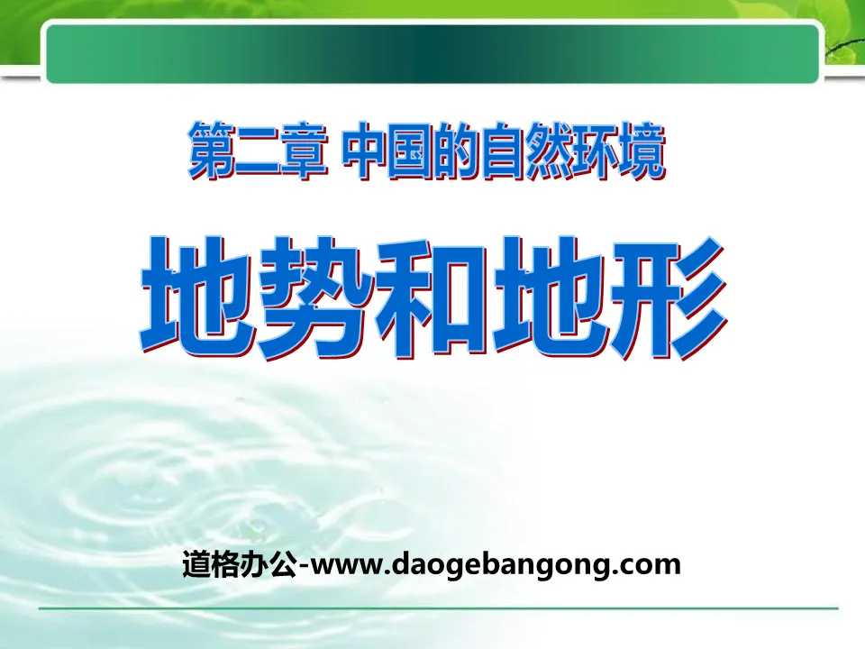
"Topography and Relief" China's Natural Environment PPT Courseware 6
Description
"Topography and Relief" China's Natural Environment PPT Courseware 6
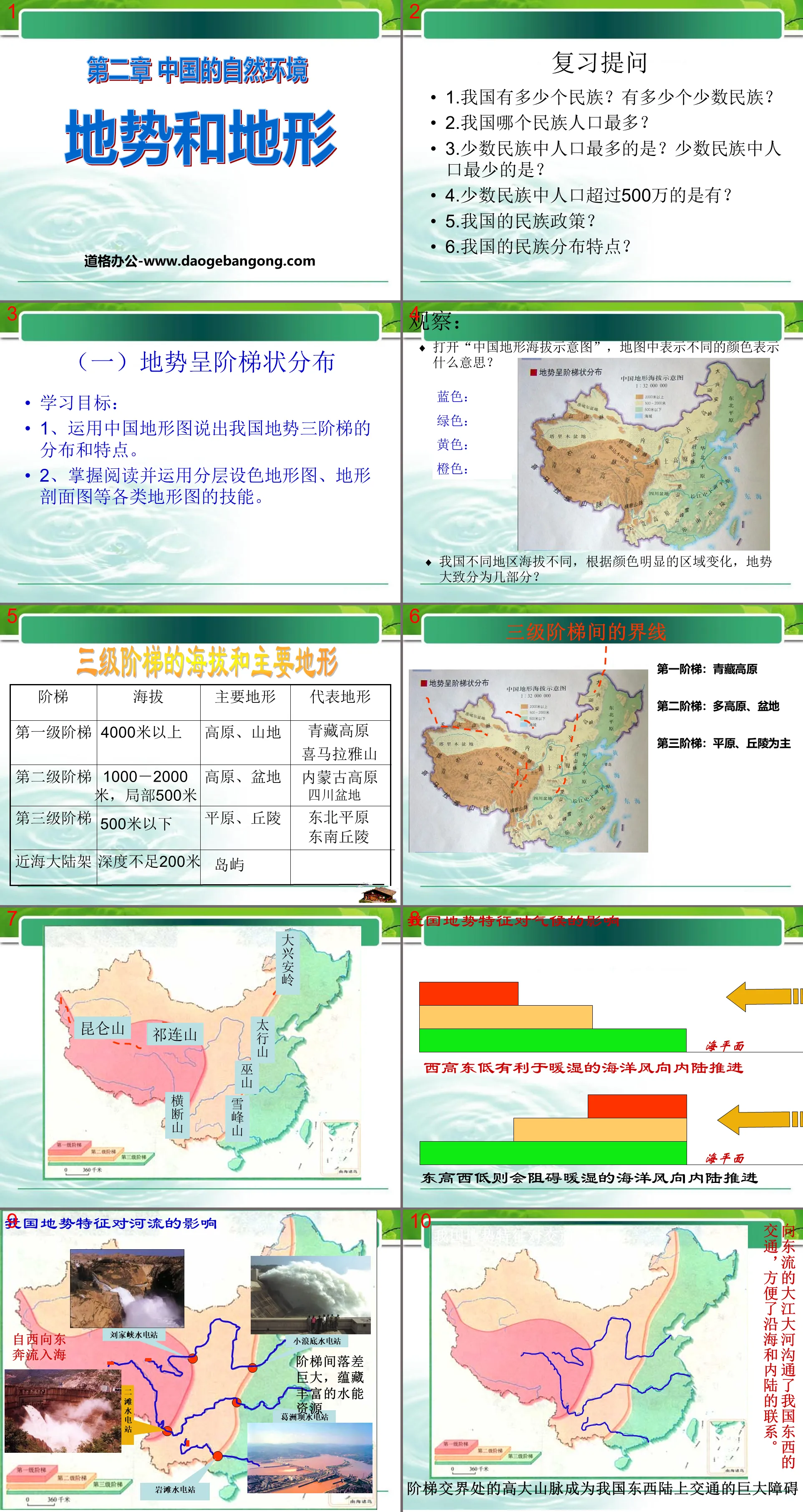
Review questions
1. How many ethnic groups are there in our country? How many ethnic minorities are there?
2. Which ethnic group has the largest population in my country?
3. Which ethnic minority has the largest population? Which ethnic minority has the smallest population?
4. Are there any ethnic minorities with a population exceeding 5 million?
5. What is my country’s ethnic policy?
6. What are the characteristics of ethnic distribution in my country?
(1) The terrain is distributed in a ladder shape
learning target:
1. Use China’s topographic map to describe the distribution and characteristics of the three terrain ladders in my country.
2. Master the skills of reading and using various topographic maps such as layered color topographic maps and topographic profile maps.
Observation: Open the "China Topography and Elevation Map". What do the different colors on the map mean?
Different regions in our country have different altitudes. According to the obvious regional changes in color, how many parts can the terrain be roughly divided into?
Elevation and main terrain of the three-level ladder
first step
More than 4000 meters
plateau, mountain
Tibetan Plateau Himalayas
second step ladder
1000-2000 meters, partially 500 meters
plateau, basin
Inner Mongolia Plateau Sichuan Basin
third level ladder
Below 500 meters
plains, hills
Northeast Plains Southeast Hills
offshore continental shelf
Depth less than 200 meters
islands
The boundary between three steps
The first step: Qinghai-Tibet Plateau
The second step: multiple plateaus and basins
The third ladder: mainly plains and hills
influence of terrain
The influence of terrain on climate: my country's terrain is high in the west and slopes toward the ocean in the east, which is conducive to the promotion of moist air from the sea to the inland of my country, bringing abundant precipitation to vast areas of our country.
The impact of terrain on rivers: "Water flows to lower areas." The terrain is high in the west and low in the east, which will inevitably cause most of my country's major rivers to flow from west to east into the sea. The gap between the steps is huge and contains abundant water energy resources.
The impact of terrain on transportation: On the one hand, the large river flowing eastward connects my country's east-west transportation and facilitates the connection between the coast and the inland; on the other hand, the tall mountains at the junction of the stairs have become a huge obstacle to my country's east-west transportation.
practise
1. Basic characteristics of China’s terrain:
It is higher in the west and lower in the east, distributed in a ladder shape.
2. On the topographic map of China, find the boundaries between the three steps:
The boundary between the first and second steps: starting from the __________ Mountains in the west, passing through the __________ Mountains to the southeast to the eastern edge of the Hengduan Mountains.
The boundaries between the second and third steps: from northeast to southwest are ____Ling, ____shan, Wushan, and ____shan.
1. Which of the following statements about the superiority of my country’s terrain, which is higher in the west and lower in the east, is correct ( )
A. The terrain slopes toward the ocean, which is not conducive to the formation of precipitation.
B. It is in the shape of a staircase, which is conducive to transportation.
C. The river flows from west to east, connecting east-west transportation and promoting economic connections between the coast and the interior.
D. Plateaus and mountains are distributed in the east, which is conducive to the development of various economies.
2. "A great river flows eastward and its waves are washed away" and "A river of spring water flows eastward" means that most of the rivers in our country flow eastward. The reason is that our country's topography ( )
A. High in the east and low in the west B. High in the south and low in the north C. High in the north and low in the south D. High in the west and low in the east
3. The main terrain of the third ladder of terrain in my country is ( )
A plains and hills B plains and plateaus C plateaus and hills D plains and basins
Read the topographic profile of my country along 36 degrees north latitude and answer the following questions:
(1) The terrain of our country is _______ high and _______ low, distributed in a ___________ shape.
(2) Our country’s terrain is divided into _______ ladders. Those with an average altitude above 4,000 meters are the _____ ladder; those whose terrain is mainly basins and plateaus are the ______ ladder; those whose terrain is mainly plains It is the _____th step of the ladder; it goes eastward to the offshore seabed, and the terrain is _______; my country's capital Beijing is located on the _______ step of the ladder.
(3) This kind of terrain is conducive to the advancement of sea ______ to the inland of our country, and the northern ______ can drive southwards for a long time, which is conducive to the formation of __________.
(4) Affected by the terrain, most of the rivers in our country run from _____ to ______ and flow into the sea, communicating ________ transportation, facilitating the connection between the coast and __________, and forming ________ zones on each ladder The huge gap contains rich _____ resources.
Keywords: China's natural environment teaching courseware, terrain and relief teaching courseware, People's Education Edition eighth grade geography PPT courseware download, eighth grade geography slide courseware download, China's natural environment PPT courseware download, topography and relief PPT courseware download, .PPT format;
For more information about the "China's Natural Environment Topography and Relief" PPT courseware, please click on the China's Natural Environment ppt topography and relief ppt tag.
"Topography and Relief" China's Natural Environment PPT Courseware 9:
"Topography and Relief" China's Natural Environment PPT Courseware 9 Four major plateaus: Qinghai-Tibet Plateau, Inner Mongolia Plateau, Loess Plateau, Yunnan-Guizhou Plateau Four major basins: Tarim Basin, Junggar Basin, Qaidam Basin, Sichuan Basin Three major plains: Northeast Plain , Huabeiping...
"Topography and Relief" China's Natural Environment PPT Courseware 8:
"Topography and Relief" China's Natural Environment PPT Courseware 8 Learning Objectives 1. Topography 2. Basic characteristics of terrain 3. Boundary lines between ladders 4. Characteristics of three-level ladders 5. The impact of terrain characteristics on my country's natural environment and economic activities 6. Practice... ...the basics of terrain...
"Topography and Relief" China's Natural Environment PPT Courseware 7:
"Topography and Relief" China's Natural Environment PPT Courseware 7 Do it Find out the main mountain ranges with different directions. Main mountain ranges: East-west direction: Tianshan Yinshan Mountains, Kunlun Mountains, Qinling Mountains, Nanling Mountains, northeast-southwest direction: Greater Hinggan Mountains, Taihang Mountains, Wushan Xuefeng Mountains, Changbai Mountains, Wuyi Mountains, Taiwan...
File Info
Update Time: 2024-07-31
This template belongs to Geography courseware People's Education Edition Geography for Grade 8 Volume 1 industry PPT template
"Topography and Relief" China's Natural Environment PPT Courseware 6 Simple campus recruitment activity planning plan summary enterprise and institution recruitment publicity lecture PPT template is a general PPT template for business post competition provided by the manuscript PPT, simple campus recruitment activity planning plan summary enterprise and institution recruitment promotion Lecture PPT template, you can edit and modify the text and pictures in the source file by downloading the source file. If you want more exquisite business PPT templates, you can come to grid resource. Doug resource PPT, massive PPT template slide material download, we only make high-quality PPT templates!
Tips: If you open the template and feel that it is not suitable for all your needs, you can search for related content "Topography and Relief" China's Natural Environment PPT Courseware 6 is enough.
How to use the Windows system template
Directly decompress the file and use it with office or wps
How to use the Mac system template
Directly decompress the file and use it Office or wps can be used
Related reading
For more detailed PPT-related tutorials and font tutorials, you can view: Click to see
How to create a high-quality technological sense PPT? 4 ways to share the bottom of the box
Notice
Do not download in WeChat, Zhihu, QQ, built-in browsers, please use mobile browsers to download! If you are a mobile phone user, please download it on your computer!
1. The manuscript PPT is only for study and reference, please delete it 24 hours after downloading.
2. If the resource involves your legitimate rights and interests, delete it immediately.
3. Contact information: service@daogebangong.com
"Topography and Relief" China's Natural Environment PPT Courseware 6, due to usage restrictions, it is only for personal study and reference use. For commercial use, please go to the relevant official website for authorization.
(Personal non-commercial use refers to the use of this font to complete the display of personal works, including but not limited to the design of personal papers, resumes, etc.)
Preview
Related Search: