Business Planet Edition 7th Grade Geography Volume 2
Business Planet Edition 7th Grade Geography Volume 1
Business Planet Edition Geography for Grade 8 Volume 1
People's Education Edition Geography for Seventh Grade Volume 2
Shanghai Education Edition Seventh Grade Geography Volume 1
People's Education Edition Geography for Eighth Grade Volume 2
Business Planet Edition Geography for Eighth Grade Volume 2
Hunan Education Edition High School Geography Compulsory Course I
People's Education Edition Geography for Grade 7 Volume 1
Shanghai Education Edition Geography for Sixth Graders Volume 1
Lu Ke version of high school geography compulsory course I
Compulsory Course 1 of High School Geography in China Graphics Edition
Hunan Education Edition High School Geography Compulsory Course II
People's Education Edition Geography for Grade 8 Volume 1
Shanghai Education Edition Seventh Grade Geography Volume 2
Shanghai Education Edition Geography for Sixth Graders Volume 2
| Category | Format | Size |
|---|---|---|
| People's Education Edition Geography for Grade 8 Volume 1 | pptx | 6 MB |

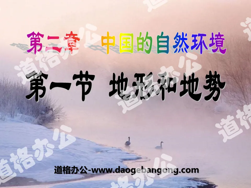
"Topography and Relief" China's Natural Environment PPT Courseware 8
2024-10-06
Copyright statement: This material is compiled and released by the user of Daoge Resources. The copyright belongs to the author. For commercial use, please contact the copyright owner. If there is any infringement, please contact the webmaster to remove the resource.
Download Points: 0.00
Free Download
Upgrade VIP
Favorite
Views: 4041 / Downloads: 917
Description
"Topography and Relief" China's Natural Environment PPT Courseware 8
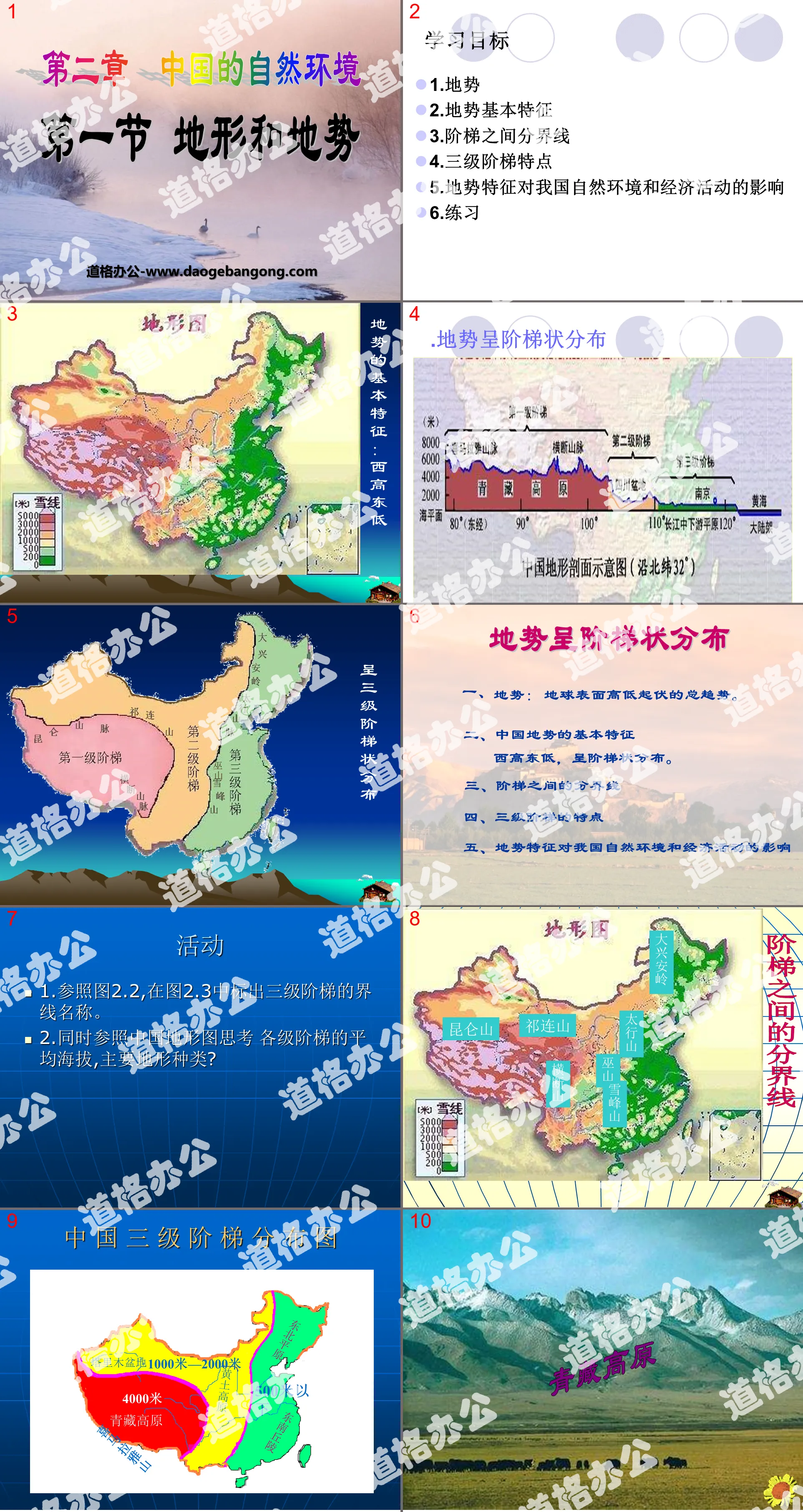
learning target
1.Topography
2. Basic characteristics of terrain
3. The dividing line between steps
4. Characteristics of the three-level ladder
5. The impact of terrain characteristics on my country’s natural environment and economic activities
6. Practice
Basic characteristics of terrain: high in the west and low in the east
The terrain is distributed in a ladder shape
1. Topography: the general trend of ups and downs on the earth's surface.
2. Basic characteristics of China’s terrain
It is higher in the west and lower in the east, distributed in a ladder shape.
3. The dividing line between stairs
Characteristics of the fourth and third levels of the ladder
5. The impact of terrain characteristics on my country’s natural environment and economic activities
practise
1. Basic characteristics of China’s terrain:
It is higher in the west and lower in the east, distributed in a ladder shape.
2. On the topographic map of China, find the boundaries between the three steps:
The boundary between the first and second steps: starting from the __________ Mountains in the west, passing through the __________ Mountains to the southeast to the eastern edge of the Hengduan Mountains.
The boundaries between the second and third steps: from northeast to southwest are ____Ling, ____shan, Wushan, and ____shan.
Think and discuss
The terrain is high in the west and low in the east. It is distributed in a ladder shape. What impact does it have on my country's natural environment and people's production and life?
Refer to activities 2, 3, and 4 on page 23 to answer.
The impact of my country's terrain characteristics on climate
High in the west and low in the east are conducive to the advancement of warm and humid ocean air flow inland
High in the east and low in the west will prevent warm and humid ocean air from advancing inland.
The impact of terrain characteristics on my country’s natural environment and economic activities
Climate: High in the west and low in the east are conducive to the advancement of warm and humid ocean air flow inland, causing abundant precipitation in most areas in the east.
Rivers: my country's major rivers run from west to east and flow into the sea.
Water energy: The gap is large and water energy resources are abundant. Hydropower stations can be built at the junction of the stairs.
Transportation: The large river flowing eastward connects the east-west transportation and facilitates the connection between the coast and the inland. However, the tall mountains at the junction of the steps have become a huge obstacle to east-west transportation.
Qaidam Basin
The Qaidam Basin is located in Qinghai Province in the northeastern part of the Qinghai-Tibet Plateau, with an average altitude of about 3,000 meters. It is the highest basin and a typical inland plateau basin. Most of the interior of the basin is Gobi and desert, with swamps and salt lakes in the east. The basin is rich in petroleum, non-ferrous metal ore and salt resources, so the Qaidam Basin is known as the "treasure basin". .
Tarim Basin and Junggar Basin
The Tarim Basin and Junggar Basin are located in the inland northwest of my country, within Xinjiang, and are separated from the north and south sides of the Tianshan Mountains. These two basins are surrounded by high mountains, and the interior is relatively flat, with vast stretches of desert and Gobi. The Tarim Basin is the largest basin in my country, and the Taklimakan Desert inside the basin is the largest desert in my country.
Sichuan Basin
The Sichuan Basin is located in Sichuan Province and Chongqing City of my country. The basin is surrounded by mountains and plateaus. The interior of the basin is undulating with low hills and hills, with an altitude of about 500 meters. Only the Chengdu Plain has a relatively flat terrain, like a fan spread diagonally in the west of the basin. It is the alluvial fan plain of the Minjiang River. It has fertile soil, convenient irrigation, and rich products. It is known as the "Land of Abundance". The Sichuan Basin is known as the "Red Basin" and "Purple Basin" due to the widespread distribution of purple sand shale.
Keywords: China's natural environment teaching courseware, terrain and relief teaching courseware, People's Education Edition eighth grade geography PPT courseware download, eighth grade geography slide courseware download, China's natural environment PPT courseware download, topography and relief PPT courseware download, .PPT format;
For more information about the "China's Natural Environment Topography and Relief" PPT courseware, please click on the China's Natural Environment PPT Topography and Relief PPT tab.
"Topography and Relief" China's Natural Environment PPT Courseware 9:
"Topography and Relief" China's Natural Environment PPT Courseware 9 Four major plateaus: Qinghai-Tibet Plateau, Inner Mongolia Plateau, Loess Plateau, Yunnan-Guizhou Plateau Four major basins: Tarim Basin, Junggar Basin, Qaidam Basin, Sichuan Basin Three major plains: Northeast Plain , Huabeiping...
"Topography and Relief" China's Natural Environment PPT Courseware 7:
"Topography and Relief" China's Natural Environment PPT Courseware 7 Do it Find out the main mountain ranges with different directions. Main mountain ranges: East-west direction: Tianshan Yinshan Mountains, Kunlun Mountains, Qinling Mountains, Nanling Mountains, northeast-southwest direction: Greater Hinggan Mountains, Taihang Mountains, Wushan Xuefeng Mountains, Changbai Mountains, Wuyi Mountains, Taiwan...
"Topography and Relief" China's Natural Environment PPT Courseware 6:
"Topography and Relief" China's Natural Environment PPT Courseware 6 Review Questions 1. How many ethnic groups are there in our country? How many ethnic minorities are there? 2. Which ethnic group has the largest population in my country? 3. Which ethnic minority has the largest population? Which ethnic minority has the smallest population? 4.Minorities..
File Info
Update Time: 2024-10-06
This template belongs to Geography courseware People's Education Edition Geography for Grade 8 Volume 1 industry PPT template
"Topography and Relief" China's Natural Environment PPT Courseware 8 Simple campus recruitment activity planning plan summary enterprise and institution recruitment publicity lecture PPT template is a general PPT template for business post competition provided by the manuscript PPT, simple campus recruitment activity planning plan summary enterprise and institution recruitment promotion Lecture PPT template, you can edit and modify the text and pictures in the source file by downloading the source file. If you want more exquisite business PPT templates, you can come to grid resource. Doug resource PPT, massive PPT template slide material download, we only make high-quality PPT templates!
Tips: If you open the template and feel that it is not suitable for all your needs, you can search for related content "Topography and Relief" China's Natural Environment PPT Courseware 8 is enough.
How to use the Windows system template
Directly decompress the file and use it with office or wps
How to use the Mac system template
Directly decompress the file and use it Office or wps can be used
Related reading
For more detailed PPT-related tutorials and font tutorials, you can view: Click to see
How to create a high-quality technological sense PPT? 4 ways to share the bottom of the box
Notice
Do not download in WeChat, Zhihu, QQ, built-in browsers, please use mobile browsers to download! If you are a mobile phone user, please download it on your computer!
1. The manuscript PPT is only for study and reference, please delete it 24 hours after downloading.
2. If the resource involves your legitimate rights and interests, delete it immediately.
3. Contact information: service@daogebangong.com
"Topography and Relief" China's Natural Environment PPT Courseware 8, due to usage restrictions, it is only for personal study and reference use. For commercial use, please go to the relevant official website for authorization.
(Personal non-commercial use refers to the use of this font to complete the display of personal works, including but not limited to the design of personal papers, resumes, etc.)
Preview
Related Search:
"Topography and Relief" China's Natural Environment PPT Courseware 8
2024-10-06
Copyright statement: This material is compiled and released by the user of Daoge Resources. The copyright belongs to the author. For commercial use, please contact the copyright owner. If there is any infringement, please contact the webmaster to remove the resource.
Download Points: 0.00
Free Download
Upgrade VIP
Favorite
Views: 4041 / Downloads: 917


