| Category | Format | Size |
|---|---|---|
| People's Education Edition Geography for Grade 7 Volume 1 | pptx | 6 MB |

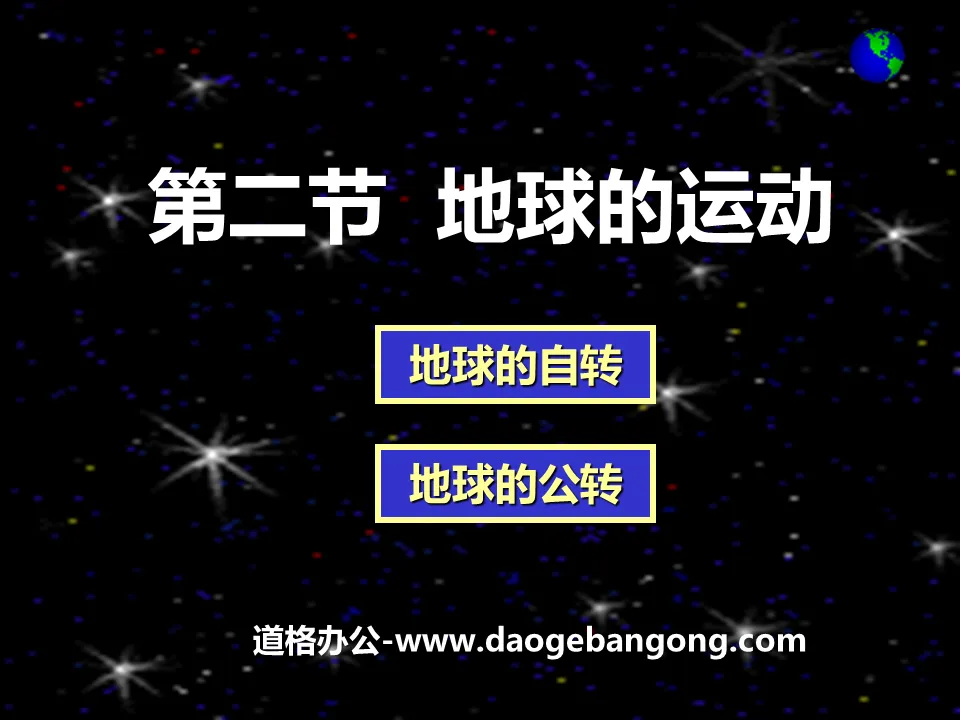
"The Movement of the Earth" Earth and Map PPT Courseware 7
Description
"The Movement of the Earth" Earth and Map PPT Courseware 7
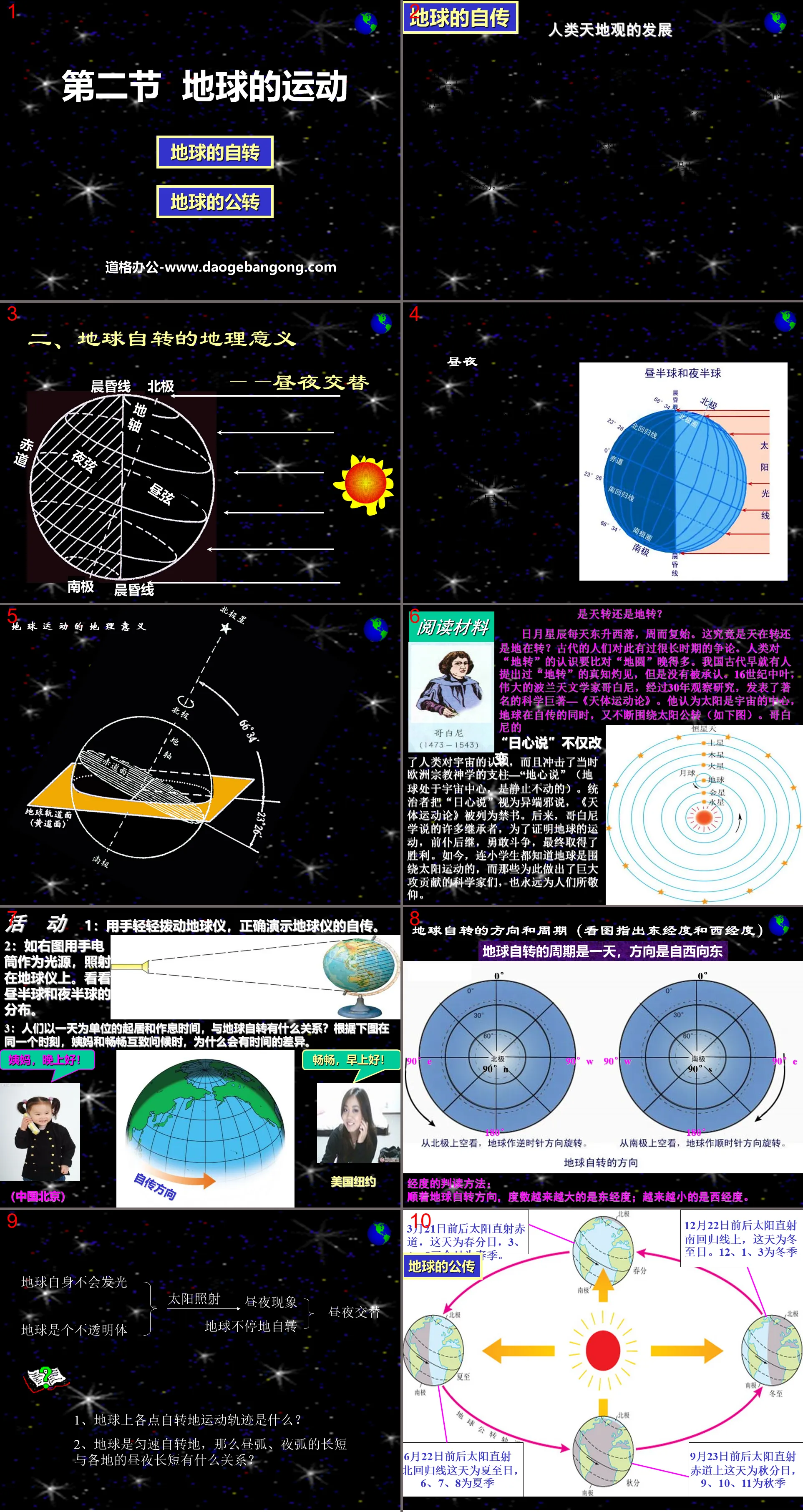
The Autobiography of the Earth: The Development of Humanity’s View of Heaven and Earth
The earliest theory of "a round sky and a square place" in the Spring and Autumn Period regards the sky as a cover covering the ground, also called "the theory of covering the sky". The sun, moon and stars rise in the east and set in the west. From where it rises and where it falls, the Gaitian theory cannot answer, so a new view came into being - the "Huntian theory", which compares the relationship between the sky and the earth to the relationship between the eggshell and the yolk, the sun and the moon. Stars are attached to eggshells and move around the earth. According to this idea, Zhang Heng of the Eastern Han Dynasty made an "armillary sphere" and carved the constellations on a ball. The ball rotated around its axis and could perform the phenomenon of stars rising in the east and setting in the west, proposing that the earth is spherical.
In the second century AD, Ptolemy of the Alexandrian school in ancient Greece summarized the results of astronomical observations of the planets and created a complete geocentric theory. It is believed that the earth is spherical, the earth is the center of the universe, and the sun revolves around the earth. Due to the establishment of a mathematical planetary system model, the movement laws of the planets are quite consistent with reality, which meets the needs of navigation and has been accepted and adopted by people for a long time. Its theory of the center of the earth was wrong, but the accuracy of observations at that time could not fully reveal this error.
In 1548, Copernicus published a brilliant work "On the Revolution of Celestial Bodies" and proposed the heliocentric theory, which believed that the sun is the center of the planetary system, and all planets revolve around the sun. The earth is also a planet, and the earth moves. The earth has two It is a kind of motion. On the one hand, it rotates like a top, and on the other hand, it revolves around the sun like other planets.
2. The geographical significance of the earth’s rotation—the alternation of day and night
day and night
Since the earth is an opaque sphere, the side of the earth facing the sun is the day hemisphere, and the side facing away from the sun is the night hemisphere.
Is it a rotation in the sky or a rotation in the earth?
The sun, moon and stars rise in the east and set in the west every day, over and over again. Is the sky spinning or the earth spinning? People in ancient times had a long debate about this. Human beings' understanding of "the rotation of the earth" was much later than that of the "round earth". In ancient my country, some people had already put forward the insight of "georotation", but it was not recognized. In the mid-16th century, the great Polish astronomer Copernicus published a famous scientific masterpiece - "On the Motion of Celestial Bodies" after 30 years of observation and research. He believed that the sun was the center of the universe, and that the earth was constantly revolving around the sun while spinning itself (as shown below). Copernican
"Heliocentric theory" not only changed mankind's understanding of the universe, but also impacted the "geocentric theory" (the earth is at the center of the universe and is stationary), which was the pillar of European religious theology at that time. The rulers regarded the "heliocentric theory" as a heresy, and "On the Movement of Celestial Bodies" was listed as a banned book. Later, many successors to the Copernican theory fought bravely one after another in order to prove the movement of the earth, and finally won. Nowadays, even primary school students know that the earth moves around the sun, and those scientists who have made great contributions to this end will always be admired by people.
Activity
1: Gently move the globe with your hands to correctly demonstrate the autobiography of the globe.
2: As shown on the right, use a flashlight as a light source and shine it on the globe. Look at the distribution of day and night hemispheres.
3: What is the relationship between people’s daily life and rest time in one day and the rotation of the earth? According to the picture below, when Auntie and Changchang greet each other at the same moment, why is there a time difference?
The sun here is so slanted that it is always below the horizon for a while, and the climate is cold all year round.
For a long time, the noon sun always shines overhead. The climate is hot all year round.
The ground here receives less sunlight and heat than in the tropics and more than in the frigid zone, and the four seasons change more obviously.
True or False:
(1) Low latitudes are tropical areas ( )
The tropics are low latitude areas ( )
(2) High latitudes are cold zone areas ( )
The cold zone is a high latitude area ( )
(3) Mid-latitude areas are temperate zones ( )
Temperate zones are mid-latitude areas ( )
1. Regarding the latitude line, the correct statement is ( )
A. With 0 degrees of longitude as the boundary, the degrees of east longitude and west longitude become larger and larger toward the east and west respectively.
B. With the equator as the boundary, the degrees of northern latitude and southern latitude become smaller and smaller towards the north and south respectively.
C. Latitude lines indicate the north-south direction, and longitude lines indicate the east-west direction.
D. All longitude lines do not intersect
2. The boundary dividing the eastern and western hemispheres is ( )
A. The warp coil composed of 0° longitude and 180° longitude B. The warp loop composed of 20°E and 160°W
C. Longitude coil composed of 20°W and 160°E D. 0° latitude coil
3. If a person stands on the North Pole and takes one step forward to the right, the direction he is heading is ( )
A. Northeast B. Due south C. Southwest D. Southeast
4. Regarding the judgment of land A (15°W, 23°N), the correct answer is ( )
A. Located in both hemispheres B. Located in the southern hemisphere C. Located in the northern temperate zone D. With direct sunlight
5. To the west of a certain point is the Western Hemisphere, to the east is the Eastern Hemisphere, to the south is direct sunlight, and to the north is the temperate zone, then the geographical location of the point is ( )
A.23.5°N, 160°E B.66.5°N, 160°E C.23.5°S, 180° D.23.5°N, 20°W
6. At 7:26 in the morning one day, a grand flag-raising ceremony was held in Tiananmen Square in Beijing. This day is most likely to be ( )
A.New Year's Day B.Qingming Festival C.Labor Day D.National Day
7. The place with direct sunlight twice a year is ( )
A.Equator B.Tropic of Cancer C.40°N D.Arctic Circle
8. The area with no direct sunlight and no polar day and night phenomena is ( )
A. Tropical zone B. Temperate zone C. Northern frigid zone D. Southern frigid zone
9. On November 29, 2010, the Chinese scientific expedition team was preparing to go to Antarctica for inspection. This time was chosen because ( )
A. It’s spring there B. It’s summer there C. It’s autumn there D. It’s winter there
10. The area with the most obvious changes in the four seasons is ( )
A. Tropical region B. Temperate region C. Cold zone D. Equatorial region
Keywords: Earth and map teaching courseware, Earth's movement teaching courseware, People's Education Edition seventh grade geography PPT courseware download, seventh grade geography slide courseware download, Earth and map PPT courseware download, Earth's movement PPT courseware download, .PPT Format;
For more information about the "Earth's Movement Earth and Maps" PPT courseware, please click the Earth's Movement ppt Earth and Maps ppt tag.
"Explanation of Polar Day and Polar Night" PPT download of the movement of the earth:
"Explanation of Polar Day and Polar Night" PPT Download of Earth's Movement Part One: Exploring New Knowledge The phenomenon of polar day and polar night The phenomenon of polar day and polar night is the result of the tilt of the earth's axis causing sunlight to hit the polar regions at different times. So people in the polar regions can see the sun for a period of time...
"Explanation of Polar Day and Polar Night" Earth's Movement PPT:
"Explanation of Polar Day and Polar Night" PPT on the Movement of the Earth Part One: The Phenomenon of Polar Day and Polar Night There are many strange things in the Antarctic and Arctic of the Earth, one of which is that the polar day or night is very long. In the northern hemisphere summer, the sun always hangs over the North Pole..
"Why there are four seasons in a year" PPT download of the movement of the earth:
"Why there are four seasons in a year" PPT download of the movement of the earth Part One: Exploring new knowledge The ancients used the method of studying the four seasons: pole measurement and publishing the measurement results. The length of the pole shadow will be used as a known condition in the study of the four seasons to determine the season..
File Info
Update Time: 2024-06-30
This template belongs to Geography courseware People's Education Edition Geography for Grade 7 Volume 1 industry PPT template
"The Movement of the Earth" Earth and Map PPT Courseware 7 Simple campus recruitment activity planning plan summary enterprise and institution recruitment publicity lecture PPT template is a general PPT template for business post competition provided by the manuscript PPT, simple campus recruitment activity planning plan summary enterprise and institution recruitment promotion Lecture PPT template, you can edit and modify the text and pictures in the source file by downloading the source file. If you want more exquisite business PPT templates, you can come to grid resource. Doug resource PPT, massive PPT template slide material download, we only make high-quality PPT templates!
Tips: If you open the template and feel that it is not suitable for all your needs, you can search for related content "The Movement of the Earth" Earth and Map PPT Courseware 7 is enough.
How to use the Windows system template
Directly decompress the file and use it with office or wps
How to use the Mac system template
Directly decompress the file and use it Office or wps can be used
Related reading
For more detailed PPT-related tutorials and font tutorials, you can view: Click to see
How to create a high-quality technological sense PPT? 4 ways to share the bottom of the box
Notice
Do not download in WeChat, Zhihu, QQ, built-in browsers, please use mobile browsers to download! If you are a mobile phone user, please download it on your computer!
1. The manuscript PPT is only for study and reference, please delete it 24 hours after downloading.
2. If the resource involves your legitimate rights and interests, delete it immediately.
3. Contact information: service@daogebangong.com
"The Movement of the Earth" Earth and Map PPT Courseware 7, due to usage restrictions, it is only for personal study and reference use. For commercial use, please go to the relevant official website for authorization.
(Personal non-commercial use refers to the use of this font to complete the display of personal works, including but not limited to the design of personal papers, resumes, etc.)
Preview
Related Search: