Business Planet Edition 7th Grade Geography Volume 1
Business Planet Edition 7th Grade Geography Volume 2
Business Planet Edition Geography for Grade 8 Volume 1
People's Education Edition Geography for Seventh Grade Volume 2
People's Education Edition Geography for Eighth Grade Volume 2
Shanghai Education Edition Seventh Grade Geography Volume 1
Hunan Education Edition High School Geography Compulsory Course I
People's Education Edition Geography for Grade 8 Volume 1
Compulsory Course 1 of High School Geography in China Graphics Edition
People's Education Edition Geography for Grade 7 Volume 1
Shanghai Education Edition Geography for Sixth Graders Volume 1
Hunan Education Edition High School Geography Compulsory Course II
Lu Ke version of high school geography compulsory course I
People's Education Press High School Geography Compulsory Course 1
Business Planet Edition Geography for Eighth Grade Volume 2
Shanghai Education Edition Seventh Grade Geography Volume 2

| Category | Format | Size |
|---|---|---|
| People's Education Edition Geography for Seventh Grade Volume 2 | pptx | 6 MB |
Description
"Brazil" Western Hemisphere countries PPT courseware 4
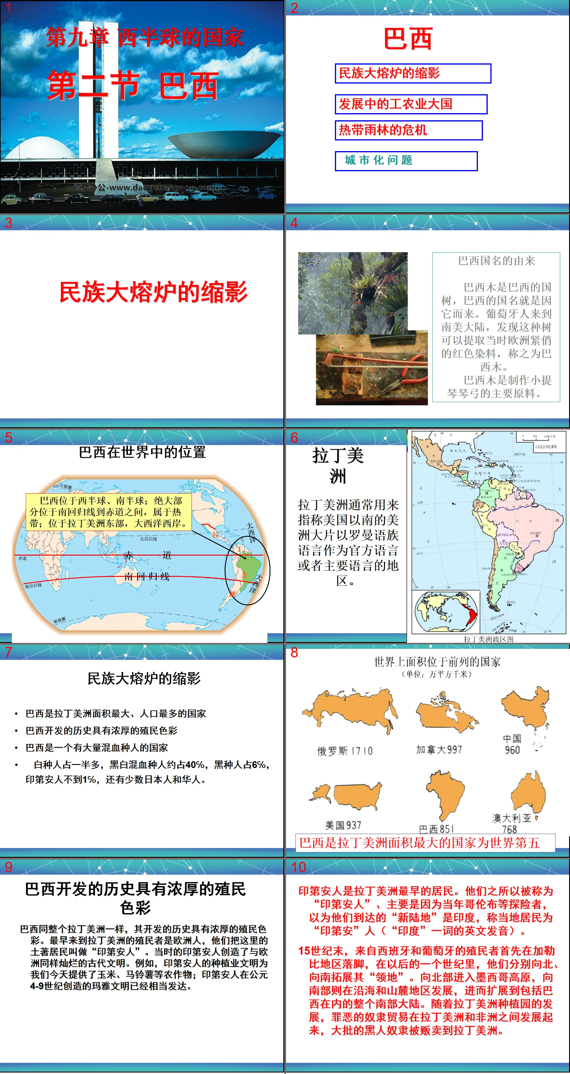
The origin of the name Brazil
The Brazilian tree is the national tree of Brazil, and the name of the country is derived from it. The Portuguese came to the South American continent and discovered that this tree could extract red dye, which was in high demand in Europe at the time, and called it Brazilian wood.
Brazilian wood is the main raw material for making violin bows.
Brazil's place in the world
Brazil is located in the Western and Southern Hemispheres; most of it is located between the Tropic of Capricorn and the equator, which is tropical; it is located in eastern Latin America on the west coast of the Atlantic Ocean.
latin america
Latin America is usually used to refer to the large area of America south of the United States where Romance languages are the official or main languages.
Brazil’s history of development has a strong colonial flavor
Brazil, like all of Latin America, has a history of development with strong colonial overtones. The first colonists to come to Latin America were Europeans, who called the indigenous people here "Indians." The Indians at that time created an ancient civilization as brilliant as Europe. For example, the planting civilization of the Indians provides us with crops such as corn and potatoes today; the Mayan civilization created by the Indians from the 4th to 9th centuries AD is already quite developed.
Indians were the first inhabitants of Latin America. The reason why they are called "Indians" is mainly because explorers such as Columbus thought that the "new land" they arrived was India, and called the local residents "Indians" (the English pronunciation of the word "India").
At the end of the 15th century, colonists from Spain and Portugal first settled in the Caribbean. In the next century, they expanded their "territory" to the north and south respectively. To the north it enters the Mexican Plateau, to the south it develops in coastal and piedmont areas, and then spreads throughout the southern continent, including Brazil. With the development of plantations in Latin America, the criminal slave trade developed between Latin America and Africa, and large numbers of black slaves were sold to Latin America.
Mayan civilization
The Mayan culture is one of the important ancient cultures in the world, and it is also a major classical culture in the Americas, with a history of more than 5,000 years.
The Mayan civilization was conceived, emerged, and developed in the Yucatan Peninsula, Chiapas and Tapasco states of present-day Mexico, and in some places in Central America.
The Mayan civilization made great achievements in material culture, science and art. For example, construction engineering reached the highest level in the ancient world, and solid stone could be carved and processed. Through long-term observation of astronomical phenomena, we have mastered the solar eclipse cycle and the movement patterns of the sun, moon, and Venus; sculptures, painted pottery, and murals all have high artistic value.
(1)Sea and land location: A maritime country in the east of South America, facing the Atlantic Ocean to the east
(2) North: French Guiana, Suriname, Guyana, Venezuela
West: Colombia, Peru, Bolivia, Paraguay
South: Argentina, Uruguay
(3)Brazil’s location
Latitude position
The latitude position is that most of the country is located between the Tropic of Capricorn and the equator, and the tropical area is vast.
Two stages of Brazilian economic development and their characteristics
Colonial rule: from the discovery of Brazil by Portuguese colonists to before World War II
Characteristics: Single production of agricultural and mineral products, underdeveloped modern industry
Economic sectors: Timber, sugar industry, mining, coffee
After World War II: From World War II to the present
Characteristics: A developing industrial and agricultural country with a complete national economic system
Economic sectors: Industry (steel, shipbuilding, automobiles, aircraft manufacturing)
Agriculture (tropical cash crops: coffee, sugar cane, citrus)
Activity P94--1 Read Figure 9.22. What mineral resources are there?
Why are heavy industries concentrated in Sao Paulo, Rio de Janeiro and other areas?
1. Main minerals: iron, manganese, coal, petroleum, gold. Among them, Brazil lacks high-quality coal and does not produce much oil. The most abundant thing is iron ore.
The reasons why heavy industry is distributed in Sao Paulo and Rio de Janeiro are: rich mineral resources, concentrated population, early industrial development, and convenient maritime transportation.
Activity p94--3 What are the main crops?
In which area are crops mainly concentrated?
3. Main crops: coffee, sugar cane, soybeans, corn, cotton, cocoa, etc. Concentrated in the southeastern coastal area;
Favorable conditions for developing agriculture: subtropical humid climate, mild and humid climate, concentrated population, and sufficient labor force.
Consolidation exercises:
1. Multiple choice questions:
1. The country with the largest area, largest population and most developed economy in Latin America is
A. Brazil B. Mexico C. Argentina D. Chile
2. Brazil is known as the “World Ethnographic Museum”, more than half of which are
A. Mixed race B. Yellow race C. White race D. Black race
3. Who created the world-famous Mayan culture ( )
A. Egyptians B. Indians C. Indians D. Babylonians
4. Among Brazilian agricultural products, the output and export volume rank first in the world ( )
A.Orange juice B.Cocoa C.Coffee D.Sugar cane,
5. Brazil’s minerals with large reserves, excellent quality, and leading output and export volume in the world are ( )
A. Manganese ore B. Iron ore C. Coal mine D. Tungsten ore
6. The country that jointly built the Itaipu Hydropower Station, the largest hydropower station in the world, with Brazil is ( )
A. Uruguay B. Guyana C. Paraguay D. Argentina
Fill in the blanks (1-7)
1. Latin America has the largest area of ______ (forest) in the world, which is called "______". In order to better protect it, "______" was formulated. The ______ people in Latin America created the splendid Mayan civilization.
2. Brazil is said to be the epitome of ______, about 40% of people are of ______ race, and the common language is ______.
3. Brazil is the country with the largest area of _____ zone (temperature zone) in the world.
4. The popular folk entertainment activity of Brazilians is _____ dance. ______ is also a favorite sport. ______ Festival is the most solemn festival.
5. The river with the largest volume of water and the widest drainage area in the world is the ______ River. It originates from ______ Mountain and flows into the _____ Ocean.
6. 1/3 of Brazil is _______ plain, which has a _______ climate. 2/3 is the _______ plateau, which is dominated by _______ climate.
7. More than 90% of Brazil’s energy relies on hydropower. Brazil and Paraguay jointly built the world’s second largest hydropower station_______.
Keywords: National teaching courseware in the Western Hemisphere, Brazilian teaching courseware, New People's Education Edition seventh grade geography PPT courseware, second volume, seventh grade geography slide courseware download, National PPT courseware download in the Western Hemisphere, Brazilian PPT courseware download, .ppt format
For more information about the PPT courseware "Brazil Countries in the Western Hemisphere", please click on the Brazil ppt Countries in the Western Hemisphere ppt tab.
"A Model of Urban Planning - Brasilia" Civilization Center - Urban PPT Courseware:
"Brasilia, a Model of Urban Planning" Civilized Central City PPT courseware Part One: Step-by-step learning 1. The location of Brazil 1. It is located in the Western Hemisphere, mostly in the Southern Hemisphere. The largest country in the southern hemisphere. 2. Mostly located in low latitudes and tropics 3. Located in South America..
"Model of Urban Planning - Brasilia" Civilization Center - City PPT:
"Brasilia, a Model of Urban Planning" Civilized Central City PPT Part One: Brazil's position on the earth Area: 8.5149 million square kilometers Population: 191 million. Caucasians account for 53.74%, mulattoes account for 38.45%, blacks account for 6.21%, yellow and...
"Brazil" PPT download:
Download "Brazil" Part One: Learning Objectives 1. Understand the location and natural environment of Brazil. 2. Master the terrain and climate characteristics of Brazil. 3. Understand Brazil’s population and diverse culture. ... ... ... Brazil PPT, Part 2: The location of Brazil..
File Info
Update Time: 2024-11-14
This template belongs to Geography courseware People's Education Edition Geography for Seventh Grade Volume 2 industry PPT template
"Brazil" Western Hemisphere countries PPT courseware 4 Simple campus recruitment activity planning plan summary enterprise and institution recruitment publicity lecture PPT template is a general PPT template for business post competition provided by the manuscript PPT, simple campus recruitment activity planning plan summary enterprise and institution recruitment promotion Lecture PPT template, you can edit and modify the text and pictures in the source file by downloading the source file. If you want more exquisite business PPT templates, you can come to grid resource. Doug resource PPT, massive PPT template slide material download, we only make high-quality PPT templates!
Tips: If you open the template and feel that it is not suitable for all your needs, you can search for related content "Brazil" Western Hemisphere countries PPT courseware 4 is enough.
How to use the Windows system template
Directly decompress the file and use it with office or wps
How to use the Mac system template
Directly decompress the file and use it Office or wps can be used
Related reading
For more detailed PPT-related tutorials and font tutorials, you can view: Click to see
How to create a high-quality technological sense PPT? 4 ways to share the bottom of the box
Notice
Do not download in WeChat, Zhihu, QQ, built-in browsers, please use mobile browsers to download! If you are a mobile phone user, please download it on your computer!
1. The manuscript PPT is only for study and reference, please delete it 24 hours after downloading.
2. If the resource involves your legitimate rights and interests, delete it immediately.
3. Contact information: service@daogebangong.com
"Brazil" Western Hemisphere countries PPT courseware 4, due to usage restrictions, it is only for personal study and reference use. For commercial use, please go to the relevant official website for authorization.
(Personal non-commercial use refers to the use of this font to complete the display of personal works, including but not limited to the design of personal papers, resumes, etc.)
Preview


