| Category | Format | Size |
|---|---|---|
| People's Education Edition Geography for Seventh Grade Volume 2 | pptx | 6 MB |

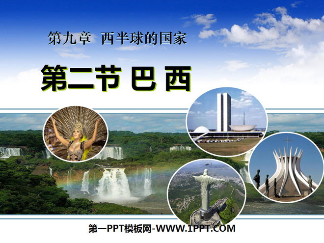
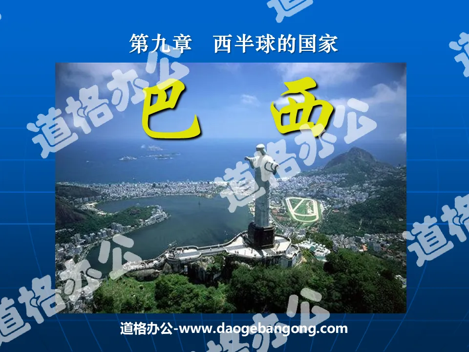
"Brazil" Western Hemisphere countries PPT courseware 5
Description
"Brazil" Western Hemisphere countries PPT courseware 5
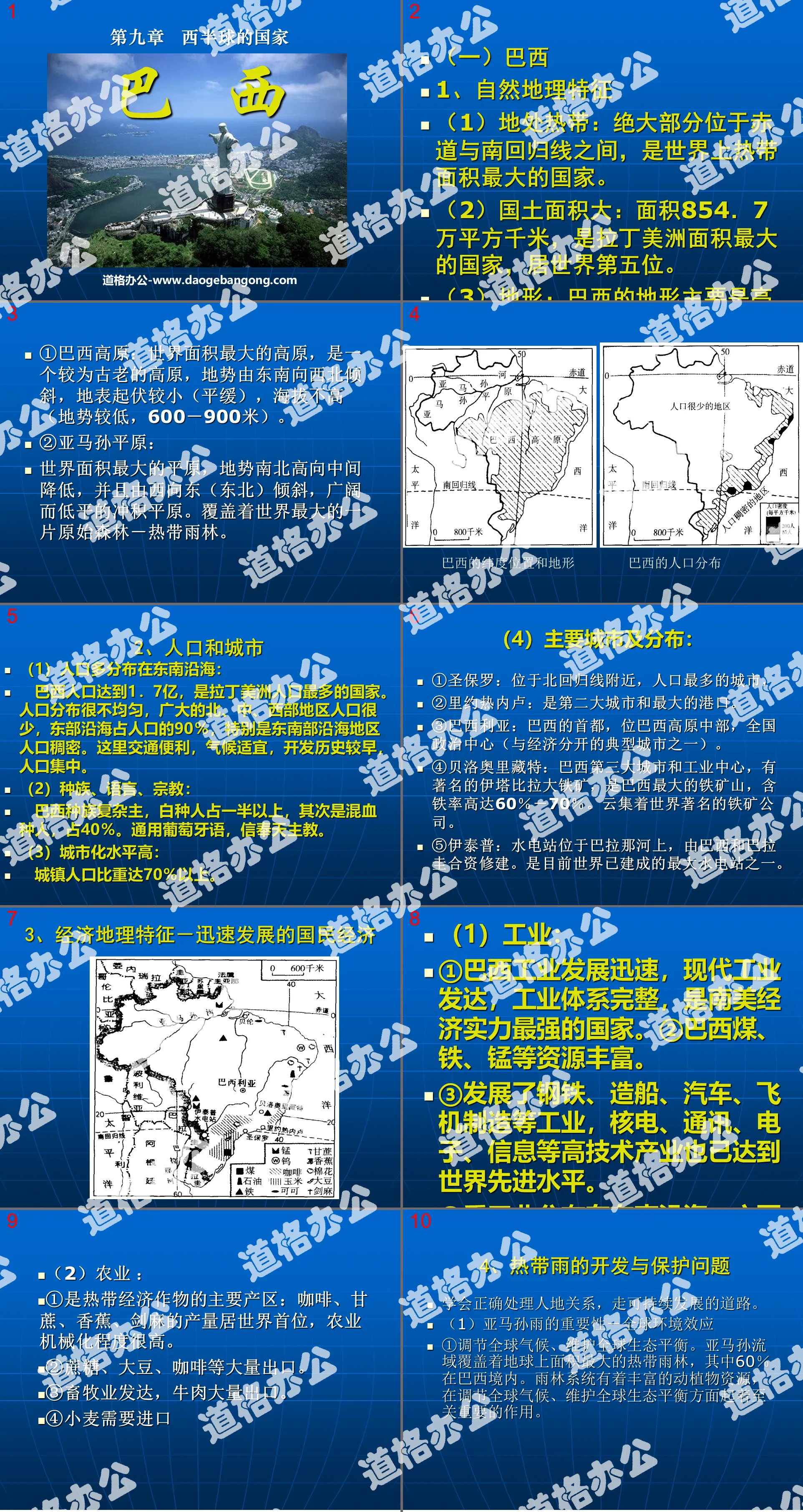
(1) Brazil
1. Natural geographical features
(1) Located in the tropics: Most of it is located between the equator and the Tropic of Capricorn. It is the country with the largest tropical area in the world.
(2) Large land area: with an area of 8.547 million square kilometers, it is the largest country in Latin America and ranks fifth in the world.
(3) Terrain: Brazil’s terrain is mainly plateaus and plains. In the north is the Amazon Plain, which accounts for 1/3 of the country's area and has a tropical rainforest climate. To the south is the Brazilian Plateau, which accounts for 2/3 of the country's area and has a tropical grassland climate.
①Brazilian Plateau: The largest plateau in the world, it is a relatively ancient plateau. The terrain slopes from southeast to northwest, the surface undulations are small (gentle), and the altitude is not high (lower terrain, 600-900 meters).
② Amazon Plain: The largest plain in the world, the terrain is high in the north and south and lowers in the middle, and slopes from west to east (northeast). It is a vast and low alluvial plain. Covered by the world's largest virgin forest - tropical rainforest.
2. Population and cities
(1) The population is mostly distributed along the southeast coast:
With a population of 170 million, Brazil is the most populous country in Latin America. The population distribution is very uneven. The vast northern, central and western regions have very small populations, while the eastern coastal areas account for 90% of the population. The southeastern coastal areas in particular are densely populated. The transportation here is convenient, the climate is suitable, the development history is early, and the population is concentrated.
(2) Race, language, religion:
Brazil's race is complex, with Caucasians accounting for more than half, followed by mixed-race people, accounting for 40%. Speaks Portuguese and believes in Catholicism.
(3) High level of urbanization:
The urban population accounts for more than 70%.
(4)Main cities and distribution:
① Sao Paulo: Located near the Tropic of Cancer, the most populous city.
② Rio de Janeiro: It is the second largest city and the largest port.
③Brasilia: The capital of Brazil, located in the middle of the Brazilian Plateau, the national political center (one of the typical cities separated from the economy).
④ Belo Horizonte: Brazil's third largest city and industrial center, home to the famous Itabira Iron Mine, the largest iron mine in Brazil, with an iron content of as high as 60%-70%. It is home to world-famous iron ore companies.
⑤ Itaipu: The hydropower station is located on the Paraná River and was built by a joint venture between Brazil and Paraguay. It is one of the largest hydropower stations built in the world.
3. Economic geographical characteristics-rapidly developing national economy
(1) Industry:
① Brazil’s industry has developed rapidly, with developed modern industry and a complete industrial system. It is the country with the strongest economic strength in South America.
② Brazil is rich in coal, iron, manganese and other resources.
③ Industries such as steel, shipbuilding, automobiles, and aircraft manufacturing have been developed, and high-tech industries such as nuclear power, communications, electronics, and information have also reached the world's advanced level.
④ Heavy industry is distributed along the southeastern coast, with the main centers being Sao Paulo, Rio de Janeiro, and Belo Horizonte.
⑤Energy: Lack of coal and oil; abundant water energy, 90% of which comes from hydropower. Brazil and Paraguay have built the Itaipu power station.
(2) Agriculture:
① It is the main producing area of tropical cash crops: the output of coffee, sugar cane, banana and sisal ranks first in the world, and the degree of agricultural mechanization is very high.
②Sucrose, soybeans, coffee, etc. are exported in large quantities.
③The animal husbandry industry is developed and beef is exported in large quantities.
④Wheat needs to be imported
4. On the development and protection of tropical rains, we must learn to correctly handle the relationship between man and land and take the path of sustainable development.
Learn to correctly handle the relationship between man and land and take the path of sustainable development.
(1) The importance of Amazon rain - global environmental effects
① Regulate the global climate and maintain global ecological balance. The Amazon Basin covers the largest area of tropical rainforest on Earth, 60% of which is in Brazil. The rainforest system is rich in animal and plant resources and plays a vital role in regulating the global climate and maintaining global ecological balance.
②Affect the carbon and oxygen balance on the earth. Rainforests absorb carbon dioxide and release oxygen through photosynthesis, thus profoundly affecting the carbon and oxygen balance on the earth. They are called the "lungs of the earth";
③Regulate global water balance. Rainforests can also absorb and store large amounts of water, promote the global water cycle through evaporation and transpiration, and regulate the global water balance.
④The world’s biological gene treasure house and human medicine treasure house. The rainforest is the world's oldest plant community, rich in diverse species resources, and a treasure trove of biological genes in the world. Human health and happiness are directly dependent on biological diversity. The Rainforest Biogene Bank is an important source of human pharmaceutical raw materials and a treasure trove of medical research.
Keywords: National teaching courseware in the Western Hemisphere, Brazilian teaching courseware, New People's Education Edition seventh grade geography PPT courseware, second volume, seventh grade geography slide courseware download, National PPT courseware download in the Western Hemisphere, Brazilian PPT courseware download, .ppt format
For more information about the PPT courseware "Brazil Countries in the Western Hemisphere", please click on the Brazil ppt Countries in the Western Hemisphere ppt tab.
"A Model of Urban Planning - Brasilia" Civilization Center - Urban PPT Courseware:
"Brasilia, a Model of Urban Planning" Civilized Central City PPT courseware Part One: Step-by-step learning 1. The location of Brazil 1. It is located in the Western Hemisphere, mostly in the Southern Hemisphere. The largest country in the southern hemisphere. 2. Mostly located in low latitudes and tropics 3. Located in South America..
"Model of Urban Planning - Brasilia" Civilization Center - City PPT:
"Brasilia, a Model of Urban Planning" Civilized Central City PPT Part One: Brazil's position on the earth Area: 8.5149 million square kilometers Population: 191 million. Caucasians account for 53.74%, mulattoes account for 38.45%, blacks account for 6.21%, yellow and...
"Brazil" PPT download:
Download "Brazil" Part One: Learning Objectives 1. Understand the location and natural environment of Brazil. 2. Master the terrain and climate characteristics of Brazil. 3. Understand Brazil’s population and diverse culture. ... ... ... Brazil PPT, Part 2: The location of Brazil..
File Info
Update Time: 2024-07-10
This template belongs to Geography courseware People's Education Edition Geography for Seventh Grade Volume 2 industry PPT template
"Brazil" Western Hemisphere countries PPT courseware 5 Simple campus recruitment activity planning plan summary enterprise and institution recruitment publicity lecture PPT template is a general PPT template for business post competition provided by the manuscript PPT, simple campus recruitment activity planning plan summary enterprise and institution recruitment promotion Lecture PPT template, you can edit and modify the text and pictures in the source file by downloading the source file. If you want more exquisite business PPT templates, you can come to grid resource. Doug resource PPT, massive PPT template slide material download, we only make high-quality PPT templates!
Tips: If you open the template and feel that it is not suitable for all your needs, you can search for related content "Brazil" Western Hemisphere countries PPT courseware 5 is enough.
How to use the Windows system template
Directly decompress the file and use it with office or wps
How to use the Mac system template
Directly decompress the file and use it Office or wps can be used
Related reading
For more detailed PPT-related tutorials and font tutorials, you can view: Click to see
How to create a high-quality technological sense PPT? 4 ways to share the bottom of the box
Notice
Do not download in WeChat, Zhihu, QQ, built-in browsers, please use mobile browsers to download! If you are a mobile phone user, please download it on your computer!
1. The manuscript PPT is only for study and reference, please delete it 24 hours after downloading.
2. If the resource involves your legitimate rights and interests, delete it immediately.
3. Contact information: service@daogebangong.com
"Brazil" Western Hemisphere countries PPT courseware 5, due to usage restrictions, it is only for personal study and reference use. For commercial use, please go to the relevant official website for authorization.
(Personal non-commercial use refers to the use of this font to complete the display of personal works, including but not limited to the design of personal papers, resumes, etc.)
Preview
Related Search: