Fifth Grade Science Volume 1, Textbook Edition
Science Edition for Sixth Grade Science Volume 2
Third Grade Science Volume 2, Textbook Edition
Science Edition for Sixth Grade Science Volume 1
Third Grade Science Volume 1, Textbook Edition
Fourth Grade Science Volume 2, Textbook Edition
Fourth Grade Science Volume 1, Textbook Edition
Qingdao Edition Fourth Grade Science Volume 2
Fourth-grade science volume 2 of the E-education edition
Hunan Education Edition Fourth Grade Science Volume 1
E-education edition fifth grade science volume 2
Fifth Grade Science Volume 2, Textbook Edition
E-education edition fifth grade science volume 1
Qingdao Edition Fifth Grade Science Volume 2
E-education edition sixth grade science volume 1
Zhejiang Education Edition Seventh Grade Science Volume 2
| Category | Format | Size |
|---|---|---|
| Zhejiang Education Edition Seventh Grade Science Volume 1 | pptx | 6 MB |

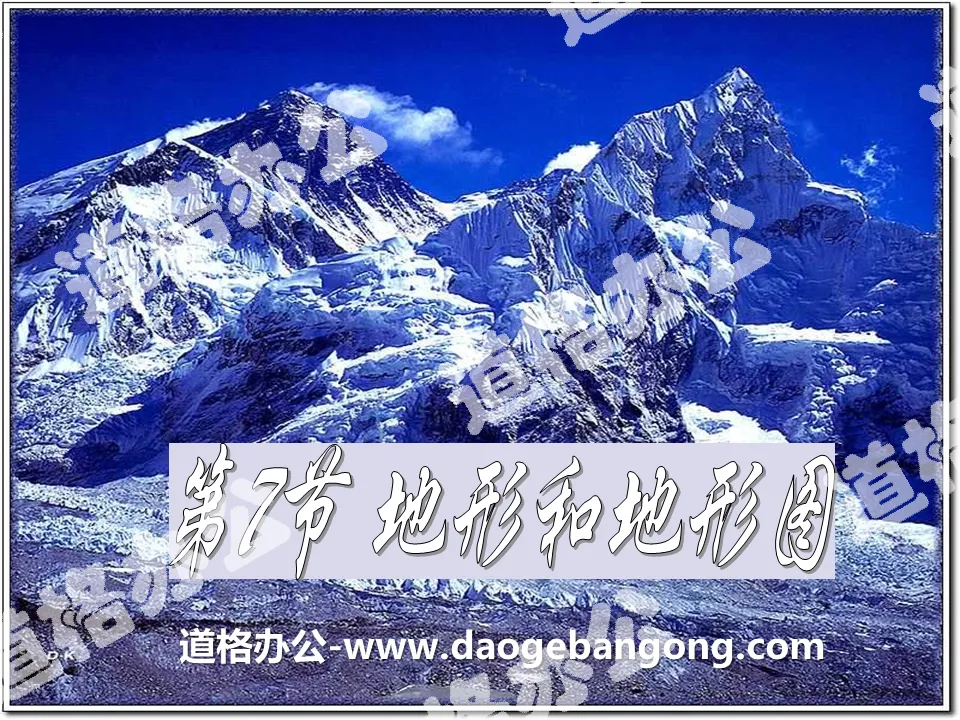
"Topography and Topographic Maps" PPT courseware
2024-09-26
Copyright statement: This material is compiled and released by the user of Daoge Resources. The copyright belongs to the author. For commercial use, please contact the copyright owner. If there is any infringement, please contact the webmaster to remove the resource.
Download Points: 0.00
Free Download
Upgrade VIP
Favorite
Views: 2185 / Downloads: 338
Description
"Topography and Topographic Maps" PPT courseware
Part One: Review and Review
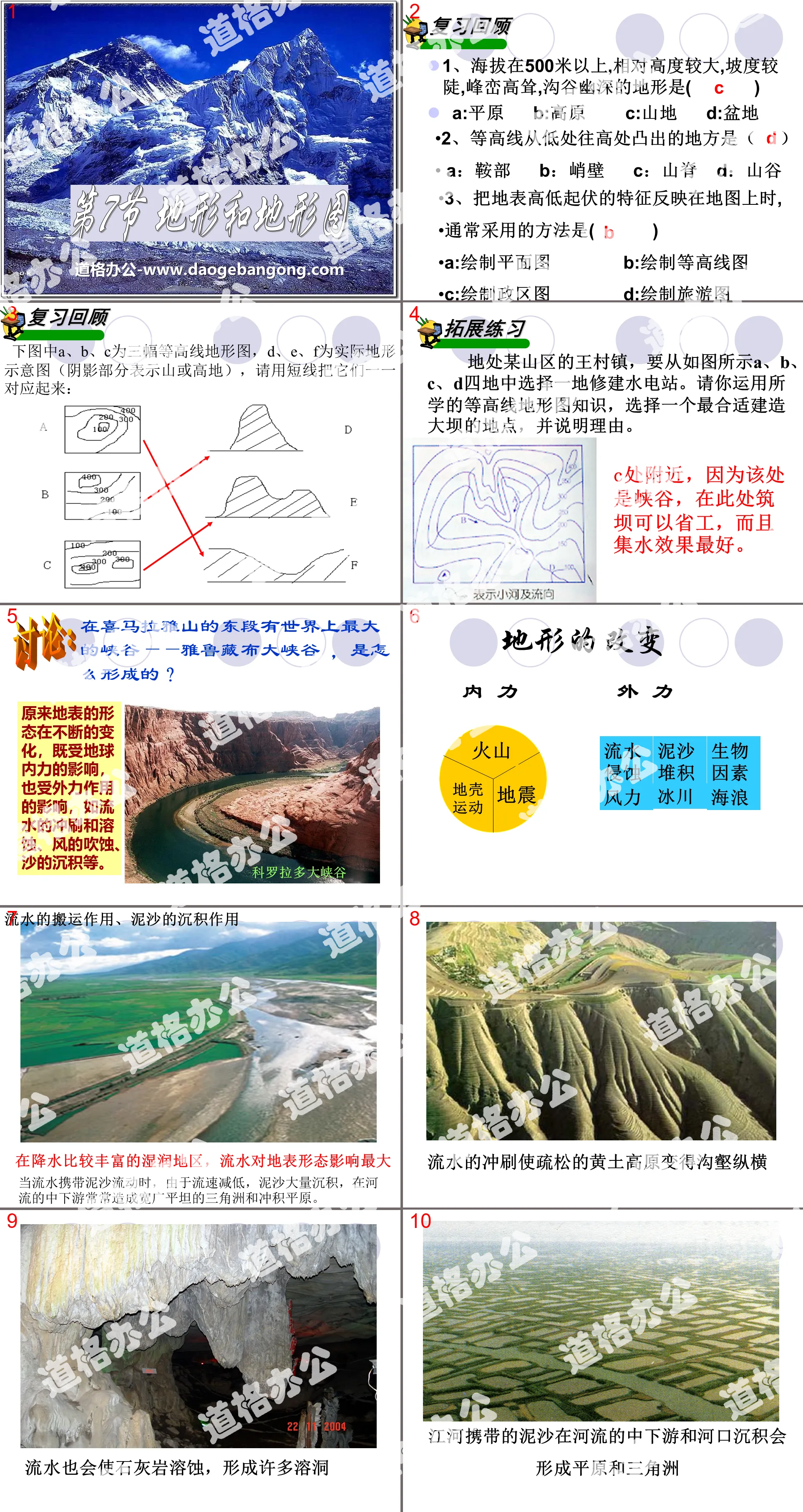
1. The terrain is above 500 meters above sea level, with relatively large heights, steep slopes, towering peaks and deep valleys ( )
A:Plain B:Plateau C:Mountain D:Basin
2. The place where the contour line protrudes from the lower point to the higher point is ( )
A: saddle B: cliff C: ridge D: valley
3. When reflecting the ups and downs of the land surface on a map, the method usually used is ()
A: Draw a floor plan B: Draw a contour map
C: Draw political district map D: Draw tourist map
Topography and topographic maps PPT, part 2: expansion exercises
Wangcun Town, located in a mountainous area, needs to choose one of the four locations A, B, C, and D as shown in the picture to build a hydropower station. Please use the knowledge you have learned about contour topographic maps to choose a location that is most suitable for building a dam and explain the reasons.
Near location C, because this location is a canyon, building a dam here can save labor and has the best water collection effect.
discuss:
In the eastern section of the Himalayas, there is the largest canyon in the world - the Brahmaputra Grand Canyon. How was it formed?
It turns out that the shape of the earth's surface is constantly changing, affected by both the internal forces of the earth and external forces, such as erosion and dissolution by running water, erosion by wind, and deposition of sand.
Terrain and topographic map PPT, part three: changes in terrain
Do external forces act the same in different regions?
Humid areas with abundant precipitation
Flowing water has the greatest impact on surface morphology. There are often karst terrains. The sediment carried by rivers is deposited in the middle and lower reaches of rivers and estuaries to form plains and deltas.
Arid areas with relatively little rainfall
The effect of wind is the most obvious. Under the influence of wind, deserts, Gobis, and wind-eroded castles appear.
Alpine areas
Forming horn peaks and cirque valleys.
Topography and topographic maps PPT, Part 4: Summary after class
changes in terrain
(1) The main external factors causing changes in surface morphology include
It is mainly affected by the weathering, erosion, transportation and sedimentation of wind, flowing water, glaciers, waves, organisms, etc.
(2) What are the differences between internal forces and external forces on the formation of the earth’s terrain?
The internal force causes the ground to form high mountains and deep valleys, making the surface more undulating. The impact is phased.
The main effects of external forces are to lower mountains, fill deep valleys, and flatten the surface. Has a slow, long-lasting effect.
(3) The shape of the earth’s surface is the result of the combined action of internal and external forces
Globally, internal forces dominate the surface morphology, while in local areas, external forces may also dominate.
Topography and topographic maps PPT, Part 5: Consolidation exercises
1: The reason why caves are formed in limestone areas is ( )
A: The effect of fire B: The effect of running water
C: The effect of wind D: Earthquake
2: Among the following functions, the one that belongs to internal force is ( )
A:wind B:flowing water C:volcano D:glacier
3: The flying rocks on the top of Huangshan Mountain are mainly affected by ( )
A: The effect of wind B: The effect of flowing water
C: The action of volcanoes D: The action of glaciers
Keywords: Zhejiang Education Edition seventh grade science PPT courseware free download, terrain and topographic map PPT download, .PPT format;
For more information about the "Topography and Topographic Maps" PPT courseware, please click on the Topographic and Topographic Maps PPT tab.
"Topography and Topographic Maps" PPT:
"Topography and Topographic Maps" PPT Part One Content: Question: We know that the earth's surface has undulations, some are flat, some are steep, some are endless, and some are layered with obstacles. What do we collectively call them? Terrain So, what are the main types of terrain...
File Info
Update Time: 2024-09-26
This template belongs to science courseware Zhejiang Education Edition Seventh Grade Science Volume 1 industry PPT template
"Topography and Topographic Maps" PPT courseware Simple campus recruitment activity planning plan summary enterprise and institution recruitment publicity lecture PPT template is a general PPT template for business post competition provided by the manuscript PPT, simple campus recruitment activity planning plan summary enterprise and institution recruitment promotion Lecture PPT template, you can edit and modify the text and pictures in the source file by downloading the source file. If you want more exquisite business PPT templates, you can come to grid resource. Doug resource PPT, massive PPT template slide material download, we only make high-quality PPT templates!
Tips: If you open the template and feel that it is not suitable for all your needs, you can search for related content "Topography and Topographic Maps" PPT courseware is enough.
How to use the Windows system template
Directly decompress the file and use it with office or wps
How to use the Mac system template
Directly decompress the file and use it Office or wps can be used
Related reading
For more detailed PPT-related tutorials and font tutorials, you can view: Click to see
How to create a high-quality technological sense PPT? 4 ways to share the bottom of the box
Notice
Do not download in WeChat, Zhihu, QQ, built-in browsers, please use mobile browsers to download! If you are a mobile phone user, please download it on your computer!
1. The manuscript PPT is only for study and reference, please delete it 24 hours after downloading.
2. If the resource involves your legitimate rights and interests, delete it immediately.
3. Contact information: service@daogebangong.com
"Topography and Topographic Maps" PPT courseware, due to usage restrictions, it is only for personal study and reference use. For commercial use, please go to the relevant official website for authorization.
(Personal non-commercial use refers to the use of this font to complete the display of personal works, including but not limited to the design of personal papers, resumes, etc.)
Preview
Related Search:
"Topography and Topographic Maps" PPT courseware
2024-09-26
Copyright statement: This material is compiled and released by the user of Daoge Resources. The copyright belongs to the author. For commercial use, please contact the copyright owner. If there is any infringement, please contact the webmaster to remove the resource.
Download Points: 0.00
Free Download
Upgrade VIP
Favorite
Views: 2185 / Downloads: 338


