Business Planet Edition 7th Grade Geography Volume 1
Business Planet Edition 7th Grade Geography Volume 2
People's Education Edition Geography for Seventh Grade Volume 2
Business Planet Edition Geography for Grade 8 Volume 1
People's Education Edition Geography for Eighth Grade Volume 2
Shanghai Education Edition Seventh Grade Geography Volume 1
Hunan Education Edition High School Geography Compulsory Course I
People's Education Edition Geography for Grade 8 Volume 1
Compulsory Course 1 of High School Geography in China Graphics Edition
People's Education Edition Geography for Grade 7 Volume 1
Shanghai Education Edition Geography for Sixth Graders Volume 1
Lu Ke version of high school geography compulsory course I
People's Education Press High School Geography Compulsory Course 1
Hunan Education Edition High School Geography Compulsory Course II
Shanghai Education Edition Seventh Grade Geography Volume 2
Business Planet Edition Geography for Eighth Grade Volume 2
| Category | Format | Size |
|---|---|---|
| People's Education Edition Geography for Eighth Grade Volume 2 | pptx | 6 MB |

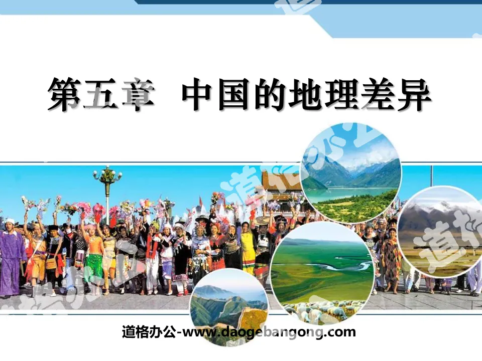
"China's Geographic Differences" PPT courseware
2024-11-22
Copyright statement: This material is compiled and released by the user of Daoge Resources. The copyright belongs to the author. For commercial use, please contact the copyright owner. If there is any infringement, please contact the webmaster to remove the resource.
Download Points: 0.00
Free Download
Upgrade VIP
Favorite
Views: 1435 / Downloads: 305
Description
"China's Geographic Differences" PPT courseware
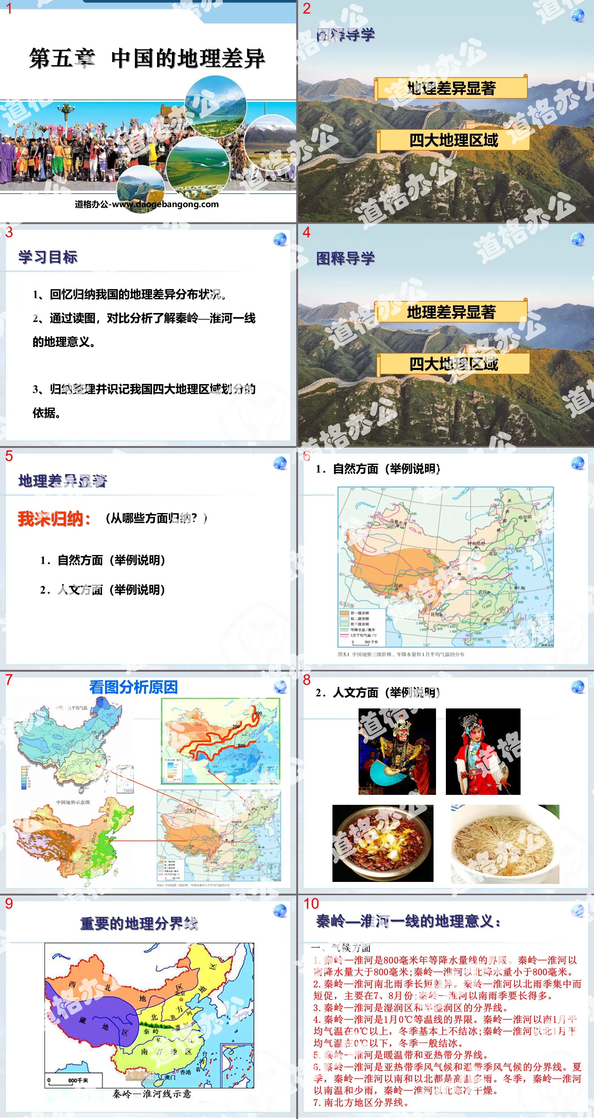
learning target
1. Recall and summarize the distribution of geographical differences in my country.
2. Understand the geographical significance of the Qinling-Huaihe River line through map reading and comparative analysis.
3. Summarize, organize and memorize the basis for the division of my country's four major geographical regions.
Significant geographical differences
Let me summarize: (In what aspects?)
1. Natural aspects (examples)
2. Humanities (examples)
The geographical significance of the Qinling-Huaihe River line:
1. Climate
1. Qinling Mountains-Huaihe River is the boundary of the 800 mm annual precipitation line. The precipitation in the south of the Qinling Mountains and the Huaihe River is more than 800 mm; the precipitation in the north of the Qinling Mountains and the Huaihe River is less than 800 mm.
2. The length of the rainy season is different between the north and south of the Qinling Mountains-Huaihe River. The rainy season north of the Qinling Mountains and the Huaihe River is concentrated and short, mainly in July and August; the rainy season south of the Qinling Mountains and the Huaihe River is much longer.
3. The Qinling Mountains-Huaihe River is the dividing line between the humid zone and the semi-humid zone.
4. Qinling Mountains-Huaihe River is the boundary of the 0℃ isotherm in January. The average January temperature in the south of the Qinling Mountains and the Huaihe River is above 0°C, and there is basically no ice in winter; the average January temperature in the north of the Qinling Mountains and the Huaihe River is below 0°C, and it is generally frozen in the winter.
5. Qinling Mountains-Huaihe River is the dividing line between warm temperate zone and subtropical zone.
6. Qinling Mountains-Huaihe River is the dividing line between subtropical monsoon climate and temperate monsoon climate. In summer, it is hot and rainy south and north of the Qinling Mountains-Huaihe River. In winter, the south of the Qinling Mountains and the Huaihe River is mild and rainy, while the north of the Qinling Mountains and the Huaihe River is cold and dry.
7. The dividing line between north and south regions.
2. Vegetation
To the south of the Qinling Mountains and the Huaihe River is the subtropical evergreen broad-leaved forest; to the north of the Qinling Mountains and the Huaihe River is the temperate deciduous broad-leaved forest. Therefore, there is a saying that "when oranges grow in Huainan, they become tangerines, and when they grow in northern Huaibei, they become oranges."
3. River hydrology
The rivers south of the Qinling Mountains and the Huaihe River have rich flow, small seasonal changes, low sand content, long flood seasons, and no ice in winter; the rivers north of the Qinling Mountains and the Huaihe River have smaller flows, large seasonal changes, high sand contents, short flood seasons, and ice in the winter. . The Qinling Mountains-Huaihe River is also the watershed between the Yellow River and the Yangtze River.
4. Topography, soil,
1. Terrain: The area south of the Qinling Mountains and the Huaihe River is dominated by hills; the area north of the Qinling Mountains and the Huaihe River is dominated by plains and plateaus.
2. Soil: The area south of the Qinling Mountains and the Huaihe River is dominated by red soil; the area north of the Qinling Mountains and the Huaihe River is dominated by yellow soil or brown soil.
5. Agriculture
1. Types of cultivated land: The area south of the Qinling Mountains and the Huaihe River is dominated by paddy fields; the area north of the Qinling Mountains and the Huaihe River is dominated by dry land.
2. Food crops: Rice is the main area to the south of the Qinling Mountains and the Huaihe River; wheat is the main area to the north of the Qinling Mountains and the Huaihe River.
3. Oil crops: The area south of the Qinling Mountains and the Huaihe River is dominated by rapeseed; the area north of the Qinling Mountains and the Huaihe River is dominated by peanuts and soybeans.
4. Sugar crops: Sugar cane is the main area to the south of the Qinling Mountains and the Huaihe River; sugar beet is the main area to the north of the Qinling Mountains and the Huaihe River.
5. Crop ripening: two to three crops a year from the Qinling Mountains to the south of the Huaihe River; three crops every two years or one crop a year from the Qinling Mountains to the north of the Huaihe River.
Understand the division of my country's four major geographical regions
1. Observe the limit A in Figure 5.5 and compare it with the equal precipitation line in Figure 5.1:
(1) Which precipitation constant line distribution is closest to limit A?
400mm constant precipitation line
(2) What are the dominant factors considered in determining limit A?
The dominant factor in determining boundary A is the monsoon (whether it is affected by the summer monsoon)
2. Observe the limit B in Figure 5.5 and compare it with the equal precipitation line and the constant precipitation line in Figure 5.1.
January isotherm comparison:
(1) Which isotherm distribution in January is closest to limit B?
0℃ isotherm
(2) Which precipitation constant line distribution is closest to limit B?
800mm constant precipitation line
(3) What are the dominant factors considered in determining boundary B?
Temperature and precipitation factors are climate factors
(4) Is boundary B close to the Qinling-Huaihe line?
Generally consistent with the Qinling-Huaihe River line
Evaluation area
1. Qinling Mountains-Huaihe River is an important geographical dividing line in my country. It is ()
① The dividing line between subtropical and warm temperate zones ② The dividing line between semi-humid and semi-arid areas ③ The dividing line between monsoon and non-monsoon areas ④ The dividing line between deciduous broad-leaved forest and evergreen broad-leaved forest ⑤ The dividing line between paddy fields and dry land ⑥ The dividing line between pastoral and agricultural areas
A. ①②⑥ B. ②③⑤ C. ①④⑤ D. ②④⑥
2. A middle school blackboard newspaper has added a new "True or False" column, as follows, among which "true" is ()
①Northern residents mainly eat rice. ②Northern residents mainly rely on land transportation. ③Northern residents pay attention to ventilation and heat dissipation in their houses. ④Northern residents' houses have small roof slopes and thick walls.
A. ①② B. ①③ C. ②④ D. ③④
3. The following mountain ranges and terrain areas are all located in the south ( )
A. Wushan Mountains Loess Plateau B. Daxinganling Plains of the middle and lower reaches of the Yangtze River
C. Sichuan Basin Wuyishan Mountains D. Yinshan Mountains Southeast Hills
4. The areas dominated by "black soil" and "yellow soil" are ( )
A. Northern region b. southern region
C. Northwest Territories D. Qinghai-Tibet region
5. "There are many paddy fields in farmland, mainly planting rice, rapeseed, etc., with two to three crops a year" is a description of the agricultural situation in which of the following areas ( )
A.Southern region B.Northern region
C. Northwest region D. Qinghai-Tibet region
Keywords: China’s geographical differences teaching courseware, New People’s Education Edition eighth grade geography PPT courseware for the second volume, eighth grade geography slide courseware download, China’s geographical differences PPT courseware download, .ppt format
For more information about the "China's Geographic Differences" PPT courseware, please click on the China's Geographic Differences PPT tab.
"China's Geographic Differences" PPT courseware 4:
"China's Geographic Differences" PPT Courseware 4 Ask students to complete activity (1): Draw the location of the Qinling Mountains and the Huaihe River line. Draw the dividing line between the northern region and the northwest. Understand the provinces and regions included in the northern and southern regions. Looking at China's three-level ladder distribution map, the northern region and...
"China's Geographic Differences" PPT courseware 3:
"China's Geographic Differences" PPT courseware 3 Basis for the division of the four geographical regions: The four major geographical regions are divided according to the different ________ and _______ characteristics of each place. The comparison of the area and population of the four major geographical regions has the largest area________ and the largest population_ __..
"China's Geographic Differences" PPT courseware 2:
"China's Geographic Differences" PPT Courseware 2 1. China's geographical location: (1) From a hemispheric position, China is located in the Eastern Hemisphere and the Northern Hemisphere. (2) From the perspective of latitude, most of them are in mid-latitude areas; most of them are in the north temperate zone, a small part of them are in the tropics, and there is no cold...
File Info
Update Time: 2024-11-22
This template belongs to Geography courseware People's Education Edition Geography for Eighth Grade Volume 2 industry PPT template
"China's Geographic Differences" PPT courseware Simple campus recruitment activity planning plan summary enterprise and institution recruitment publicity lecture PPT template is a general PPT template for business post competition provided by the manuscript PPT, simple campus recruitment activity planning plan summary enterprise and institution recruitment promotion Lecture PPT template, you can edit and modify the text and pictures in the source file by downloading the source file. If you want more exquisite business PPT templates, you can come to grid resource. Doug resource PPT, massive PPT template slide material download, we only make high-quality PPT templates!
Tips: If you open the template and feel that it is not suitable for all your needs, you can search for related content "China's Geographic Differences" PPT courseware is enough.
How to use the Windows system template
Directly decompress the file and use it with office or wps
How to use the Mac system template
Directly decompress the file and use it Office or wps can be used
Related reading
For more detailed PPT-related tutorials and font tutorials, you can view: Click to see
How to create a high-quality technological sense PPT? 4 ways to share the bottom of the box
Notice
Do not download in WeChat, Zhihu, QQ, built-in browsers, please use mobile browsers to download! If you are a mobile phone user, please download it on your computer!
1. The manuscript PPT is only for study and reference, please delete it 24 hours after downloading.
2. If the resource involves your legitimate rights and interests, delete it immediately.
3. Contact information: service@daogebangong.com
"China's Geographic Differences" PPT courseware, due to usage restrictions, it is only for personal study and reference use. For commercial use, please go to the relevant official website for authorization.
(Personal non-commercial use refers to the use of this font to complete the display of personal works, including but not limited to the design of personal papers, resumes, etc.)
Preview
Related Search:
"China's Geographic Differences" PPT courseware
2024-11-22
Copyright statement: This material is compiled and released by the user of Daoge Resources. The copyright belongs to the author. For commercial use, please contact the copyright owner. If there is any infringement, please contact the webmaster to remove the resource.
Download Points: 0.00
Free Download
Upgrade VIP
Favorite
Views: 1435 / Downloads: 305


