| Category | Format | Size |
|---|---|---|
| People's Education Edition Geography for Grade 7 Volume 1 | pptx | 6 MB |

"Reading Maps" Earth and Maps PPT Courseware 6
Description
"Reading Maps" Earth and Maps PPT Courseware 6
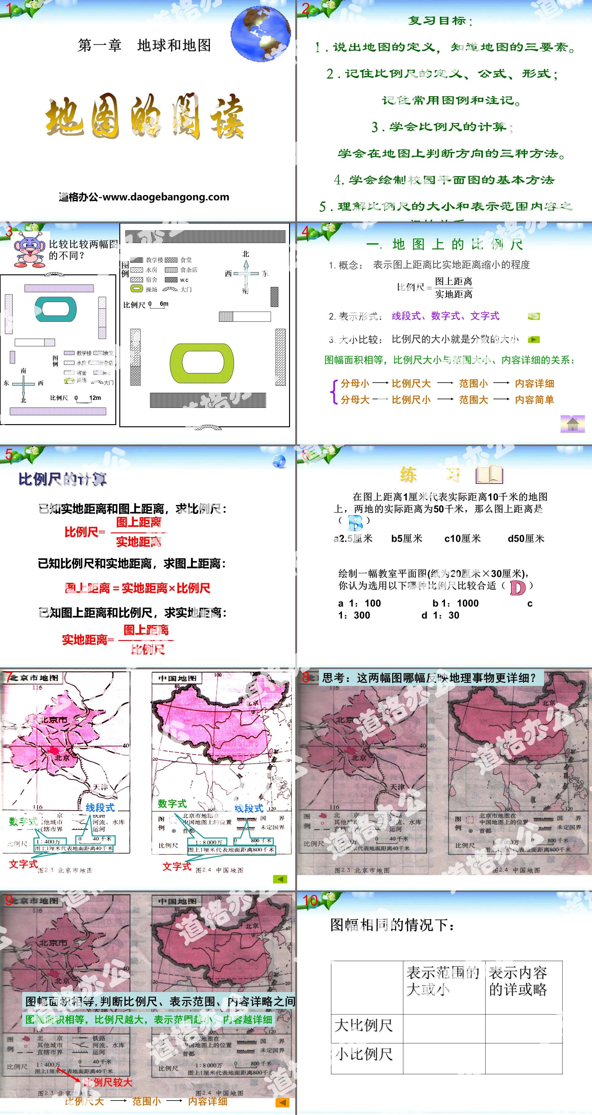
Review goals:
1. State the definition of a map and know the three elements of a map.
2. Remember the definition, formula, and form of the scale; remember commonly used legends and notes.
3. Learn to calculate the scale; learn three methods to determine the direction on the map.
4. Learn the basic methods of drawing campus floor plans
5. Understand the relationship between the size of the scale bar and the content of the representation range.
1. Scale on the map
1. Concept: Indicates the degree to which the distance on the map is smaller than the distance on the ground
2. Expression form: line segment, number, text
3. Size comparison: the size of the scale is the size of the fraction
The picture areas are equal, and the relationship between scale size, range size, and detailed content is:
Small denominator - large scale - small range - detailed content
Large denominator - small scale - large range - simple content
practise
On a map where a distance of 1 centimeter represents an actual distance of 10 kilometers, the actual distance between the two places is 50 kilometers, then the distance on the map is ( )
A2.5 cm B5 cm C10 cm D50 cm
Draw a classroom floor plan (the paper is 20 cm x 30 cm). Which of the following scales do you think is more appropriate ( )
A 1:100 B 1:1000 C 1:300 D 1:30
China political district map
The scale is larger/smaller than ()
Display range () large/small
The content is more detailed/omitted than ()
World political district map
The scale is larger/smaller than ()
Display range () large/small
The content is more detailed/omitted than ()
2. Direction on the map
1. On a map without latitude and longitude grid and no direction guide: (general map)
Up north, down south, left west, right east
2. On a map with a beacon: the arrow pointing to the beacon points north.
3. On a map with a latitude and longitude network: longitude lines indicate north and south, and latitude lines indicate east and west.
Determining north and south according to longitude is absolute: the North Pole is the northernmost point on the earth, and the South Pole is the southernmost point on the earth.
To determine whether things are relative based on latitude lines, you must first select the minor arc segment.
(The arc between two points is less than 180°)
4. Land B (175°E, 38°N) is located in land A (145°W, 35°S)
A. Northeast B. Northwest
C. Southwest D. Southeast
Think about it: What should you do if you get lost in the wild?
1. During the day, the sun rises in the east and sets in the west;
2. At night, you can locate according to the direction of Polaris;
3. You can use a compass on cloudy days;
4. Use the tree crown and annual rings to orient: the side with lush tree crowns is south, the side with sparse crowns is north; the side with dense annual rings is north, and the side with sparse annual rings is south.
Review and consolidate:
1. Multiple choice questions
1. On the China traffic map, the straight-line distance from Shanghai to Guiyang is 5 centimeters, and the actual straight-line distance between the two places is 1,500 kilometers. The scale of the map is
A. 1:300 B. 1:300000 C. 1:3 000000 D. 1:30000000
2. Draw a map of China's administrative regions according to the scale of 1 centimeter representing 500 kilometers. (China is 5,000 kilometers long from east to west and 5,500 kilometers wide from north to south.) The length and height of the frame of the map must not be less than
A. 11×10 cm B. 10×11 cm
C. 6 × 5 cm D. 10 × 8 cm
3. If the scale of the map where 1 centimeter represents 180 kilometers is enlarged to twice that of the original map, then the scale of the new map is
A. 1:18000000 B. 1 centimeter on the picture represents 90 kilometers on the ground
C. 1:360 D. 1 centimeter on the picture represents the actual distance of 360 kilometers
4. An Antarctic expedition team member walked 60 meters due north from the pole and 80 meters due west. At this time, he was at the starting point.
A. 100 meters northwest B. 60 meters northwest
C. 100 meters due north D. 60 meters due north
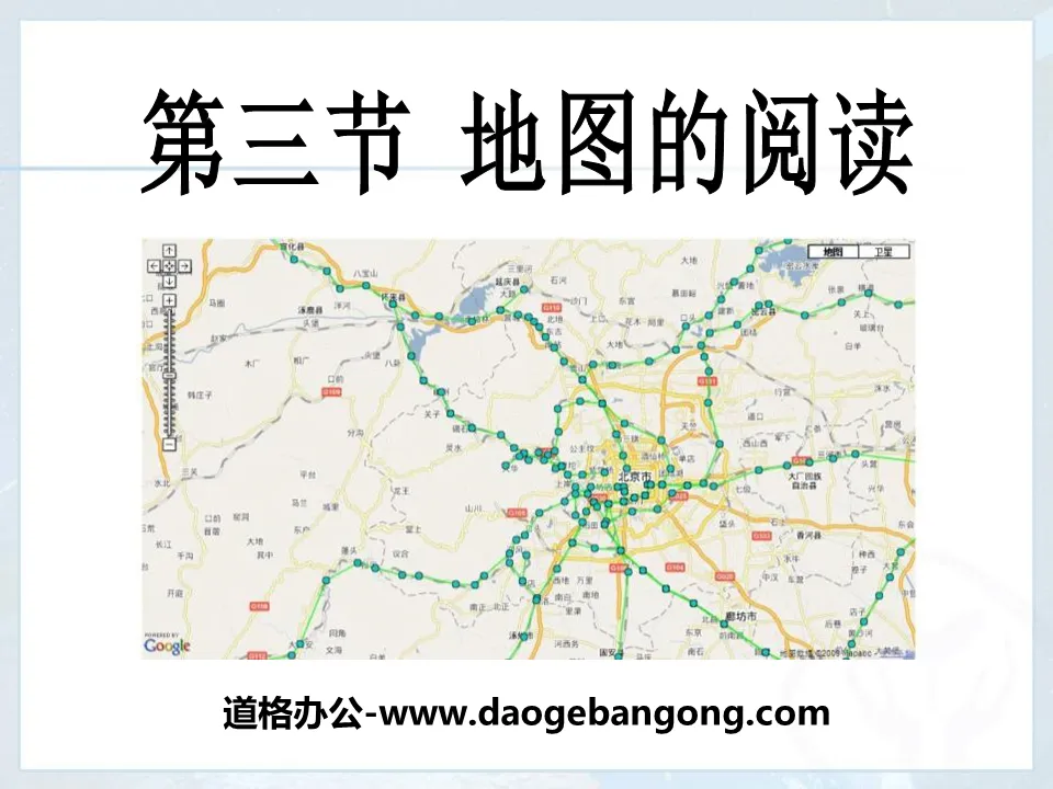
3. Obtain information from the map
1. Select maps from different categories accurately according to your needs.
For example: to visit a park, you should choose a tour guide map; to understand international current affairs, you should choose a world political map, etc.
2. Maps of the same category have different scales and different levels of detail.
The larger the scale you choose, the smaller the area represented by the map and the more detailed content it reflects; the smaller the scale you choose, the larger the area it represents and the simpler the content it reflects.
For example, a large-scale map of Beijing shows a small range, but the content is detailed, drawing railway lines, rivers and urban outlines; a small-scale map of China has simple content, with Beijing only drawn into square blocks and the city. Areas are drawn as small dots.
Keywords: Earth and map teaching courseware, map reading teaching courseware, People's Education Edition seventh grade geography PPT courseware download, seventh grade geography slide courseware download, Earth and map PPT courseware download, map reading PPT courseware download, .PPT Format;
For more information about the "Earth and Maps Map Reading" PPT courseware, please click the "Earth and Maps PPT Map Reading PPT" tab.
"Reading Maps" Earth and Maps PPT Courseware 9:
"Reading Maps" Earth and Maps PPT Courseware 9 Learning Objectives 1. Know the three elements of a map. 2. Know the representation method of scale bar on the map, the conversion and calculation of scale bar. 3. Know the three representation methods of direction and be able to identify different directions on the map. ..
"Reading Maps" Earth and Maps PPT Courseware 8:
"Reading Maps" Earth and Map PPT Courseware 8 1. Learn to read maps Definition: A map is an image on a plane that uses various symbols to reduce geographical things to a certain proportion. The language scale, direction and legend of the map 1. The scale on the map..
"Reading Maps" Earth and Maps PPT Courseware 7:
"Reading Maps" Earth and Maps PPT Courseware 7 Basic Elements of Map Reading Scale The scale on the map indicates the degree to which the distance on the map is smaller than the distance on the ground, so the scale is also called a scale. Calculation of scale bar: Given the distance on the ground and the distance on the map, find the ratio..
File Info
Update Time: 2024-06-22
This template belongs to Geography courseware People's Education Edition Geography for Grade 7 Volume 1 industry PPT template
"Reading Maps" Earth and Maps PPT Courseware 6 Simple campus recruitment activity planning plan summary enterprise and institution recruitment publicity lecture PPT template is a general PPT template for business post competition provided by the manuscript PPT, simple campus recruitment activity planning plan summary enterprise and institution recruitment promotion Lecture PPT template, you can edit and modify the text and pictures in the source file by downloading the source file. If you want more exquisite business PPT templates, you can come to grid resource. Doug resource PPT, massive PPT template slide material download, we only make high-quality PPT templates!
Tips: If you open the template and feel that it is not suitable for all your needs, you can search for related content "Reading Maps" Earth and Maps PPT Courseware 6 is enough.
How to use the Windows system template
Directly decompress the file and use it with office or wps
How to use the Mac system template
Directly decompress the file and use it Office or wps can be used
Related reading
For more detailed PPT-related tutorials and font tutorials, you can view: Click to see
How to create a high-quality technological sense PPT? 4 ways to share the bottom of the box
Notice
Do not download in WeChat, Zhihu, QQ, built-in browsers, please use mobile browsers to download! If you are a mobile phone user, please download it on your computer!
1. The manuscript PPT is only for study and reference, please delete it 24 hours after downloading.
2. If the resource involves your legitimate rights and interests, delete it immediately.
3. Contact information: service@daogebangong.com
"Reading Maps" Earth and Maps PPT Courseware 6, due to usage restrictions, it is only for personal study and reference use. For commercial use, please go to the relevant official website for authorization.
(Personal non-commercial use refers to the use of this font to complete the display of personal works, including but not limited to the design of personal papers, resumes, etc.)
Preview
Related Search: