| Category | Format | Size |
|---|---|---|
| People's Education Edition Geography for Grade 7 Volume 1 | pptx | 6 MB |

"Reading Maps" Earth and Maps PPT Courseware
Description
"Reading Maps" Earth and Maps PPT Courseware
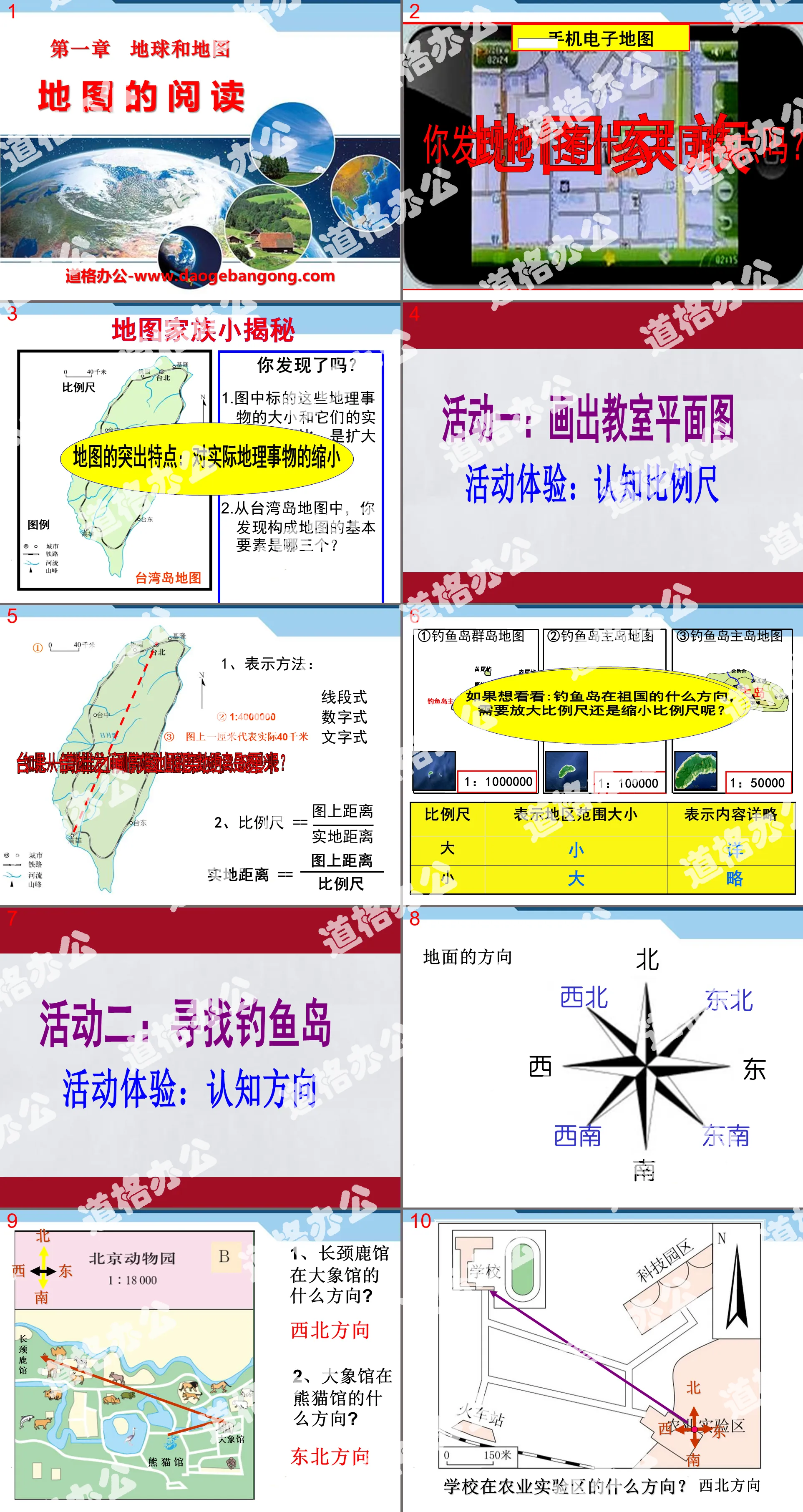
A little secret about the map family
Did you discover it?
1. Compared with their actual size, have the sizes of the geographical objects marked in the picture expanded or shrunk?
2. From the map of Taiwan Island, what three basic elements did you find that constitute the map?
Activity 1: Draw a classroom floor plan
If you want to see: In which direction the Diaoyu Islands are located in the motherland, do you need to enlarge or reduce the scale?
The comparison of the size of scale bars is the comparison of fractional values. The numerators are the same. The larger the denominator, the smaller the scale bar.
Activity 2: Looking for Diaoyu Islands
direction of ground
1. In which direction is the Giraffe Hall located to the Elephant Hall?
Northwest direction
2. In which direction is the Elephant House located?
Northeast direction
After what you just learned, what do you think are the ways to determine the direction on the map?
1. General method: up, north, down, south, left, west, right, east
2. Pointing method: The direction of the pointing arrow is true north, and then determine other directions.
3. Meridian network method: Meridians indicate the north-south direction, and latitude lines indicate the east-west direction. The North Pole indicated by the longitude is true north, and the opposite direction is true south.
Classroom test:
1. The basic elements of a map are: ______, ______, ______. The scale bar represents the degree of reduction compared to ______ distance on the map. The formula for a scale is ______.
2. On a map, when there is neither a beacon nor a latitude and longitude grid, it is usually "up, north, down______, left, west, right______". On this basis, the northeast, ______, southeast and Southwest direction. On a map without a latitude and longitude grid, the direction must be determined based on the latitude and longitude lines. Longitude lines indicate the ______ direction, and latitude lines indicate the ______ direction.
3. The smallest of the following scales is: ( )
A. 1:500 B. 1:4000 C. 1:3000 D. 1:600
4. On a map with a scale of 1:500000, the straight-line distance between place A and place B is measured to be 4 cm, and the actual distance between the two places is: ( )
A. 2 kilometers B. 0.2 kilometers C. 20 kilometers D. 4 kilometers
5. On the China traffic map, the straight-line distance from Shanghai to Guiyang is 5 centimeters, and the actual straight-line distance between the two places is 1,500 kilometers. The scale of the map is
A. 1:300 B. 1:300000 C. 1:3 000000 D. 1:30000000
Keywords: Earth and map teaching courseware, map reading teaching courseware, People's Education Edition seventh grade geography PPT courseware download, seventh grade geography slide courseware download, Earth and map PPT courseware download, map reading PPT courseware download, .PPT Format;
For more information about the "Earth and Maps Map Reading" PPT courseware, please click the "Earth and Maps PPT Map Reading PPT" tab.
"Reading Maps" Earth and Maps PPT Courseware 9:
"Reading Maps" Earth and Maps PPT Courseware 9 Learning Objectives 1. Know the three elements of a map. 2. Know the representation method of scale bar on the map, the conversion and calculation of scale bar. 3. Know the three representation methods of direction and be able to identify different directions on the map. ..
"Reading Maps" Earth and Maps PPT Courseware 8:
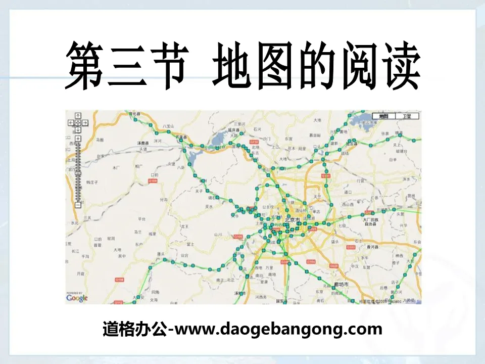
"Reading Maps" Earth and Map PPT Courseware 8 1. Learn to read maps Definition: A map is an image on a plane that uses various symbols to reduce geographical things to a certain proportion. The language scale, direction and legend of the map 1. The scale on the map..
"Reading Maps" Earth and Maps PPT Courseware 7:
"Reading Maps" Earth and Maps PPT Courseware 7 Basic Elements of Map Reading Scale The scale on the map indicates the degree to which the distance on the map is smaller than the distance on the ground, so the scale is also called a scale. Calculation of scale bar: Given the distance on the ground and the distance on the map, find the ratio..
File Info
Update Time: 2024-07-04
This template belongs to Geography courseware People's Education Edition Geography for Grade 7 Volume 1 industry PPT template
"Reading Maps" Earth and Maps PPT Courseware Simple campus recruitment activity planning plan summary enterprise and institution recruitment publicity lecture PPT template is a general PPT template for business post competition provided by the manuscript PPT, simple campus recruitment activity planning plan summary enterprise and institution recruitment promotion Lecture PPT template, you can edit and modify the text and pictures in the source file by downloading the source file. If you want more exquisite business PPT templates, you can come to grid resource. Doug resource PPT, massive PPT template slide material download, we only make high-quality PPT templates!
Tips: If you open the template and feel that it is not suitable for all your needs, you can search for related content "Reading Maps" Earth and Maps PPT Courseware is enough.
How to use the Windows system template
Directly decompress the file and use it with office or wps
How to use the Mac system template
Directly decompress the file and use it Office or wps can be used
Related reading
For more detailed PPT-related tutorials and font tutorials, you can view: Click to see
How to create a high-quality technological sense PPT? 4 ways to share the bottom of the box
Notice
Do not download in WeChat, Zhihu, QQ, built-in browsers, please use mobile browsers to download! If you are a mobile phone user, please download it on your computer!
1. The manuscript PPT is only for study and reference, please delete it 24 hours after downloading.
2. If the resource involves your legitimate rights and interests, delete it immediately.
3. Contact information: service@daogebangong.com
"Reading Maps" Earth and Maps PPT Courseware, due to usage restrictions, it is only for personal study and reference use. For commercial use, please go to the relevant official website for authorization.
(Personal non-commercial use refers to the use of this font to complete the display of personal works, including but not limited to the design of personal papers, resumes, etc.)
Preview
Related Search: