Business Planet Edition 7th Grade Geography Volume 2
Business Planet Edition Geography for Grade 8 Volume 1
Business Planet Edition 7th Grade Geography Volume 1
People's Education Edition Geography for Seventh Grade Volume 2
Shanghai Education Edition Seventh Grade Geography Volume 1
Business Planet Edition Geography for Eighth Grade Volume 2
Hunan Education Edition High School Geography Compulsory Course I
People's Education Edition Geography for Grade 7 Volume 1
People's Education Edition Geography for Eighth Grade Volume 2
Shanghai Education Edition Geography for Sixth Graders Volume 1
Lu Ke version of high school geography compulsory course I
Hunan Education Edition High School Geography Compulsory Course II
Shanghai Education Edition Seventh Grade Geography Volume 2
Compulsory Course 1 of High School Geography in China Graphics Edition
People's Education Edition Geography for Grade 8 Volume 1
People's Education Press High School Geography Compulsory Course 1
| Category | Format | Size |
|---|---|---|
| People's Education Edition Geography for Eighth Grade Volume 2 | pptx | 6 MB |

"Natural Features and Agriculture" Qinghai-Tibet Region PPT Courseware 4
2024-10-03
Copyright statement: This material is compiled and released by the user of Daoge Resources. The copyright belongs to the author. For commercial use, please contact the copyright owner. If there is any infringement, please contact the webmaster to remove the resource.
Download Points: 0.00
Free Download
Upgrade VIP
Favorite
Views: 3059 / Downloads: 792
Description
"Natural Features and Agriculture" Qinghai-Tibet Region PPT Courseware 4
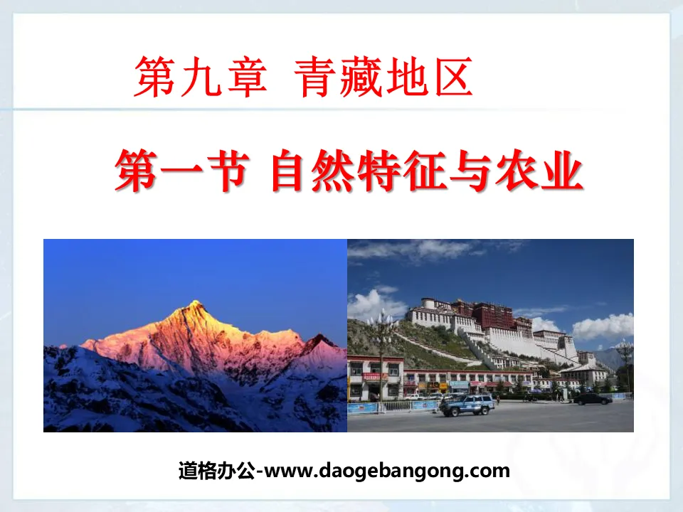
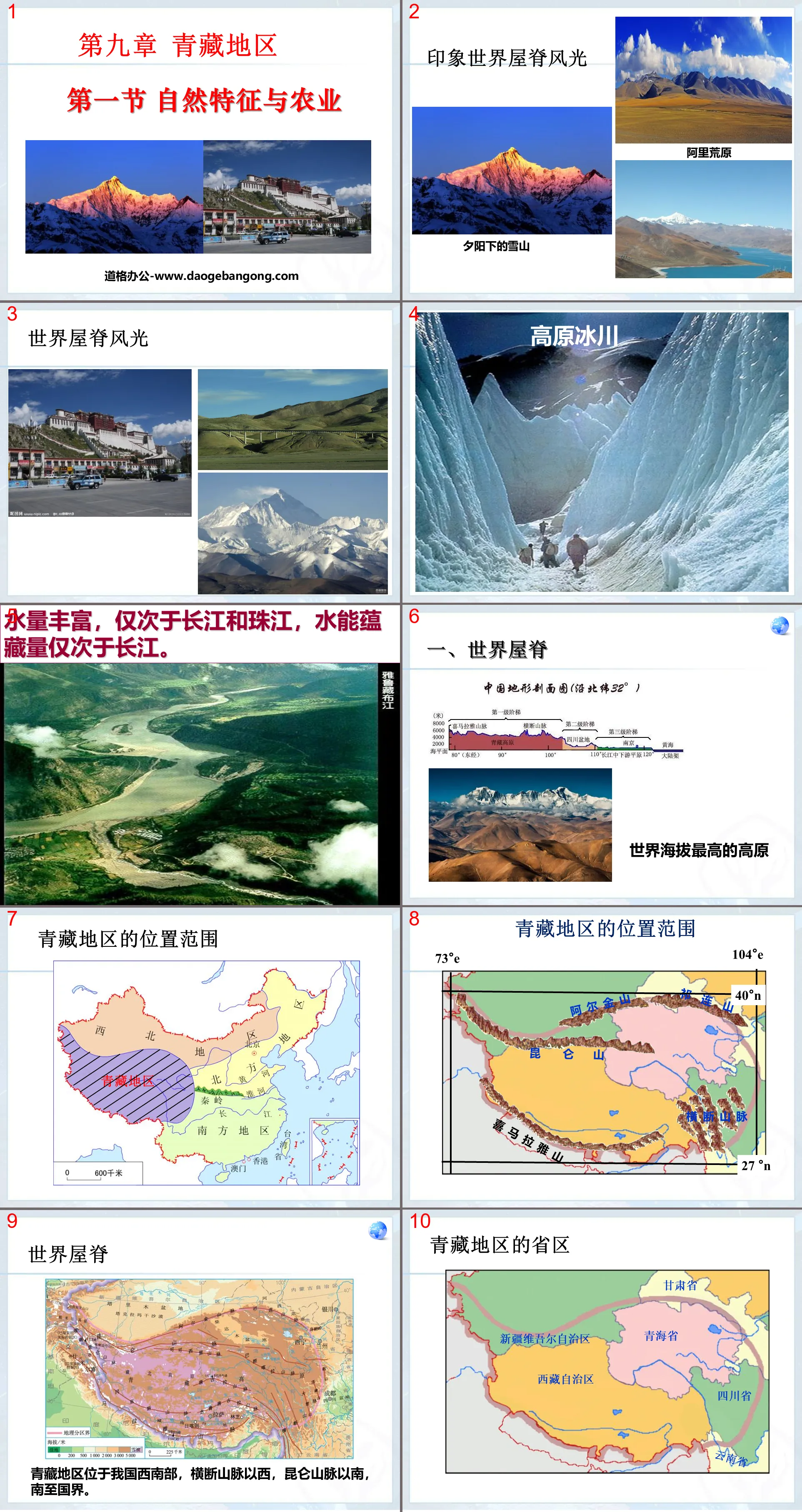
1. Roof of the World
The Qinghai-Tibet region is located in the southwest of my country, west of the Hengduan Mountains, south of the Kunlun Mountains, and to the national border in the south.
terrain, topography
It is dominated by high plateaus in the northwest and low plateaus in the southeast, with an average altitude of 4,000 meters.
Qinghai-Tibet Plateau: "The Roof of the World". High altitude, continuous snow peaks and widespread glaciers
Cause: The Eurasian Plate and the Indian Ocean Plate are compressed and uplifted.
Snowy plateau climate
Climate type: plateau mountain climate
Characteristics: Cold winters, cool summers, little precipitation, uneven distribution of precipitation within the year, obvious dry and wet seasons, and precipitation decreasing from southeast to northwest. Solar radiation is strong.
Reasons for temperature difference
Lhasa has a high altitude, thin air, and sunny days. The solar radiation is strong during the day, the thermal insulation effect of the atmosphere is weak at night, and the air flow is good. Chengdu is located in the Sichuan Basin, with low altitude, closed terrain, poor air mobility, and frequent rainy weather, which strongly weakens solar radiation and has good atmospheric insulation effect.
Transportation
Transportation based on roads
1. Road network with Lhasa as the center: Qinghai-Tibet Highway, Sichuan-Tibet Highway, Yunnan-Tibet Highway, and Xinjiang-Tibet Highway
2. Aviation: Ground transportation construction is difficult (alpine cold, hypoxia, frozen soil), and aviation can avoid the impact of the surface.
3.Main railways: Lanzhou-Qinghai Line, Qinghai-Tibet Line.
4. Inconvenient transportation restricts economic development
The Qinghai-Tibet Railway was fully opened to traffic at 9:00 on July 1, 2006. The Qinghai-Tibet Railway is the railway with the highest altitude and longest distance in the world, and has overcome world-class difficulties on frozen soil.
1. Considering the special natural environment characteristics of the plateau, what items should you prepare? Why?
Sunscreen, sunglasses, sun hat and other items: UV protection, because the air in Qinghai-Tibet area is thin and the solar radiation is strong.
Oxygen bag: Provides oxygen, because the altitude in Qinghai-Tibet is high and the air is thin;
Cotton clothing: Keep out the cold, because the climate in Qinghai-Tibet is cold and the daily temperature difference is large;
Others: As long as it is related to the natural environmental characteristics of the Qinghai-Tibet region;
2. What landscapes do you most want to see? Why?
Hoh Xil is less disturbed by human activities, and most areas still maintain the original natural ecology. It is a paradise for wild animals, with Tibetan antelopes, Tibetan wild donkeys, Tibetan gazelles and other unique plateau animals growing there.
Qinghai Lake is the largest saltwater lake in the country. It is surrounded by high mountains. The water is green and the blue waves reflect the blue sky and white clouds. The lakeside is green like a carpet, with wild flowers blooming and sheep like clouds. It is full of poetry and painting.
The top of Nyenchen Tanglha Mountain is covered with snow all year round, and at the foot of the mountain are green grass, dotted with yurts, and herds of cattle and sheep, forming a moving picture of snow-covered pasture scenery.
Cona Lake is a freshwater lake on the plateau that gathers many mountain streams in the southern Tanggula Mountains. It has a good ecological environment and is an ideal place for birds to breed and live. It is exceptionally beautiful against the backdrop of the endless grassland and blue sky and white clouds.
3. During the journey, yaks, known as the "ships of the plateau", are often seen along the railway. Please speculate on how yaks have adapted to the unique environment of the plateau.
The yak's long hair and thick skin can maintain body temperature and protect against cold; its short body and strong body can carry heavy loads.
Analyze the natural conditions for the development of agriculture in the Brahmaputra Valley.
Read the graphic information below to analyze the conditions for developing agricultural workers in the Brahmaputra Valley from different perspectives.
1. Read Figure 9.5 and use Lhasa as an example to summarize the caloric conditions required for the development of agricultural workers in the middle reaches of the Brahmaputra Valley.
The middle reaches of the Brahmaputra River are at the same latitude as Lhasa, and the altitude is 1,500 to 2,000 meters lower than Lhasa. According to the calculation that "for every 100 meters of altitude decrease, the temperature increases by about 0.6°C", the temperature in the valley of the middle reaches of the Brahmaputra River is about 9 to 12°C higher than that of Lhasa. In summer, the average temperature in Lhasa from July to September is about 15°C. During the same period, the average monthly temperature in the middle reaches of the Yarlung Zangbo River Valley exceeds 20°C, which is close to the spring and autumn temperatures in the Chengdu Plain. Therefore, the heat conditions in the valley of the middle reaches of the Brahmaputra River can meet the growth needs of crops.
2. Analyze the water source conditions for agricultural development in the Brahmaputra Valley.
The middle reaches of the Brahmaputra River receive rainfall in summer and are close to the river, making it easy to divert water for irrigation. The water source conditions can meet the growth needs of crops.
3. Analyze the reasons for the excellent quality of agricultural products in the Brahmaputra Valley from the conditions of sunshine and temperature difference.
The valley in the middle reaches of the Yarlung Zangbo River has long sunshine hours, which is conducive to the photosynthesis of crops; low temperatures, long growth periods of crops; and large temperature differences between day and night, which is conducive to the accumulation of crop nutrients and sugar. Therefore, the agricultural products of the Brahmaputra Valley are of excellent quality.
Ability evaluation
1. The correct statement about the Qinghai-Tibet region is: ( )
①Natural characteristics dominated by drought
②There are few rivers, mostly inland rivers
③Has abundant solar energy resources
④Many mountain peaks are covered with snow all year round, and glaciers are widely spread
A.①② B.③④ C.②③ D.①④
2. Which of the following does not belong to the Qinghai-Tibet region ( )
A. Tibet Autonomous Region B. Qinghai Province
C. Western Sichuan Province D. Shaanxi Province
3. The main crops on the Qinghai-Tibet Plateau are ( )
A.Highland barley, wheat B.Wheat, corn
C.Highland barley, corn D.Highland barley, rice
4. The main economic sectors in northwest my country and Qinghai-Tibet region are ( )
A.Industry B.Plantation C.Animal husbandry D.Forestry
5. The reason why the natural landscapes of the Qinghai-Tibet Plateau and the Sichuan Basin at the same latitude are very different is ( )
A.Sea and land factors B.Topography
C. Proximity to borders D. Geographical location
6. Crops in Qinghai-Tibet region are distributed in ( )
A. Hetao Plain, Ningxia Plain
B. Hexi Corridor, foothills of Tianshan Mountains
C.South Tibet Valley, Huangshui Valley
D. Hexi Corridor, Ningxia Plain
Keywords: Qinghai-Tibet region teaching courseware, natural features and agriculture teaching courseware, New People's Education Edition Geography PPT courseware for eighth grade volume 2, eighth-grade geography slide courseware download, Qinghai-Tibet region PPT courseware download, natural features and agriculture PPT courseware download,. ppt format
For more information about the PPT courseware "Natural Characteristics and Agriculture in the Qinghai-Tibet Region", please click the "Natural Characteristics and Agriculture in the Qinghai-Tibet Region ppt" ppt tag.
"Natural Features and Agriculture" Qinghai-Tibet Region PPT Courseware 3:
"Natural Features and Agriculture" Qinghai-Tibet Region PPT Courseware 3 1. The Roof of the World The Qinghai-Tibet region is located on the _____th level of terrain in my country, with an average altitude of more than _____ meters. It is called _____ and is the _____ plateau in the world. . What are the characteristics of the terrain in the Qinghai-Tibet region? Looking from afar...
"Natural Features and Agriculture" Qinghai-Tibet Region PPT Courseware 2:
"Natural Features and Agriculture" Qinghai-Tibet Region PPT Courseware 2 1. The location and scope of the Qinghai-Tibet region 2. The natural geographical features are high and cold. Causes: the Eurasian plate and the Indian Ocean plate squeeze and uplift the source of the river, and there are many lakes in the Yangtze River, Yellow River, Yarlung Zangbo River, Nujiang Snow Peaks...
"Natural Features and Agriculture" Qinghai-Tibet Region PPT Courseware:
"Natural Features and Agriculture" Qinghai-Tibet Region PPT Courseware 1. Roof of the World Tell us what is the difference in temperature between the two places (near the same latitude)? What do you think is causing this? What items do we need to prepare before departure for the snowy plateau trip? Snowy Plateau Tour We...
File Info
Update Time: 2024-10-03
This template belongs to Geography courseware People's Education Edition Geography for Eighth Grade Volume 2 industry PPT template
"Natural Features and Agriculture" Qinghai-Tibet Region PPT Courseware 4 Simple campus recruitment activity planning plan summary enterprise and institution recruitment publicity lecture PPT template is a general PPT template for business post competition provided by the manuscript PPT, simple campus recruitment activity planning plan summary enterprise and institution recruitment promotion Lecture PPT template, you can edit and modify the text and pictures in the source file by downloading the source file. If you want more exquisite business PPT templates, you can come to grid resource. Doug resource PPT, massive PPT template slide material download, we only make high-quality PPT templates!
Tips: If you open the template and feel that it is not suitable for all your needs, you can search for related content "Natural Features and Agriculture" Qinghai-Tibet Region PPT Courseware 4 is enough.
How to use the Windows system template
Directly decompress the file and use it with office or wps
How to use the Mac system template
Directly decompress the file and use it Office or wps can be used
Related reading
For more detailed PPT-related tutorials and font tutorials, you can view: Click to see
How to create a high-quality technological sense PPT? 4 ways to share the bottom of the box
Notice
Do not download in WeChat, Zhihu, QQ, built-in browsers, please use mobile browsers to download! If you are a mobile phone user, please download it on your computer!
1. The manuscript PPT is only for study and reference, please delete it 24 hours after downloading.
2. If the resource involves your legitimate rights and interests, delete it immediately.
3. Contact information: service@daogebangong.com
"Natural Features and Agriculture" Qinghai-Tibet Region PPT Courseware 4, due to usage restrictions, it is only for personal study and reference use. For commercial use, please go to the relevant official website for authorization.
(Personal non-commercial use refers to the use of this font to complete the display of personal works, including but not limited to the design of personal papers, resumes, etc.)
Preview
Related Search:
"Natural Features and Agriculture" Qinghai-Tibet Region PPT Courseware 4
2024-10-03
Copyright statement: This material is compiled and released by the user of Daoge Resources. The copyright belongs to the author. For commercial use, please contact the copyright owner. If there is any infringement, please contact the webmaster to remove the resource.
Download Points: 0.00
Free Download
Upgrade VIP
Favorite
Views: 3059 / Downloads: 792


