Business Planet Edition 7th Grade Geography Volume 2
Business Planet Edition Geography for Grade 8 Volume 1
Business Planet Edition 7th Grade Geography Volume 1
People's Education Edition Geography for Seventh Grade Volume 2
Shanghai Education Edition Seventh Grade Geography Volume 1
Business Planet Edition Geography for Eighth Grade Volume 2
Hunan Education Edition High School Geography Compulsory Course I
People's Education Edition Geography for Grade 7 Volume 1
People's Education Edition Geography for Eighth Grade Volume 2
Shanghai Education Edition Geography for Sixth Graders Volume 1
Lu Ke version of high school geography compulsory course I
Hunan Education Edition High School Geography Compulsory Course II
Shanghai Education Edition Seventh Grade Geography Volume 2
Compulsory Course 1 of High School Geography in China Graphics Edition
People's Education Edition Geography for Grade 8 Volume 1
People's Education Press High School Geography Compulsory Course 1
| Category | Format | Size |
|---|---|---|
| People's Education Edition Geography for Eighth Grade Volume 2 | pptx | 6 MB |

"Natural Features and Agriculture" Southern Region PPT Courseware 4
2024-10-02
Copyright statement: This material is compiled and released by the user of Daoge Resources. The copyright belongs to the author. For commercial use, please contact the copyright owner. If there is any infringement, please contact the webmaster to remove the resource.
Download Points: 0.00
Free Download
Upgrade VIP
Favorite
Views: 2792 / Downloads: 698
Description
"Natural Features and Agriculture" Southern Region PPT Courseware 4
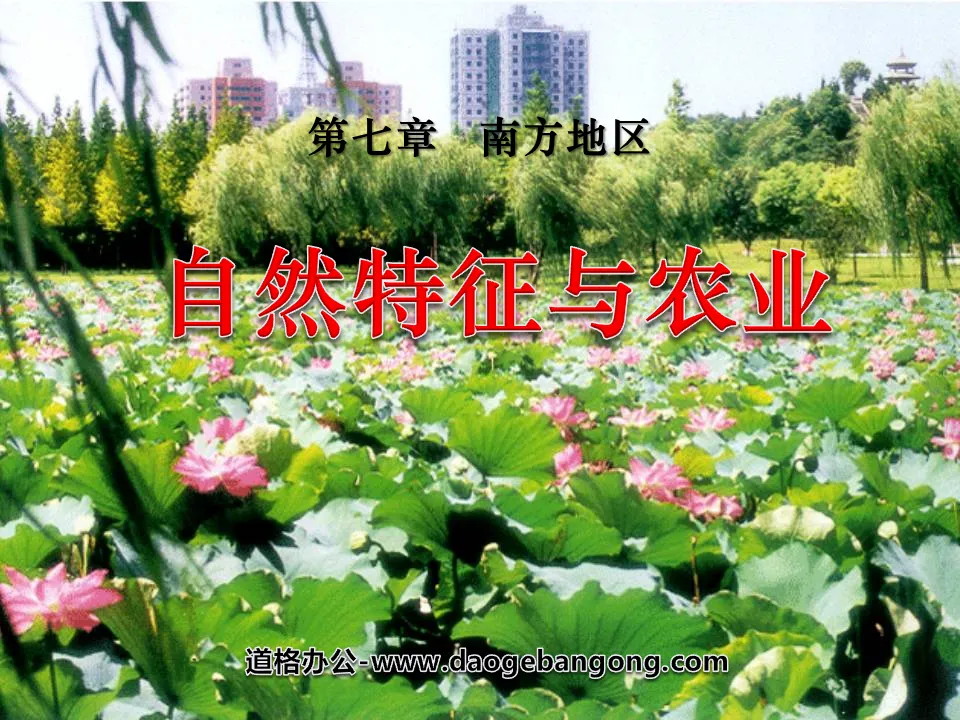
1. Location and scope
1. Natural:
① Qinling Mountains - south of the Huaihe River, east of the Qinghai-Tibet Plateau; the east and south face the East China Sea and the South China Sea.
② To the south of 35°N, the Tropic of Cancer passes through its southern part (Taiwan, Guangdong, Guangxi and Yunnan), and all of Hainan Province is located in the tropics. Most of them are located between 98°E and 123°E (note the areas where the three longitudes 100°E, 110°E, and 120°E pass through).
③The main geographical units include the Sichuan Basin, the plains of the middle and lower reaches of the Yangtze River, the southeastern hills and the Yunnan-Guizhou Plateau.
2. Administrative Region: Mainly includes six provinces and one city in the middle and lower reaches of the Yangtze River (Hubei, Hunan, Anhui, Jiangxi, Jiangsu, Zhejiang, and Shanghai), five provinces and two districts in the southern coastal area (Fujian, Taiwan, Guangdong, Guangxi, Qiong, and Hong Kong) , Macao) and three provinces and one city in southwest China (Sichuan, Yunnan, Guizhou, and Chongqing).
3. Neighboring countries: The neighboring countries on land in the southern region from west to east are: Myanmar, Laos, and Vietnam.
4. Area: The area accounts for 25% of the country.
2. Characteristics of natural areas:
1. Terrain: mainly hilly and plain terrain.
(1) Main terrain areas: the middle and lower reaches of the Yangtze River Plain, Sichuan Basin, Yunnan-Guizhou Plateau, Southeast Hills, Nanling, Wuyi Mountain, Xuefeng Mountain, Taiwan Island, Hainan Island, Chongming Island, etc.;
(2) Terrain characteristics: The terrain differs greatly from east to west, mainly located on the second and third steps.
①The eastern plains and hills are vast
A. The middle and lower reaches of the Yangtze River plain is the lowest plain in my country. The middle and lower reaches of the Yangtze River plains include _________, _________, _________, _________, _________Chaohu Plain, Yangtze River Delta, etc. There are many artificially cultivated paddy soils in these plain areas. Both are commercial grain bases; there are many rivers and lakes in the plain area, so it is known as a "water town".
B. The southeast hills are the largest hills in my country. It consists of three parts: Jiangnan hills, Guangdong and Guangxi hills, and Fujian and Zhejiang hills.
These hills are mostly red soil and yellow soil (i.e. zonal soil).
Methods of utilizing and transforming red soil:
① Apply more organic fertilizer to increase soil organic matter, supplement hydrated lime, and reduce soil acidity;
② Plant economic trees such as tea trees, camellia oleifera, fir and masson pine that are suitable for growing in red soil;
③ Develop diversified operations based on local conditions, such as planting rice in valley basins in hilly areas, turning gentle slopes of hills into tea gardens, planting trees on the tops of hills, etc., which can not only turn low-yield fields into high-yield fields, but also prevent water and soil erosion.
②The west is dominated by plateaus and basins
A. The Sichuan Basin (with the Chengdu Plain in the northwest) is one of the four major basins in my country.
Known as the "Purple Basin" and the "Land of Abundance"; purple soil is distributed in the Sichuan Basin. It is developed from the purple-red sandstone and shale in the basin. It is rich in phosphorus and potassium and is relatively fertile.
(Genesis analysis: During the formation of the Sichuan Basin, the surrounding fine sand
The soil was deposited to the bottom of the basin by flowing water, and some minerals were oxidized and turned into purple-red sandstone and shale. Purple sandstone and shale are easily weathered to form purple soil. Purple soil is rich in nutrients such as phosphorus and potassium and is relatively fertile soil. )
③Mountain
The Hengduan Mountains, Nanling Mountains, Xuefeng Mountains and Wuyi Mountains are important geographical boundaries in my country. The main peak of Taiwan's Yushan Mountain is the highest peak on the southeastern coast of my country. In addition, Daba Mountain, Dabie Mountain, Wushan Mountain, Daiyun Mountain Range, etc. have red soil and yellow soil (acidic, low organic matter content, heavy sticky, suitable for tree planting, especially suitable for growing tea).
2. Climate:
(1) Climate type:
Tropical and subtropical monsoon climate prevails.
(2) Climate characteristics:
①The summer is hot and rainy, the winter is warm and humid, the average temperature in January is above 0℃, and the annual precipitation is more than 800 mm. Rain and heat are at the same time.
② The climate in the Hengduan Mountains varies greatly vertically. The Yunnan-Guizhou Plateau is the intersection of two types of monsoons originating from the Pacific Ocean and the Indian Ocean. In winter, it is rainy, cold and wet to the east of the Kunming stationary front, while it is sunny and warm to the west.
③The middle and lower reaches of the Yangtze River (east of Yichang, south of the Huaihe River, and north of the Nanling Mountains) are affected by the Jianghuai stationary front from June to July every year, causing plum rains. From July to August, under the control of the Hawaiian high pressure ridge, a latent drought occurs (summer high temperatures in Chongqing, Wuhan and Nanjing are the three major furnaces along the Yangtze River).
④ Cold waves in winter and typhoons in summer and autumn in coastal areas are the main disastrous weather. (Sichuan, Guangdong, Hainan, Guizhou, and Yunnan are less affected by the cold wave. Although typhoons with frequent activity from July to September converge on the southeastern coast and bring wind damage and floods, they are controlled by the Pacific subtropical high pressure ridge during this period, often forming latent droughts. The precipitation brought by typhoons can play a role in alleviating drought).
1. Agricultural production – a land of plenty
(1) Characteristics of agricultural activities:
One of the important farming areas, mainly paddy fields. To the north of the Yangtze River, there are two crops a year, and to the south of the Yangtze River, there are three crops a year. Agricultural areas are dominated by animal husbandry. Freshwater aquaculture is developing rapidly. The south (Hainan, Yunnan Xishuangbanna, etc.) develops tropical cash crop production. Marine fisheries are developed, and the Zhoushan fishery is the largest fishery in my country.
(2) Agricultural production conditions:
Advantages:
Adverse conditions:
① During the drought period in the Jianghuai region, temperatures are high, precipitation decreases, and evaporation is strong.
② The area south of the Yangtze River is a red soil distribution area. The soil is highly acidic and sticky, which is not conducive to the development of planting industry.
③The Yunnan-Guizhou region has developed karst landforms, rugged surface, thin soil layer, and lack of surface water, which are not conducive to agricultural development.
(3) Main crops (products):
①Planting industry: Mainly planting rice, wheat, rapeseed, cotton and sugar cane.
②Forestry: Timber forests: fir, masson pine, bamboo.
Economic forest: tea, camellia oleifera, tung tree, sumac, citrus, banana, lychee, longan (longan),
Pineapple, sericulture. Camphor tree (camphor is abundant in Taiwan), rubber, sisal, and coconut.
③Fisheries: Rivers and lakes are rich in aquatic products and aquatic plants.
(4) Distribution of main crops and their status in the country:
① Grain base: The plains of the middle and lower reaches of the Yangtze River and the Pearl River Delta are the famous "Land of Fish and Rice", and the Sichuan Basin is known as the "Land of Abundance". Among the plains in the middle and lower reaches of the Yangtze River, the Han Plain, Dongting Lake Plain, Poyang Lake Plain, Taihu Plain, Jianghuai Plain and the Pearl River Delta are all national commercial grain bases;
② Cotton base: The cotton planting area in the middle and lower reaches of the Yangtze River is second only to the middle and lower reaches of the Yellow River.
7. Development of Hainan Island
(1) Geographical location advantages:
①Greater Southwest moves toward the forefront of the world,
② A base for the development and utilization of South China Sea resources.
③Broad economic hinterland: Hong Kong, Macao, Taiwan, Pearl River Delta, Southeast Asia
(2) Natural area characteristics: Tropical resource advantages:
①Climate-Rich light and heat resources
Light - the northern edge of the tropics, with more than 2,000 hours of sunshine per year and sufficient light
Heat - the average temperature of the coldest month is >16℃, and the accumulated temperature of ≥10℃ reaches 8400-9200℃.
②Biological resources - the largest gene bank of tropical species
③Land resources - various types
An annular layered landform composed of mountains, hills, mesas, and plains is the natural basis for the industrial layout of the annular zone.
8. Three Gorges Water Conservancy Project Construction:
(1) Location characteristics: The Three Gorges is located in Sandouping, Xiling Gorge, Yichang, Hubei Province. A is a river canyon zone with good water storage conditions. B is located in the transition zone of the second and third step ladders in the national terrain, with a large drop and large water energy reserves. C. Subtropical humid monsoon climate with large river flow. D. No ice in winter. E. The geological conditions of the reservoir area are stable and safe.
(2) Project investment: Calculated based on prices at the end of May 1993, the static investment of the Three Gorges Project was 90.09 billion yuan. Among them, 50.09 billion yuan is for hub projects and 40 billion yuan is for resettlement.
(3) Engineering functions: ① Flood control: The main purpose of constructing the Three Gorges Project is flood control. The contradiction between the flood capacity of the middle and lower reaches of the Yangtze River and the large amount of floods in the upper reaches is very prominent. The Three Gorges Reservoir has planned flood diversion and discharge, which has reduced the flood hazards in the middle and lower reaches.
② Power generation: It is of great significance to alleviate the tight energy supply situation in central and eastern China and reduce the pressure on railway transportation (see the figure below).
③ Shipping: At the same time, the construction of the Three Gorges Water Conservancy Project can fundamentally improve the shipping conditions of the Sichuan River and enable the Yangtze River to truly play its role as a "golden waterway" (see the picture below).
Keywords: Southern region teaching courseware, Natural Features and Agriculture teaching courseware, New People's Education Edition Geography PPT courseware for eighth grade volume 2, Eighth grade geography slide courseware download, Southern region PPT courseware download, Natural Features and Agriculture PPT courseware download,. ppt format
For more information about the "Natural Features and Agriculture in the Southern Region" PPT courseware, please click on the "Natural Features and Agriculture in the Southern Region ppt" tab.
"Natural Features and Agriculture" Qinghai-Tibet Region PPT Courseware 4:
"Natural Features and Agriculture" Qinghai-Tibet Region PPT Courseware 4 1. The Roof of the World The Qinghai-Tibet region is located in the southwest of my country, west of the Hengduan Mountains, south of the Kunlun Mountains, and to the national border in the south. Topography: The northwest is high and the southeast is low plateau, with an average altitude of 4,000 meters. Qinghai-Tibet Plateau..
"Natural Features and Agriculture" Qinghai-Tibet Region PPT Courseware 3:
"Natural Features and Agriculture" Qinghai-Tibet Region PPT Courseware 3 1. The Roof of the World The Qinghai-Tibet region is located on the _____th level of terrain in my country, with an average altitude of more than _____ meters. It is called _____ and is the _____ plateau in the world. . What are the characteristics of the terrain in the Qinghai-Tibet region? Looking from afar...
"Natural Features and Agriculture" Qinghai-Tibet Region PPT Courseware 2:
"Natural Features and Agriculture" Qinghai-Tibet Region PPT Courseware 2 1. The location and scope of the Qinghai-Tibet region 2. The natural geographical features are high and cold. Causes: the Eurasian plate and the Indian Ocean plate squeeze and uplift the source of the river, and there are many lakes in the Yangtze River, Yellow River, Yarlung Zangbo River, Nujiang Snow Peaks...
File Info
Update Time: 2024-10-02
This template belongs to Geography courseware People's Education Edition Geography for Eighth Grade Volume 2 industry PPT template
"Natural Features and Agriculture" Southern Region PPT Courseware 4 Simple campus recruitment activity planning plan summary enterprise and institution recruitment publicity lecture PPT template is a general PPT template for business post competition provided by the manuscript PPT, simple campus recruitment activity planning plan summary enterprise and institution recruitment promotion Lecture PPT template, you can edit and modify the text and pictures in the source file by downloading the source file. If you want more exquisite business PPT templates, you can come to grid resource. Doug resource PPT, massive PPT template slide material download, we only make high-quality PPT templates!
Tips: If you open the template and feel that it is not suitable for all your needs, you can search for related content "Natural Features and Agriculture" Southern Region PPT Courseware 4 is enough.
How to use the Windows system template
Directly decompress the file and use it with office or wps
How to use the Mac system template
Directly decompress the file and use it Office or wps can be used
Related reading
For more detailed PPT-related tutorials and font tutorials, you can view: Click to see
How to create a high-quality technological sense PPT? 4 ways to share the bottom of the box
Notice
Do not download in WeChat, Zhihu, QQ, built-in browsers, please use mobile browsers to download! If you are a mobile phone user, please download it on your computer!
1. The manuscript PPT is only for study and reference, please delete it 24 hours after downloading.
2. If the resource involves your legitimate rights and interests, delete it immediately.
3. Contact information: service@daogebangong.com
"Natural Features and Agriculture" Southern Region PPT Courseware 4, due to usage restrictions, it is only for personal study and reference use. For commercial use, please go to the relevant official website for authorization.
(Personal non-commercial use refers to the use of this font to complete the display of personal works, including but not limited to the design of personal papers, resumes, etc.)
Preview
Related Search:
"Natural Features and Agriculture" Southern Region PPT Courseware 4
2024-10-02
Copyright statement: This material is compiled and released by the user of Daoge Resources. The copyright belongs to the author. For commercial use, please contact the copyright owner. If there is any infringement, please contact the webmaster to remove the resource.
Download Points: 0.00
Free Download
Upgrade VIP
Favorite
Views: 2792 / Downloads: 698


