The website of the Ministry of Natural Resources recently released the "Notice of the Ministry of Natural Resources on Printing and Distributing". For the whole map of China and the map of Taiwan Province, the "Specification" clearly stipulates:
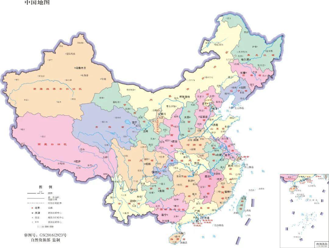
·In addition to showing the mainland, Hainan Island, and Taiwan Island, the map of China should also show important islands such as the South China Sea Islands, Diaoyu Island and its affiliated islands.
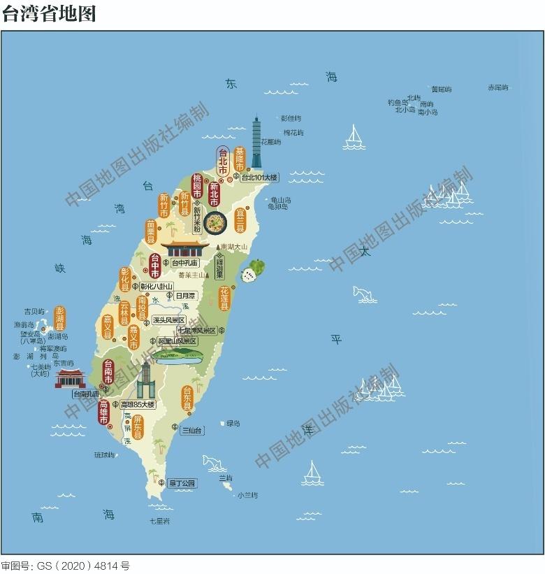
·Taiwan Province should be represented on the map as a provincial administrative unit. Taipei City is represented as a provincial administrative center (note the provincial administrative center in the legend). New Taipei City, Taoyuan City, Taichung City, Tainan City, and Kaohsiung City in Taiwan Province are expressed according to prefecture-level administrative centers.
· Diaoyu Island and Chiwei Islet should be drawn on the scope of the map of Taiwan Province (except for the map named after "Taiwan Island"). Diaoyu Island and Chiwei Islet can be included in the whole map of Taiwan Province, or can be reflected by the geographical relationship between Taiwan main island and Diaoyu Island and Chiwei Islet.
·The map of Taiwan Province that shows the content of the neighboring areas should correctly reflect the geographical relationship between Taiwan Island and the mainland or configure corresponding illustrations.
·On the thematic map, Taiwan Province should indicate the corresponding thematic content in the same way as mainland China. If the information is not available, it should be marked in the appropriate position of the map: "Taiwan Province information is temporarily missing".
·Where there are written explanations on the map, it shall give key explanations on Taiwan Island, Penghu Islands, Diaoyu Islands, Chiwei Islet, Pengjia Islet, Lanyu Islet, and Green Island.
Map of Taiwan Province

Taiwan Province Map (Humanities Map). Source: Standard Map Service System Website
Taiwan Province on the map of China

Source: Standard Map Service System Website China Map 1:16 million 8-fold, color by province, no neighboring countries, uniform line (part)
Map of China

Map of China 1:16 million, 8-fold, color by province, no neighboring countries, uniform lines Source: Standard Map Service System Website
Netizen: There is nothing less about China!


Source: Ministry of Natural Resources website, standard map service system website, Sina Weibo
Articles are uploaded by users and are for non-commercial browsing only. Posted by: Lomu, please indicate the source: https://www.daogebangong.com/en/articles/detail/The%20latest%20specification%20is%20released%20The%20map%20of%20Taiwan%20Province%20looks%20like%20this.html

 支付宝扫一扫
评论列表(196条)
测试