Hi, friends, my name is Xiaomu.
I believe that everyone should have encountered a lot of map typesetting pages in PPT.
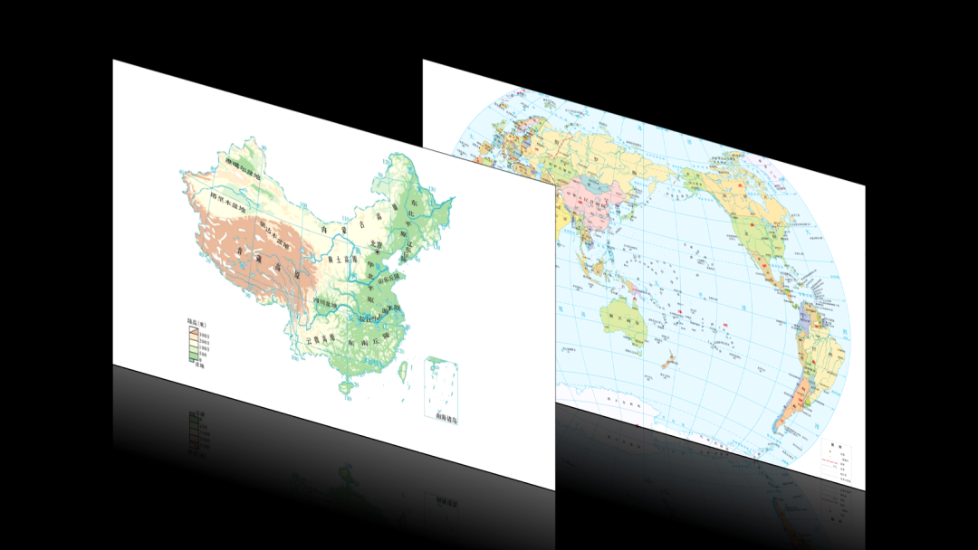
For example, various topographic maps, water system maps or world maps that need to be displayed in geography courseware:

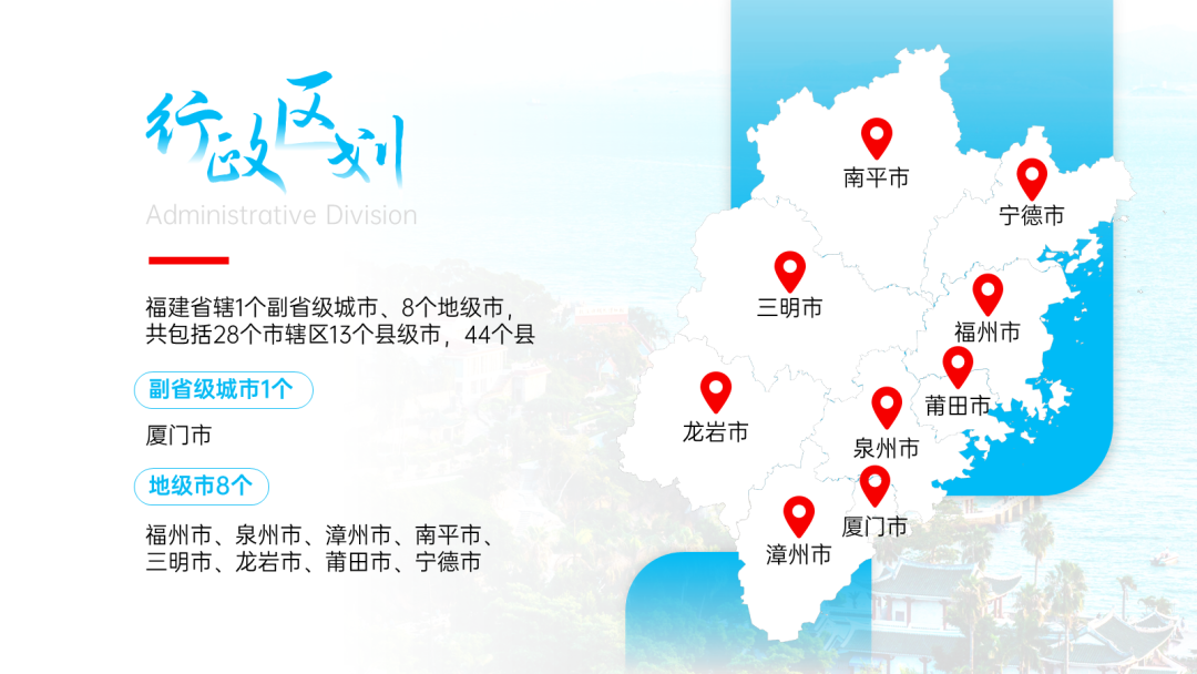
Or company introduction, school recruitment PPT needs to show the company's geographical location and traffic routes, etc.:

If you want to typeset this type of page well, you have to do at least a little bit of the following two points, and masters generally know both points :
:
Use high-quality map material
UsingUse a good-lookingversionstyle
▎Map page, 3 points for typesetting, 97 points for material
The quality of a map material has a great influence on the aesthetics of the layout.
For example, You feel itDown these two pictures , to see if this is the case:


And the following two :
:


I believe that most wooden friends should be able to see which is good and which is bad:

That's why I just said,No matter whether the layout is complex or not, the quality of the map material itself has the greatest impact on the aesthetics .
.
Then here comes the question:
Where can I find high-quality editable map material like this ?
?


1)Concise map material
The map materials we generally use are screenshots taken directly from navigation software, or various old-fashioned maps found on the Internet.


The disadvantage of this kind of map is that there are too many complicated text information and the color matching is very messy.
Good-looking maps have less text information and simple color matching .
.


Where can I find such a concise map?
I searched a lot yesterday, compared a variety of map drawing tools, and found that [Lantuhui] This website is the best, URL ldmap.net:

First declare that this is not an advertisement Please remember to pay me for the advertisement when you see it, thank you .
.
After opening this website, click [Get Started] on the homepage of the website, and then click [New Map]-[Open Map]:

Then click [Map] on the top menu bar - enter the location, and you will be able to see the map of the location:

Then comes the important point :
:
a,If you want a concise business map
In the [Style] menu bar on the right, you canmodify the color scheme of the map, and Hide text information in the map, road information, landmark informationetc:

For example, the following maps are the color matching effects obtained after I hide the text information:

After generating this kind of map,Put the screenshot directly into the PPT, you can get a Extremely malleable map material!
For example, you can draw your own route and add landmarks, and the map looks very simple and comfortable!

b, If you want topographic maps, water system maps
Directly select [Terrain Map] in [Style], and you can get a map with only terrain and water system information:

Slide the mouse wheel and zoom in a little bit, you can even see the contour lines of the terrain, which is so powerful!

▲There are even contour lines!
If you only want the water system map, then select the [No Road] style in [Style], the water system is so fine that it can only be described as crazy!

Click [Style] - [3D Terrain], you can even get a 3D earth, which can be rotated or enlarged arbitrarily! However, If the computer performance is not good, it may be a little stuck:

2)Vector map material
If you need a blank map of our country's administrative regions, such as provinces, cities, or even counties/districts, like the following:

Then I recommend two places for you:
a、Standard map service network
The official and authoritative national map website, where you can download world, national and provincial vector map materials, website: bzdt.ch.mnr.gov.cn
After opening the URL, you can choose the type of map you want to download from the menu at the top:

After selecting the map material and clicking the download button, you can choose to download the map in jpg image format or eps vector format:

The vector map in eps format needs to be opened by [illustrator(ai for short)], and then you can < /span>Copy and paste the material into PPT for editing.
At the bottom of the website, there are links to standard map websites of various provinces, where you can download more detailed districtzoningMap:

b,Datav.GeoAtlas
This is a map material website under Alibaba Cloud. The data in the website comes from AutoNavi Maps. Here you can download city-level, county/district-level maps.< /span>URL:datav.aliyun.com/tools/atlas/
After opening the website, first enter the region name in the upper right corner box, press Enter, and click the download button in the lower right corner of the web page, the downloaded material here issvg format:

If your PPT isoffice 2019 or 365version, then you can directly insert and edit the map material.
The specific operation is: first select the map material, then press [Ctrl+Shift+G] twice to force ungroup, and convert the material into an editable shape, and you can get a shape that can be modified arbitrarily like me. Color the map now.

If your office version is earlier than 2019, then you may need to use ai first Open the material, and then copy and paste the material into PPT.
If you are using WPS, it will be a lot of trouble:
You need to convert the material in svg format firstto emf format(there are many online conversion material format websites), then it can be inserted into the PPT of WPS, and after insertion, it is unable to edit......
In summary, if you want to use this material, I suggest you install Office 2019 or 365 , which can save you a ton of trouble.

▎Super practical Several map layouts!
Generally speaking, when you get a high-quality map material, even if you just usethe simplest layout, the page will not be difficult to see where to go:


But if you are like me, you are a person who is a little bit bored, then you can learn the following two slightly complicated layouts.
1)Full graphic layout
Beast first, first spread the map to cover the entire page, and then cover a rectangle with a transparent gradient on top of the map:


▼


After setting the rectangle, finally put the texton top of the rectangle, you can get the following effect:


Is it okay if I don't want to do all those fancy gradients and just overlay a normal shape?
Of course! We can put a circle on it now:

If you want, just throw a piece of "glass" and no one cares about you :
:

Look, there is a high-quality map that can be wretched...
2)Three-dimensional rotation
In addition to the two-dimensional flat map, you can even use the [3D rotation] effect on the map !
!

What is the use of making the map three-dimensional?
It's useless, at most it can make the following creative effects , completely useless:


What? You just want to learn this kind of useless stuff?
Okay, the method is not difficult, right click on the material, click [Set Image/Shape Format] - [Effect] - [3D Rotation] - select a 3D angle you want in [Preset] Just:

If there is no angle you want in [Preset], you can also adjust the value of [X/Y/Z/Perspective], Rotation angle of custom material:

However, you may encounter two problems after rotation:
Question 1: [Perspective] menu is gray, and the value cannot be adjusted

Don't panic, you just need to choose any [angle] in [Preset], and you can see that the [Perspective] menu is displayed normally:

Question 2: The color of the material changes after 3D rotation

Don’t panic, you can try several [materials] in [3D format], or try to modify several [light sources], there will always be one that can restore the color of the material or Near normal:

What? Three-dimensional things are too complicated?
Hey, you said you wanted to learn these useless things , I didn't force you with a whip.
▎Summary
Now let's summarize the above:
Have a high-quality map material, no matter how the layout is beautiful;
A good-looking layout can help low-quality materials in a timely manner, and can also add icing on the cake to high-quality materials.
Old rules, I have packaged all the source files of the above cases:
Reply to the keyword [Map] in the official account "Learn a P with me", and you can get it without routine download link. The link will be deleted at any time, and the reason will not be listed.
Last reminder:When using maps, you must ensure the accuracy of the maps. A very serious matter.
Especially when it comes to national maps, you must use maps from official channels, such as the standard map service network I listed earlier.
Okay, that's all for today's content, if you find it helpful, remember to click [Like] for me.
Let's be cheap next time~
▎A good article you may have missed recently:
How to write the title of the PPT cover to attract people?
I reproduced this animation on Douyin with PPT!
How to design a PPT flow chart to be brilliant?
< span >I'm Xiaomu, I'm with my brother, I'm useful for P!
▼
This article was published by the official account "Learn a P with me".
Click Read the original text to join Xiaomu's PPT community!
Articles are uploaded by users and are for non-commercial browsing only. Posted by: Lomu, please indicate the source: https://www.daogebangong.com/en/articles/detail/How%20to%20layout%20the%20map%20in%20PPT%20to%20look%20good.html

 支付宝扫一扫
评论列表(196条)
测试