
For PPT, map materials are indispensable
When making PPT, maps must be indispensable materials.
The company's business layout, customer distribution, store addresses, product sales across the country... Once these are used on maps and charts, they can be improved by N levels in minutes.
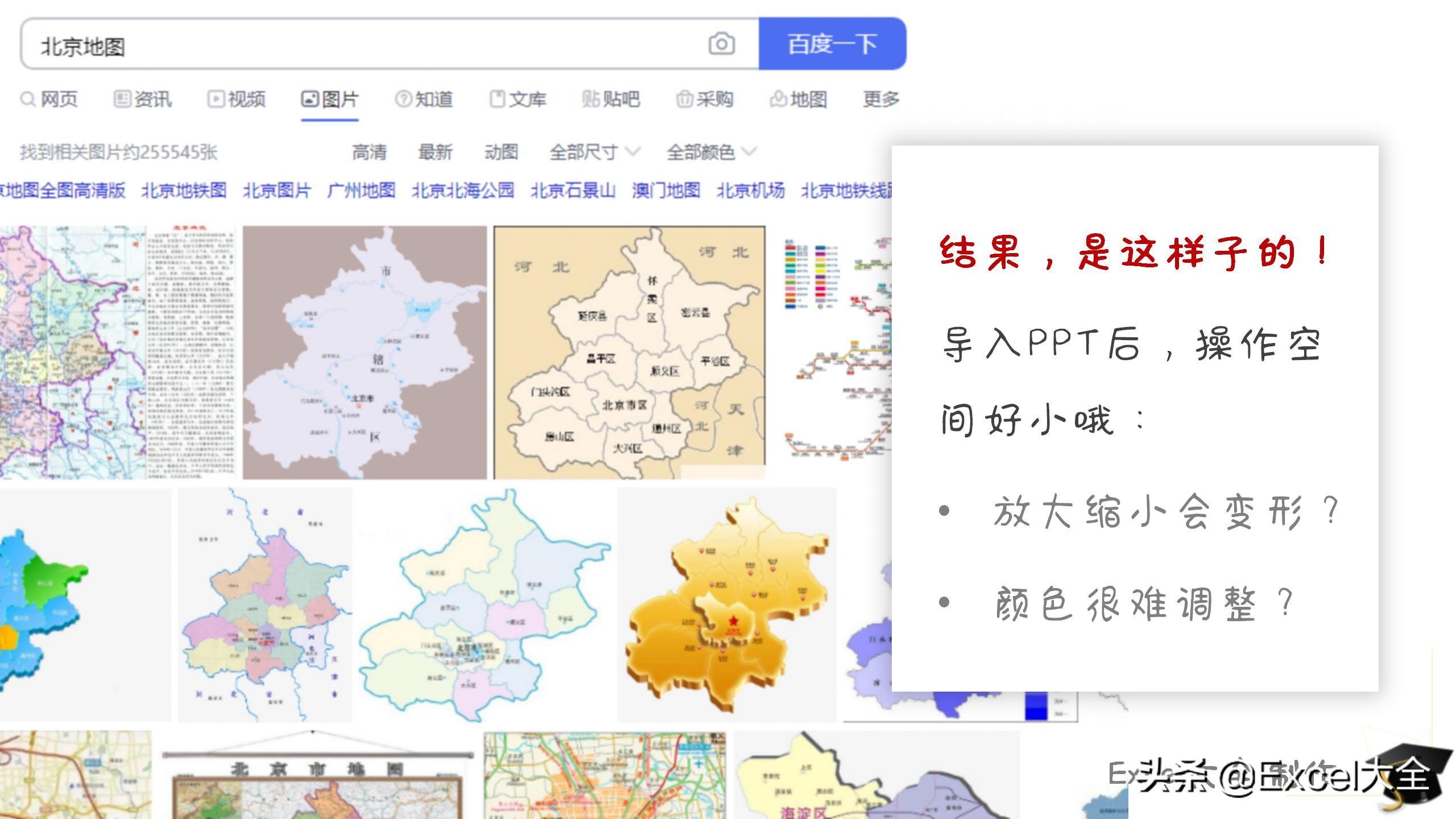
So, where do you usually go to find these map materials? Du Niang? Various PPT material template network?
Well, before, me too, but I just learned a new trick.
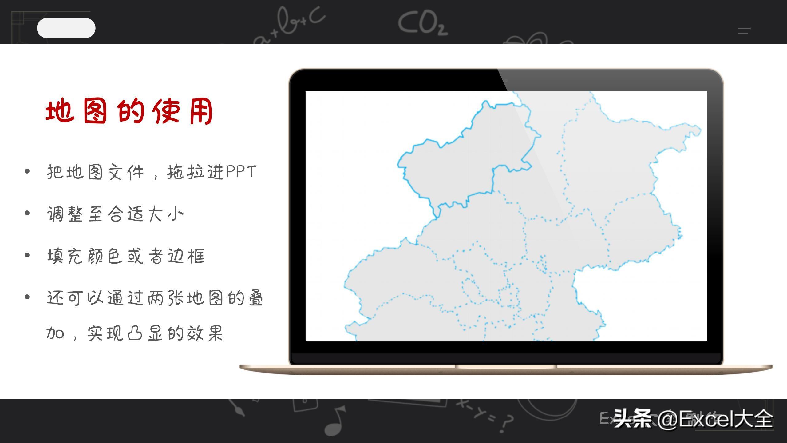
Here, you can download the vector maps of all provinces, cities and counties across the country, and insert them directly into the PPT, God cooperates!
Note that what is said here is "vector map", that is to say, in PPT, you can do whatever you want, you can zoom in, zoom out, rotate, color..., and icons The operating skills are the same.


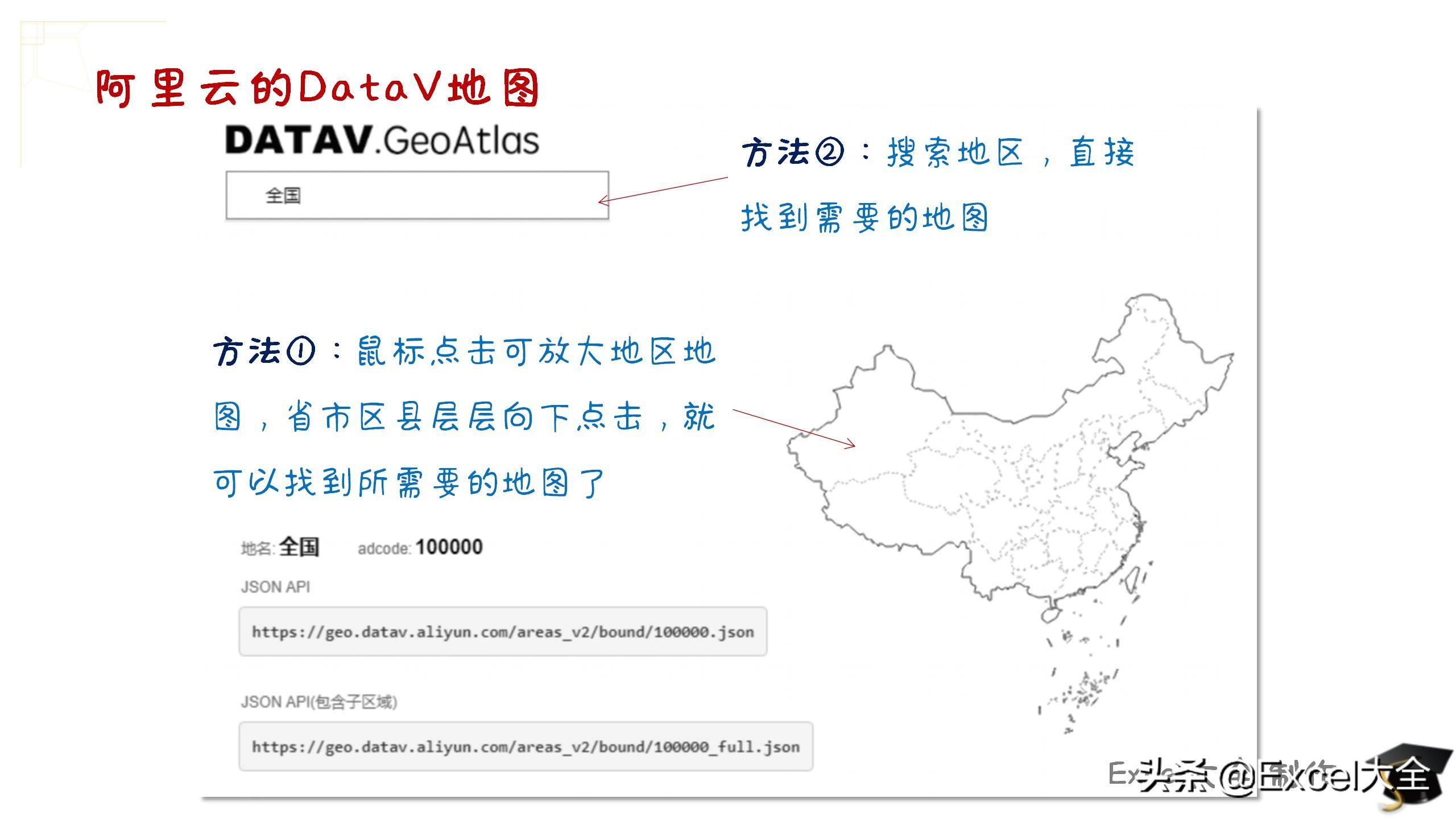
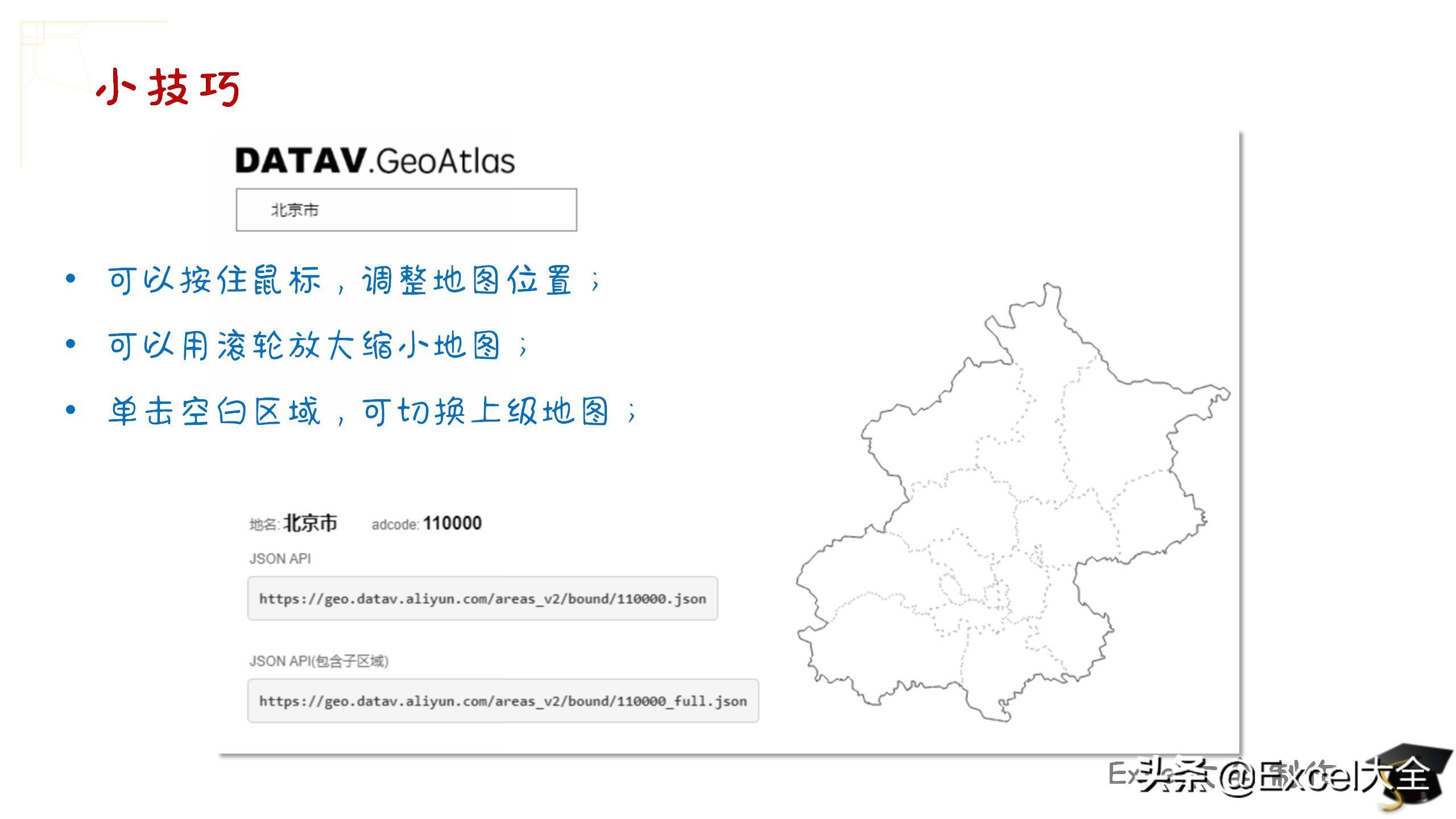
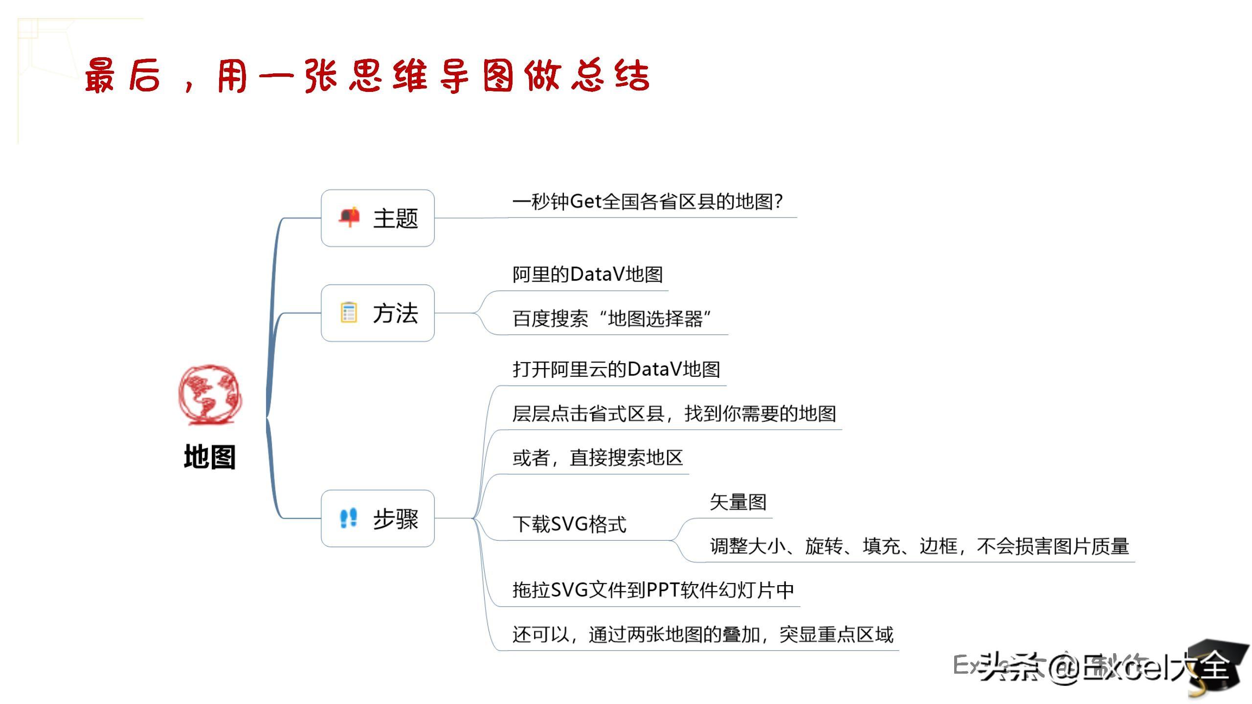
DataV map
That's right, it is Alibaba Cloud's DataV map, free of charge.
You can find it by searching for "DataV map" or "map selector" in Du Niang.
On the homepage of the DataV map, there is a national map:
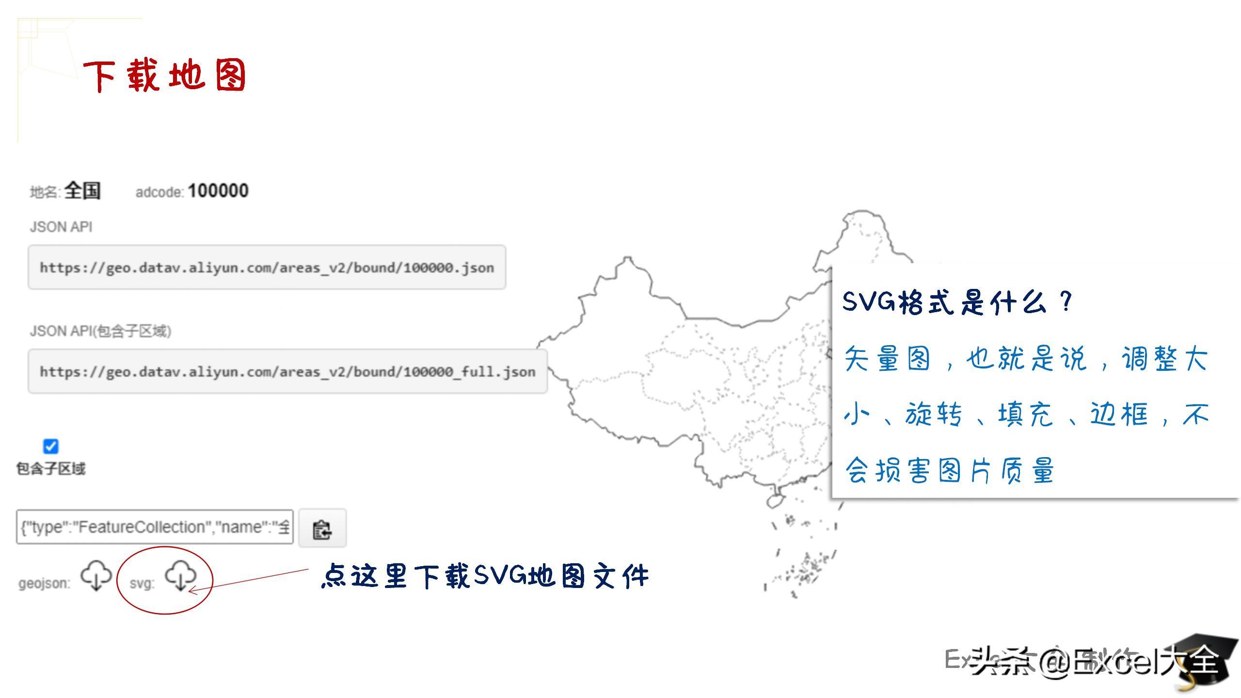
In PPT, use vector graphics
The downloaded SVG file can be directly dragged into the PPT, and the map can be used and edited in the PPT.
Of course, you can also import maps from the Insert Image menu.
Then, you can draw your map chart according to your purpose.
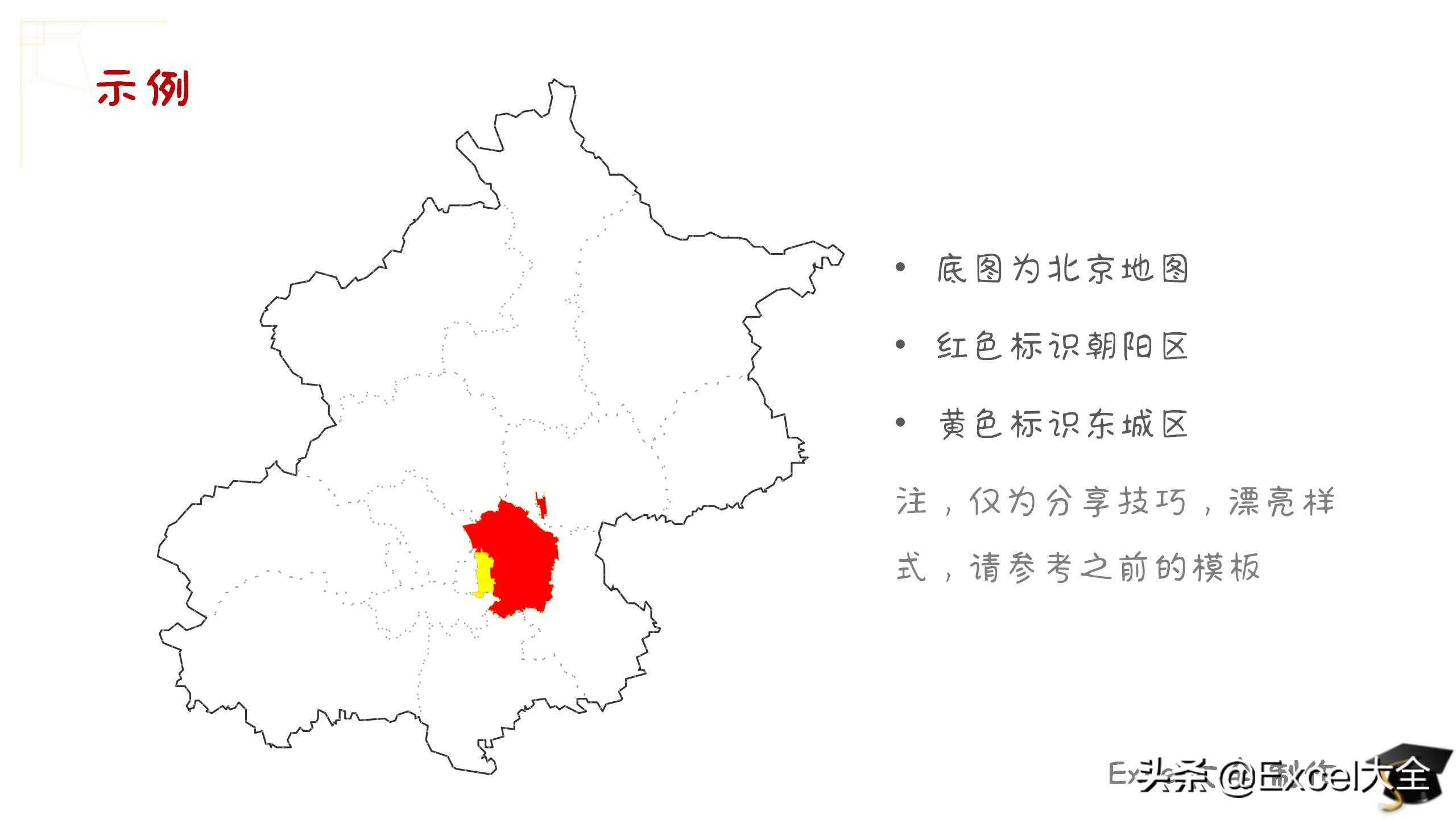
If you want to highlight a specific area, it can also be achieved by superimposing multiple vector graphics, such as:
- I downloaded three maps of "Beijing", "Chaoyang District" and "Dongcheng District" respectively;
- Import the three maps into PPT, and adjust the size and position (Beijing The map is the base map, Chaoyang District and Dongcheng District are on the upper layer);
- Fill "Chaoyang District" and "Dongcheng District" with different colors.
Use a mind map to make a small summary

Finally, there is a little bonus
This PPT is shared with everyone, just forward + like + private message "28041"!
Articles are uploaded by users and are for non-commercial browsing only. Posted by: Lomu, please indicate the source: https://www.daogebangong.com/en/articles/detail/12page%20PPT%20Vector%20map%20materials%20of%20all%20provinces%20cities%20and%20counties%20in%20the%20country%20are%20available%20here%20easy%20to%20use.html
 支付宝扫一扫
评论列表(196条)
测试